 |
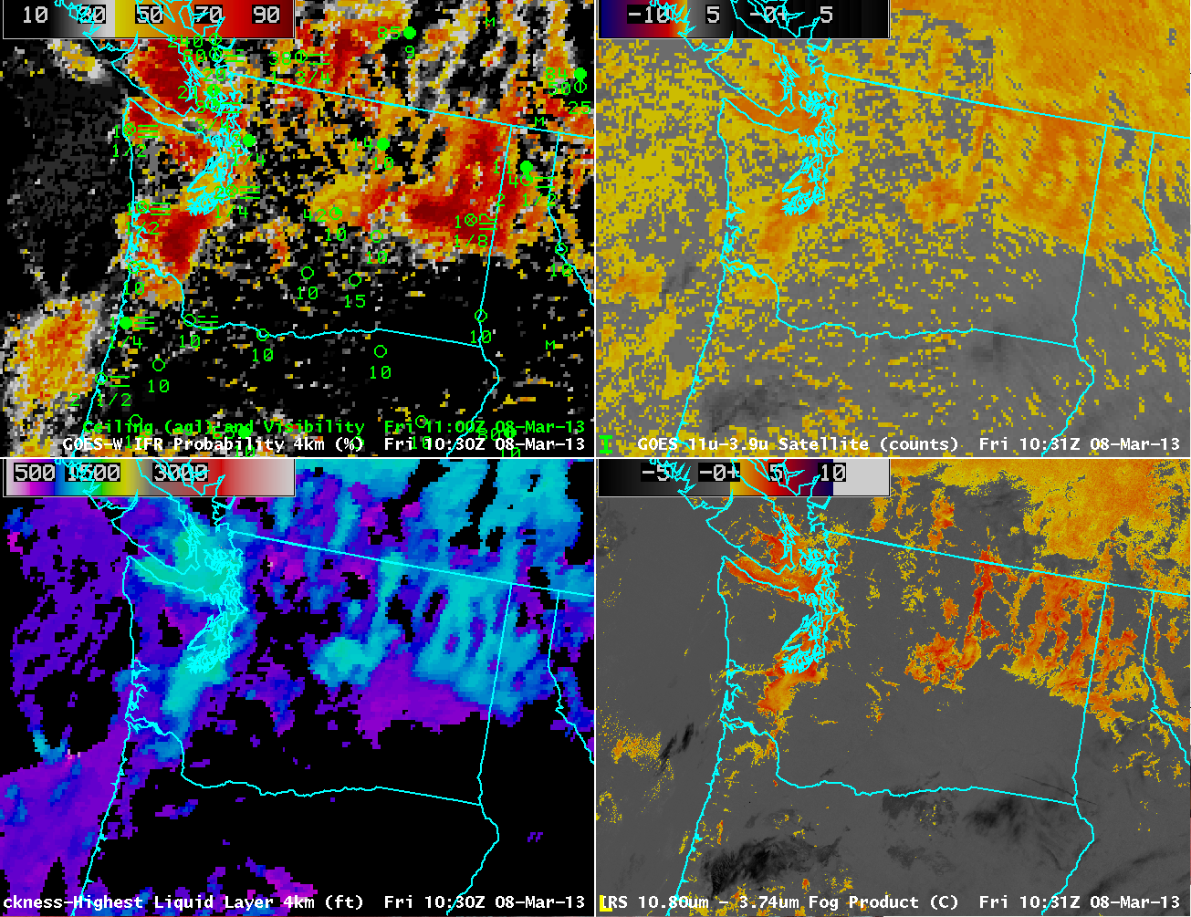
| GOES-R IFR Probabilities computed from GOES-West (Upper Left), GOES-E/W Brightness Temperature Difference (10.7 µm – 3.9µm) (Upper Right), GOES-R Cloud Thickness (Lower Left), Suomi/NPP VIIRS Brightness Temperature Difference (Lower Right) |
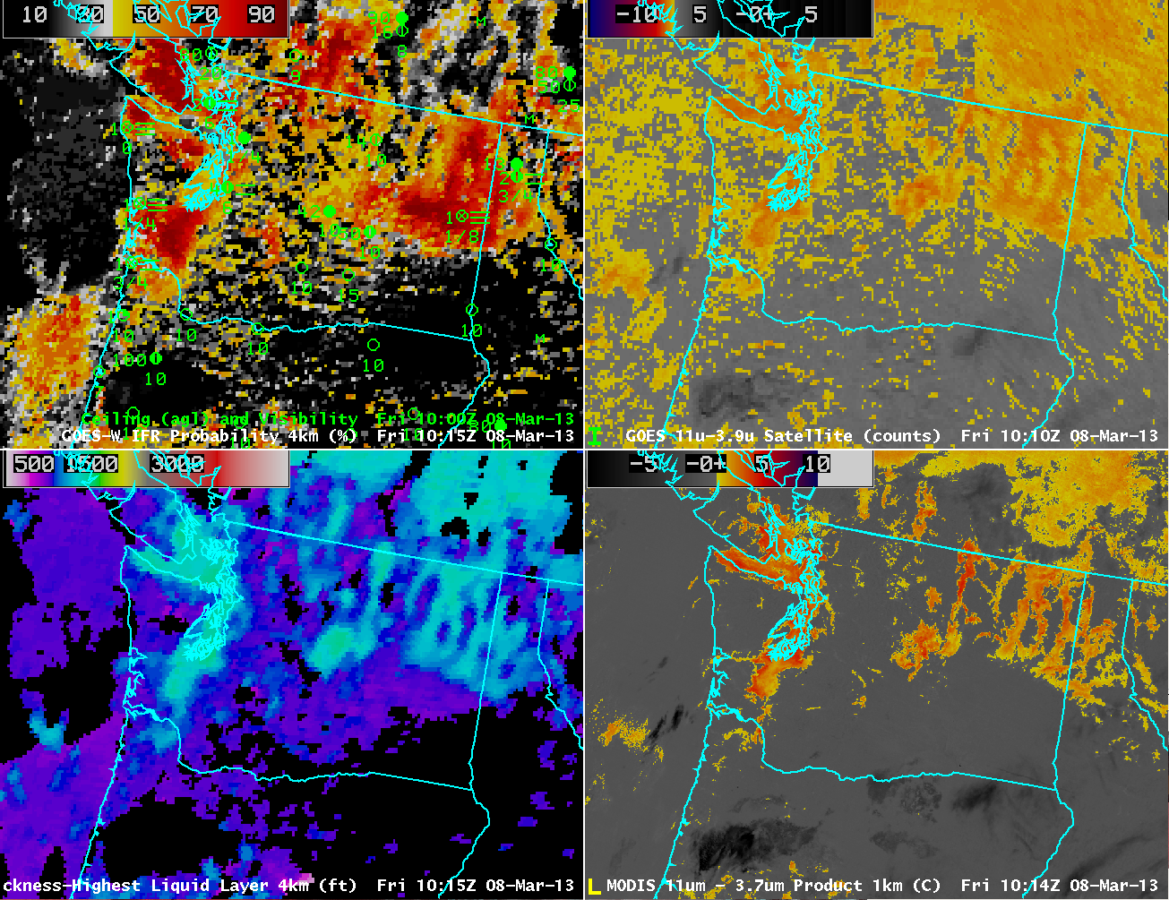 |
| As on top, but with MODIS Brightness Temperature Difference (11 µm – 3.7 µm) in the bottom right. |
The imagery above underscores the power of higher resolution on fog detection. The images on the right side of the images are brightness temperature difference fields, the heritage method for detecting fog and low stratus. The GOES field (top right) actually includes data from GOES-East (eastern Washington and points east — a faint seam is discernible in the image) and GOES-West (western Washington). Pixel size over Washington is large — 6 or 8 kilometers (vs. 4 kilometers at the subsatellite point). In contrast, Suomi/NPP VIIRS data and MODIS data (bottom right) has a resolution of 1 km. The brightness temperature difference from MODIS and VIIRS more easily resolves the fine-scale structure of the topographically influenced or topographically constrained fog and low stratus. The brightness temperature difference field from GOES is one of the predictors used to generate the IFR Probabilities shown in the upper right. When poor resolution smears out the horizontal domain of the fog and low stratus in the brightness temperature difference field, you might expect a similar effect on the IFR probabilities.
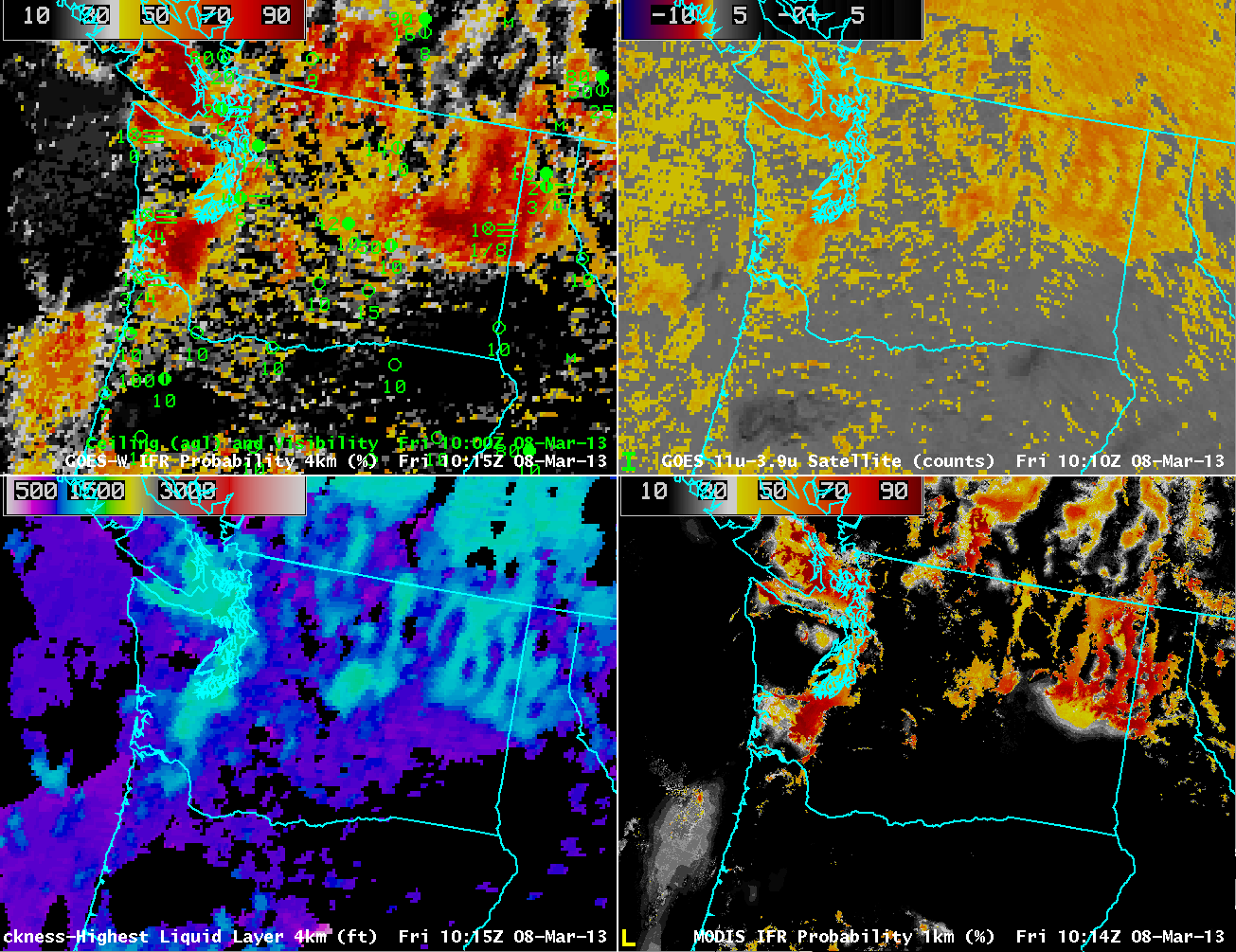 |
| As above, but with MODIS-based GOES-R IFR Probabilities in the lower right |
MODIS data can be used to compute IFR probabilities. Compare the lower right and upper left figures. High MODIS IFR Probabilities are far more restricted to regions where IFR conditions are observed. In contrast, GOES-based IFR probabilities seem to leak into regions where IFR conditions are not reported.
The higher resolution MODIS-based IFR Probabilities (and coming soon, Suomi/NPP-based IFR probabilities) nicely complement the higher temporal resolution of the GOES imagery. Ideally, use of the changes in the GOES-based IFR probabilities shows how IFR conditions evolve over the course of a night. These changes should be tempered with knowledge of the limitations of the horizontal resolution of GOES that are highlighted in the above imagery.