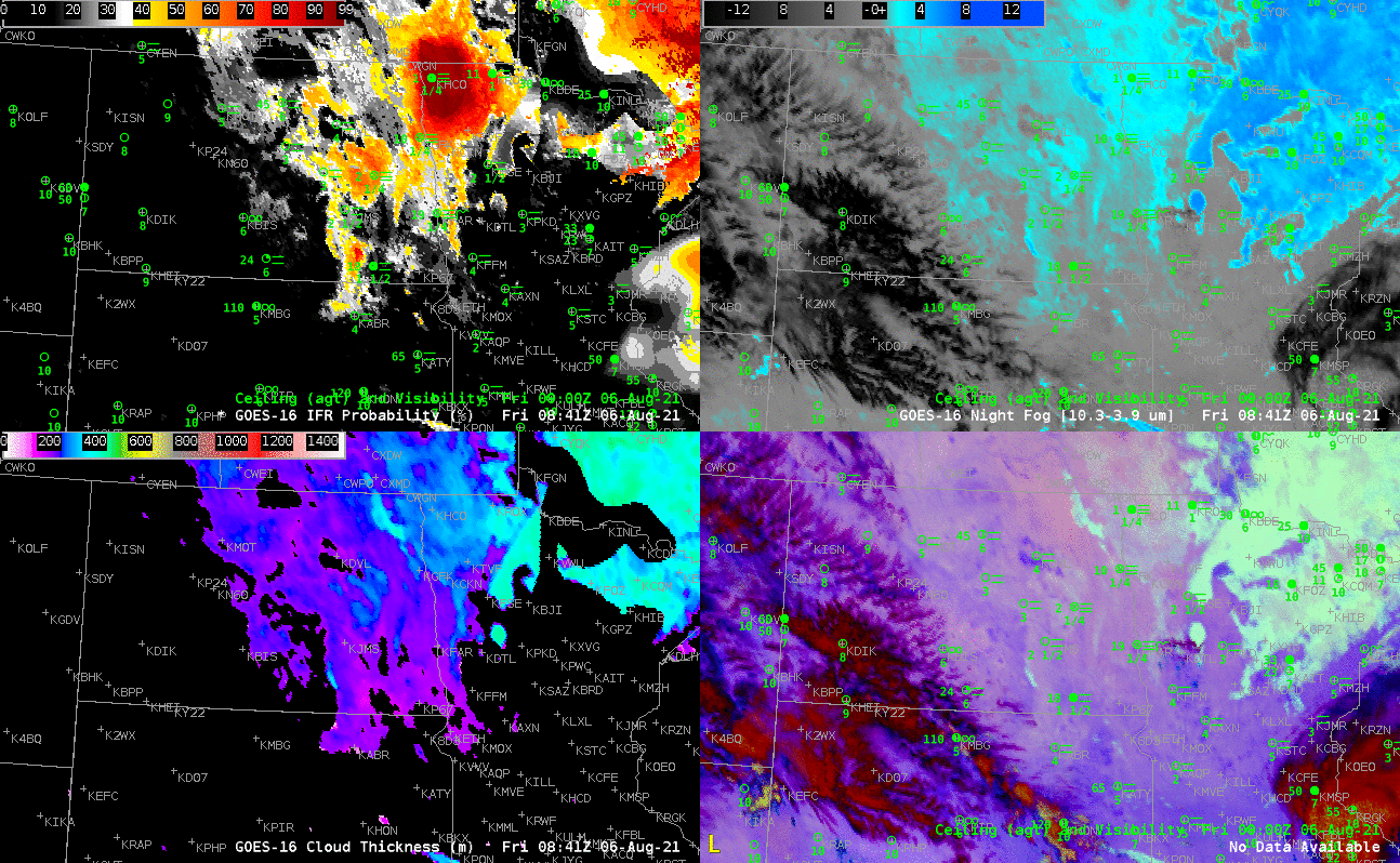
Examine the four-panel animation above. Fog with IFR conditions developed over night over North Dakota. IFR Probability fields, upper left in the four-panel, do a credible job of outlining where the restrictions to visibility are (including the low ceilings). Indeed, a strong signal develops in the IFR Probability field before one develops in the Night Fog brightness temperature difference. In addition, there is a strong signal in the brightness temperature difference field (10.3 µm – 3.9 µm) and also in the night time microphysics RGB over northern Minnesota, but observations suggest that the stratiform clouds highlighted there by those two products are not hugging the ground, that is, they are elevated stratus vs. fog. Also note how the signal diminishes as the sun rises, as expected. The bottom left panel shows GOES-R Cloud Thickness, and it suggests that the fog over North Dakota is fairly thin. Rapid burnoff-should occur.
Some of the stations in the Dakotas are reporting visibility restrictions due to smoke. IFR Probability fields do not provide information for that kind of IFR conditions: Smoke detection with infrared imagery is very challenging, and the Rapid Refresh model being used (to identify regions of fog by assessing low-level saturation) does not predict smoke. The image below, taken from the CSPP Geosphere site (link), shows the widespread smoke, and also the patches of stratus and mid-level clouds as depicted in the scene above.
