Category Archives: Low IFR Probability

IFR Probability and Low IFR Probability in the Pacific Northwest

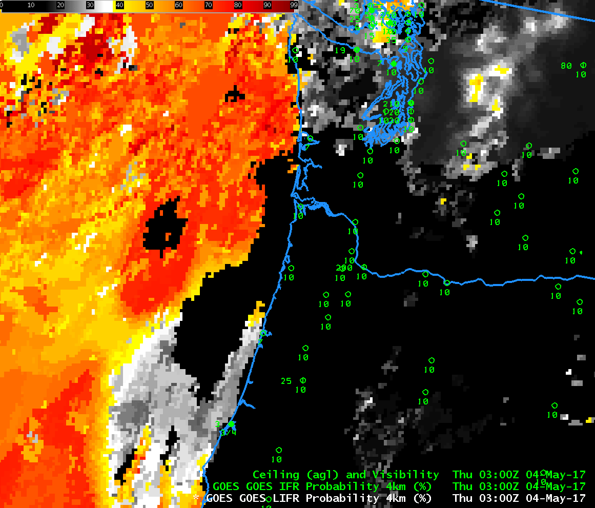
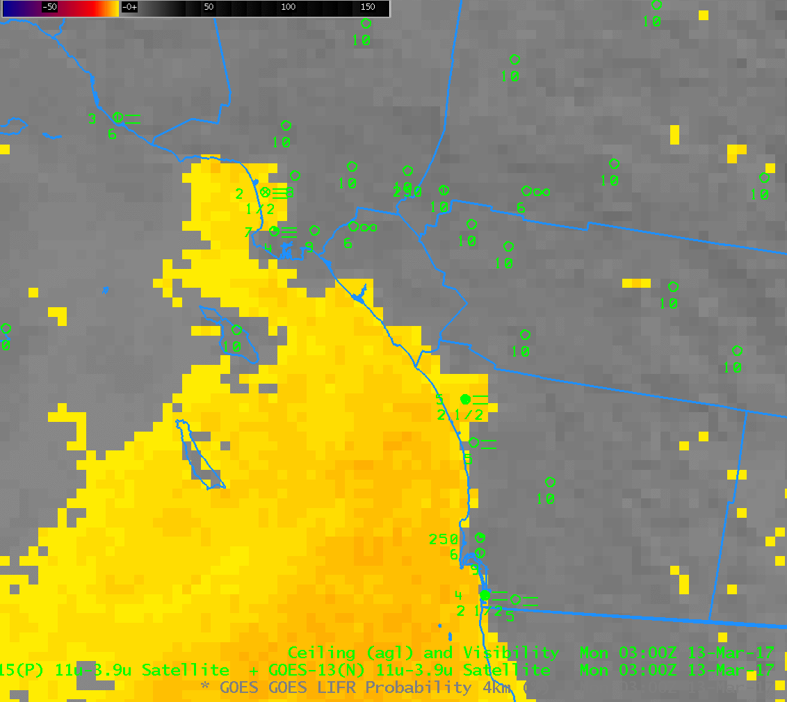
GOES-R IFR Probability fields, hourly from 0300 through 1500 UTC on 4 May 2017 (Click to enlarge)

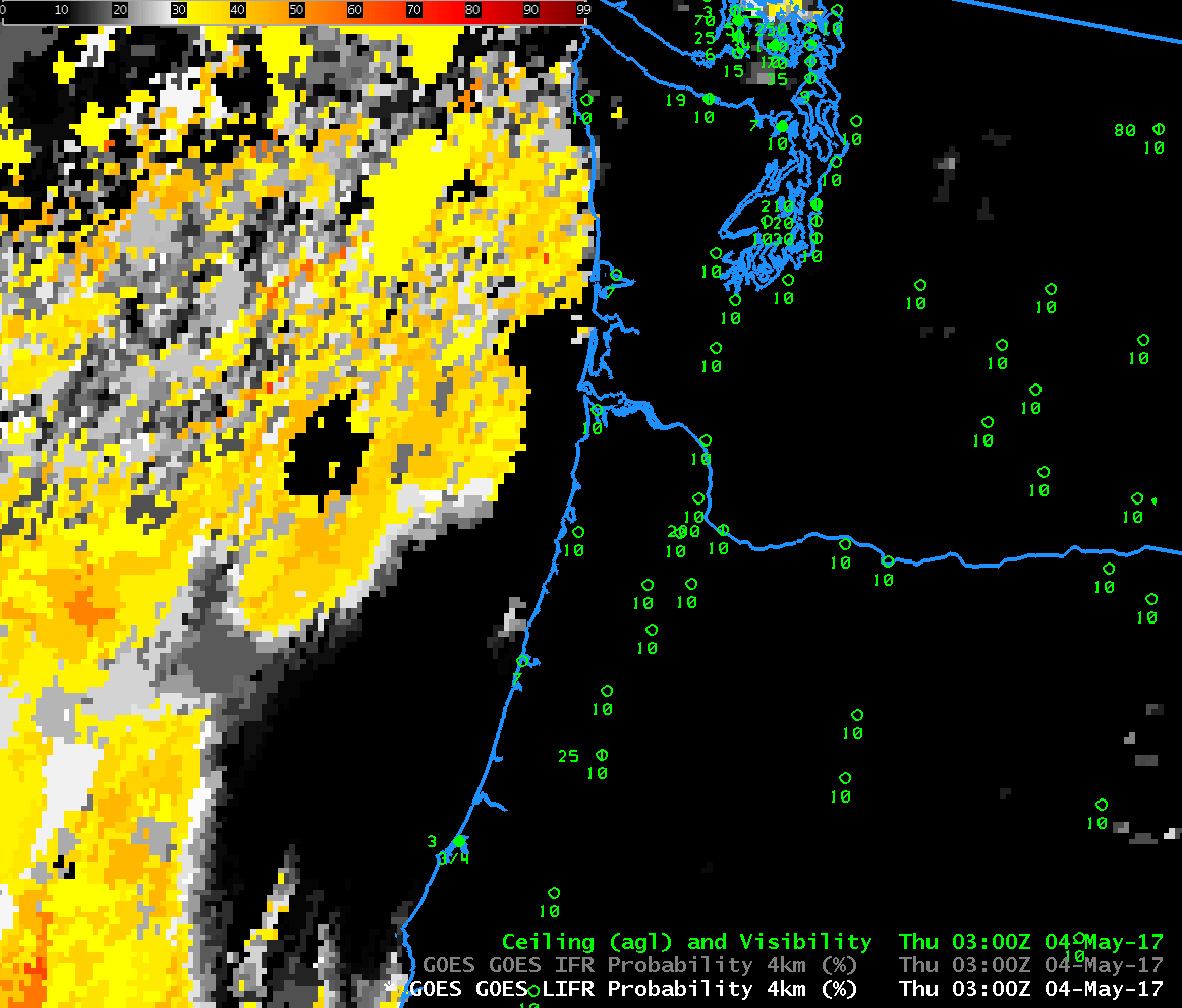
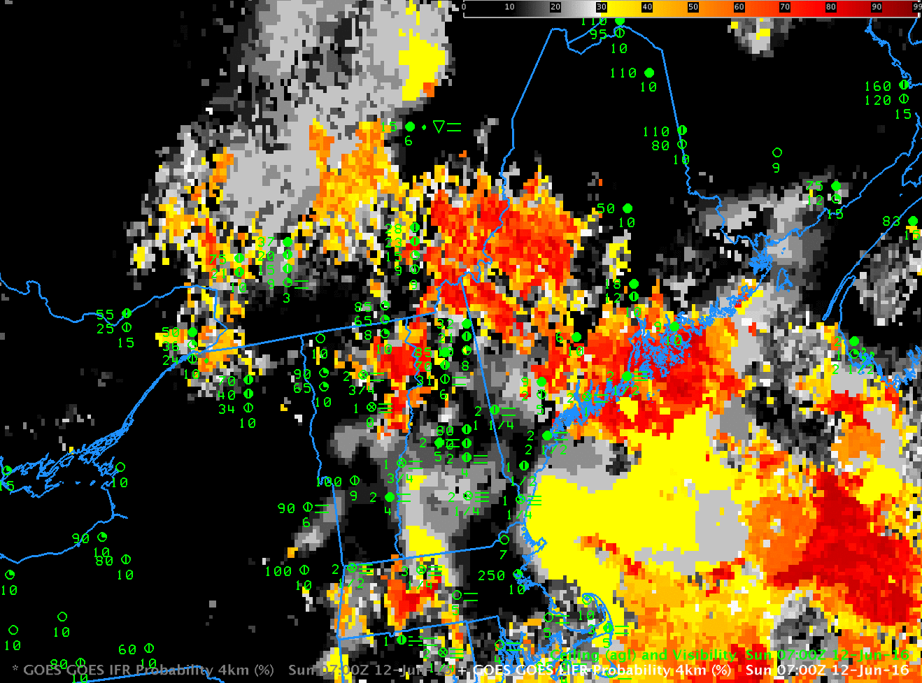
GOES-R Low IFR Probability fields, hourly from 0300 through 1500 UTC on 4 May 2017 (Click to enlarge)

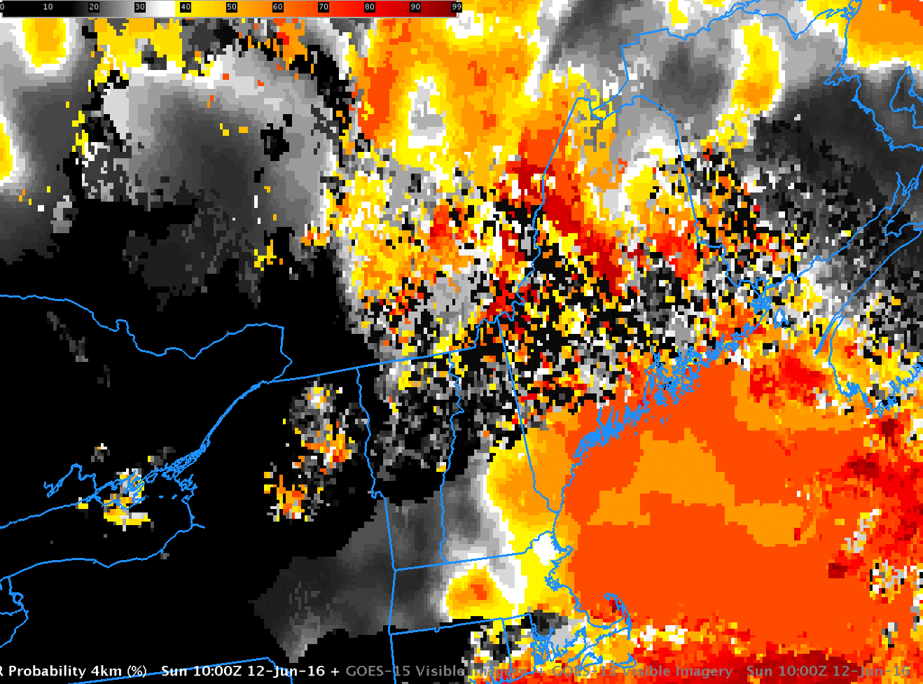
Note: GOES-R IFR Probabilities are computed using Legacy GOES (GOES-13 and GOES-15) and Rapid Refresh model information; GOES-16 data will be incorporated into the IFR Probability algorithm in late 2017.

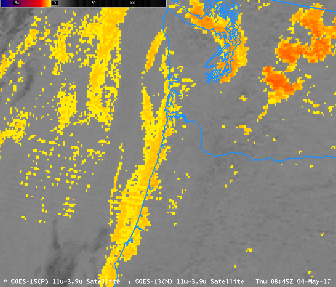
Dense fog with IFR and Low IFR Conditions occurred along the Oregon and Washington Coasts early on 4 May 2017. The animations above show the evolution of IFR Probability and Low IFR Probability. Note that IFR Conditions/Low IFR Conditions mostly occurred where Probabilities were high, with a few exceptions (KSMP, Stampede Pass, WA; KKLS, Kelso WA at 1400 UTC). Both IFR and Low IFR Probabilities show a general areal increased between 0800 and 0900; this can be traced to a big increase in the brightness temperature difference that occurred between 0845 and 0900 UTC (shown here) that is likely due to stray light intruding into the satellite detectors. (Brightness Temperature Difference values decreased after 0900 UTC — note that the Brightness Temperature Difference enhancement has color starting when ‘counts’ in the image reach -6).

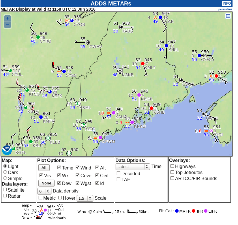
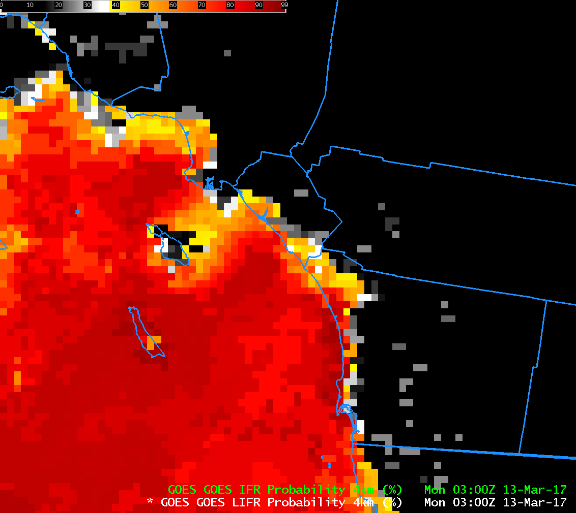
Low IFR Probabilities do a particularly good job above of outlining the regions of visibility and ceiling restrictions along the coasts of Oregon and of Puget Sound.  Note also that a strip of missing satellite data exists at 1100 UTC over northern Washington.  When satellite data are missing completely, IFR Probabilities are not computed.

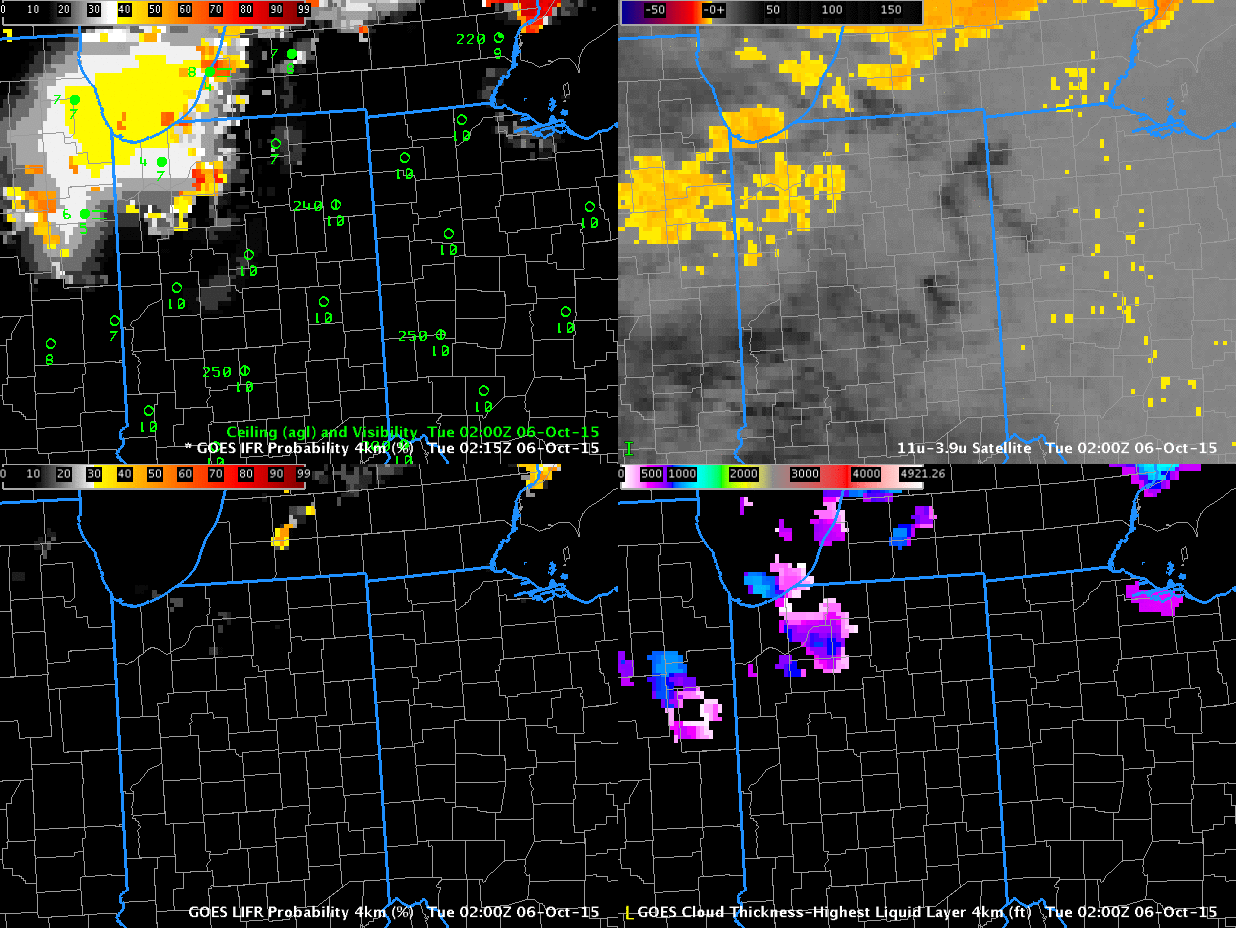
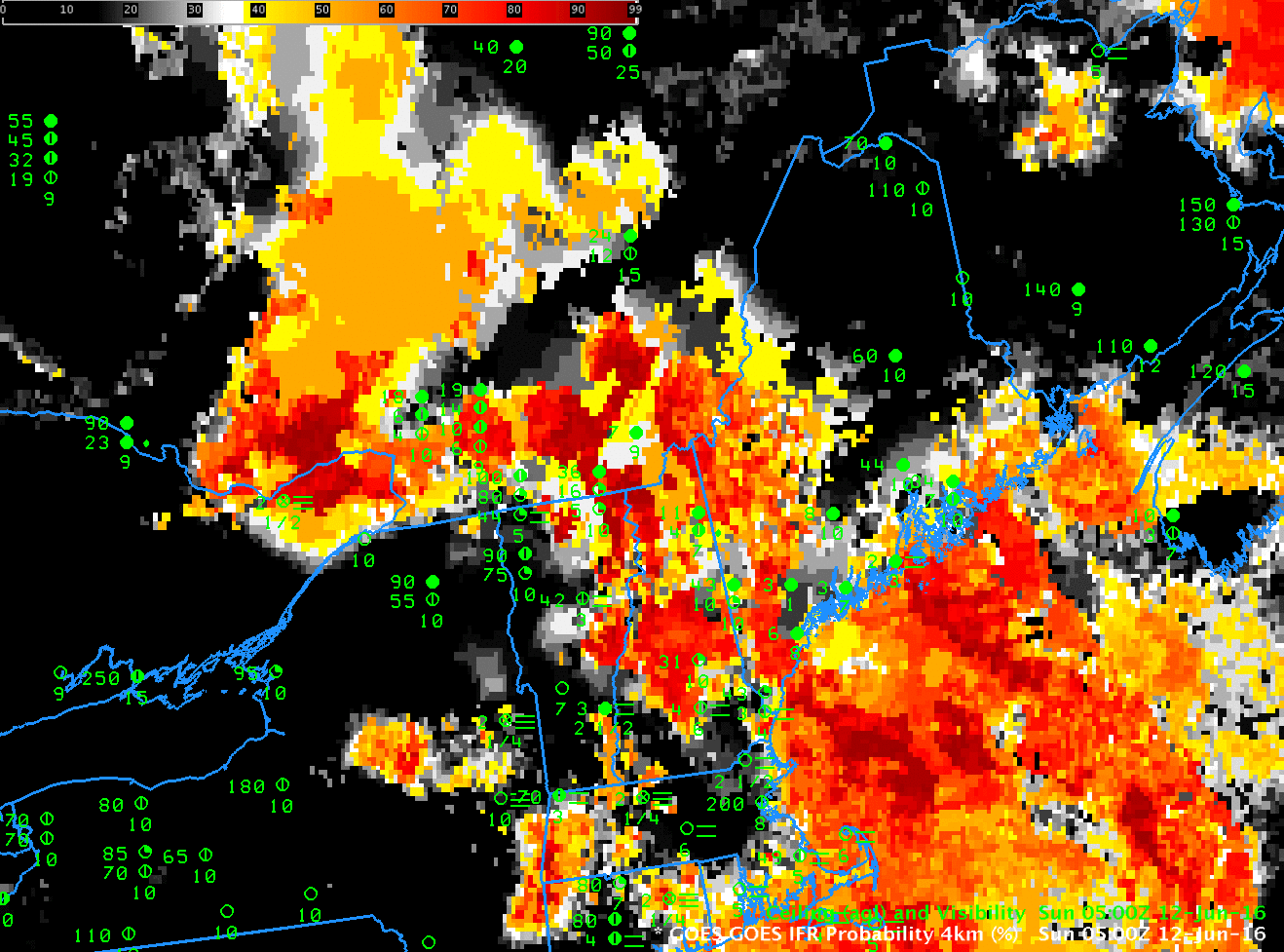
A difficulty in using Brightness Temperature Difference fields is shown below. The 1300 and 1400 UTC Brightness Temperature Difference fields show an apparent decrease in low clouds detected as the sun rises (in reality, the amount of reflected 3.9 radiation is increasing as the Sun rises). Fog persists through sunrise as shown in the observations; IFR Probabilities (and Low IFR Probabilities) maintain a signal throughout sunrise.

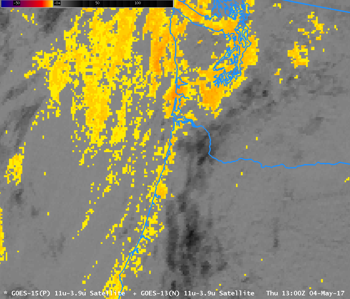
GOES-15 Brightness Temperature Difference (3.9 µm – 10.7 µm) at 1300 and 1400 UTC on 4 May 2017 followed by GOES-R IFR Probability fields at 1300 and 1400 UTC on 4 May 2017 (Click to enlarge)

Marine Stratus over southern California

GOES-R IFR Probability, hourly from 0300 to 1300 UTC, 13 March 2017 (Click to enlarge)

Note:  GOES-R FLS products are currently derived from GOES-13 and GOES-15 data.  A GOES-16 version of the GOES-R FLS products will not be available until later in 2017.

IFR Conditions developed early on March 13th 2017 as Marine Stratus moved over the southern California. This is a typical occurrence that nevertheless requires timely monitoring because of the impact of fog on transportation. The Brightness Temperature Difference fields, below, show the tops of the clouds. Water clouds do not emit 3.9 µm radiation as a blackbody, but they do emit 10.7 µm radiation nearly as a blackbody. Result: Inferred brightness temperatures (a computation that assumes blackbody emission from the source) are cooler and 3.9 µm than at 10.7 µm, and a difference field will highlight clouds made up of water droplets, i.e., stratus. If the stratus is at the surface, fog is a result. Low IFR Probability fields, above, include surface information in the form of low-level relative humidity fields from the Rapid Refresh model. Only where saturation near the surface is indicated by the model will Low IFR Probabilities be large.

In the animation above, IFR conditions develop along the coast and penetrate inland as Low IFR Probabilities increase.  Probabilities are decreasing by 1300 UTC.

IFR and Low IFR Conditions are shown in this plot from the Aviation Weather CenterThis toggle, from 0300 UTC, shows both Low IFR Probability and IFR Probability.  As might be expected, IFR Probabilities exceed Low IFR Probabilities

GOES-15 Brightness Temperature Difference (3.9 µm – 10.7 µm) Fields, hourly from 0300 to 1300 UTC on 13 March 2017 (Click to enlarge)

IFR Conditions over Maine

GOESR_IFR_0500_1215_12June2016anim

GOES-R IFR Probability, and surface plots of ceilings and visibility, 0500-1215 UTC on 12 June 2016 (Click to enlarge)

IFR Probability fields, above (a slower animation is here), show high probabilities of IFR Conditions over much of Maine, but a definite western edge is also present, moving eastward through New Hampshire and Vermont and reaching western Maine by 1215 UTC. The screen capture below, from this site, shows IFR (station models with red) and Low IFR Conditions (station models with magenta) over much of southern Maine at 1200 UTC on 12 June in advance of a warm front.

Careful inspection of the IFR Probability animation shows a field at 1000 UTC that is very speckled/pixelated. This likely results from cloud shadowing. The combination of a very low sun and multiple cloud layers resulted in many dark regions in the visible imagery that the cloud masking may have interpreted as clear regions. (Click here for a toggle between Visible Imagery and GOES-R IFR Probabilities at 1000 UTC).

MetarPLOT_1200UTC

Surface plot at 1200 UTC 12 June 2016. See text for details (Click to enlarge)

Low IFR Probability fields are also computed by the GOES-R Algorithms. Values are typically smaller than IFR Probability. Plots of Low IFR and IFR Probabilities at 0700 and 1215 UTC are shown below.

GOESR_IFR_LIFR_0700_1215_12June2016toggle

GOES-R Low IFR Probability and GOES-R IFR Probability, 0700 and 1215 UTC (Click to enlarge)

Fog under high clouds in Indiana

Indiana_06Oct2015_02_12_anim

GOES-R IFR Probability (Upper Left), GOES-R Low IFR Probability (Lower Left), GOES-13 Brightness Temperature Difference (10.7µm – 3.9µm) (Upper Right), GOES-R Cloud Thickness (Lower Right) (Click to enlarge)

Fog developed over Indiana and surrouding states (again) on the morning of 6 October, and the animation above traces that development as diagnosed by GOES-R IFR Probability fields. Multiple cloud layers over the region meant that the Brightness Temperature Difference field, a traditional method of low cloud detection (that keys on the differences in emissivity at 10.7 and 3.9 in water-based clouds) could not be used because low cloud detection was hampered by the presence of high clouds. The fused product, GOES-R IFR Probability, provides useful information by combining Rapid Refresh Data information about low-level saturation with satellite fields. When satellite information about low clouds are missing, as in this case, model data provides a signal.

Because multiple cloud layers exist, the GOES-R Cloud Thickness Product (that diagnoses the depth of the lowest water-based cloud based on an empirical relationship between 3.9 µm emissivity and cloud depth developed using sodar observations off the West Coast of the United States) is not produced over much of the region. It is also not produced at times of twilight — such as those that occur at the end of the animation. There are values over southeastern lower Michigan at the start of the animation, where high clouds were not present.

Low IFR Probability is also shown in the animation above (Lower Left figures). The small values in this case suggest any fog is unlikely to be producing visibilities less than 1 mile or ceilings less than 500 feet.