Monthly Archives: November 2020

GOES-17 IFR Probability around Bristol and Kvichak Bays

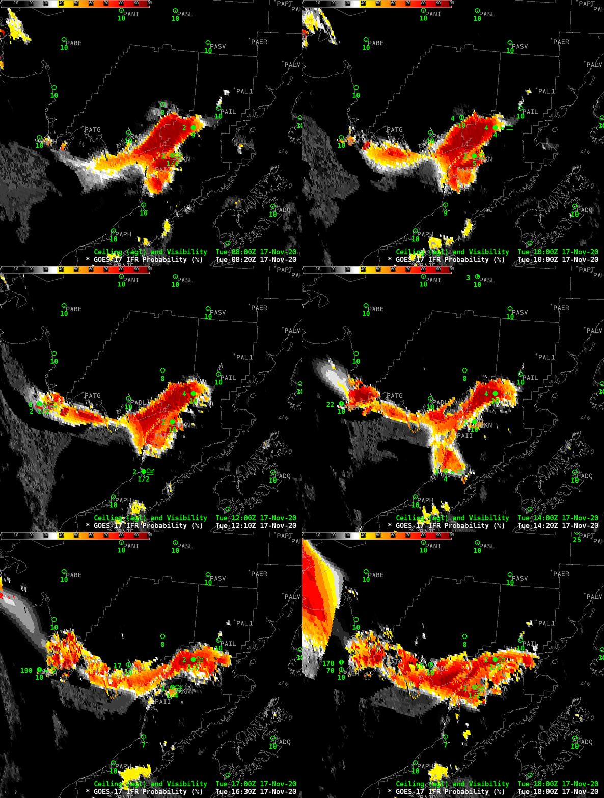
GOES-17 IFR Probability, 0820 – 1800 UTC on 17 November 2020 (Click to enlarge)

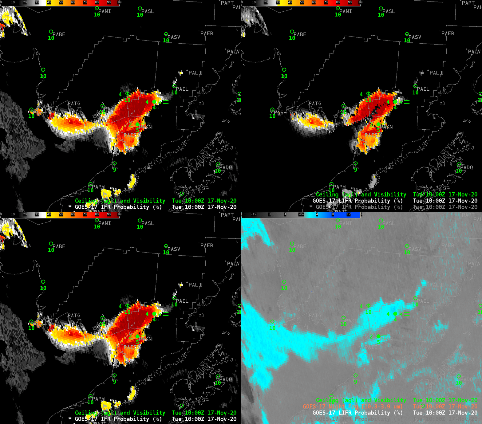
GOES-17 IFR Probability fields, above, show a thin region along the northern shore of Bristol and Kvichak Bays in southwestern Alaska, north of the Aleutian Peninsula, where IFR conditions are likely . Probabilities are highest around King Salmon (PAKN) and Igiugig (PAIG) northeast of King Salmon. Several nearby airports are not reporting observations (PAII — Egegik — just south of King Salmon; PATG –Togiak — along the northern shore of the Bay, east of PAEH (Cape Newenham). IFR probability uses satellite and model information to create an estimate of whether or not IFR conditions will be met in regions where observations are missing. Sometimes, as over Cape Newenham at the end of the animation, high clouds are present and only model data can be used to create the estimate.

The Night Fog Brightness Temperature Difference field, below, shows that low clouds (made up of water droplets) exist over the same region — but this one product cannot indicate whether the stratus deck observed is reducing visibility near the surface (where aviation interests require that information). The model data that are incorporated into IFR Probability in concert with satellite data allow for a better estimate of where visibility is reduced than do satellite data alone. This is especially important when the presence of high clouds, as at the end of the animation in the western part of this domain, makes it difficult for the satellite to view low clouds.
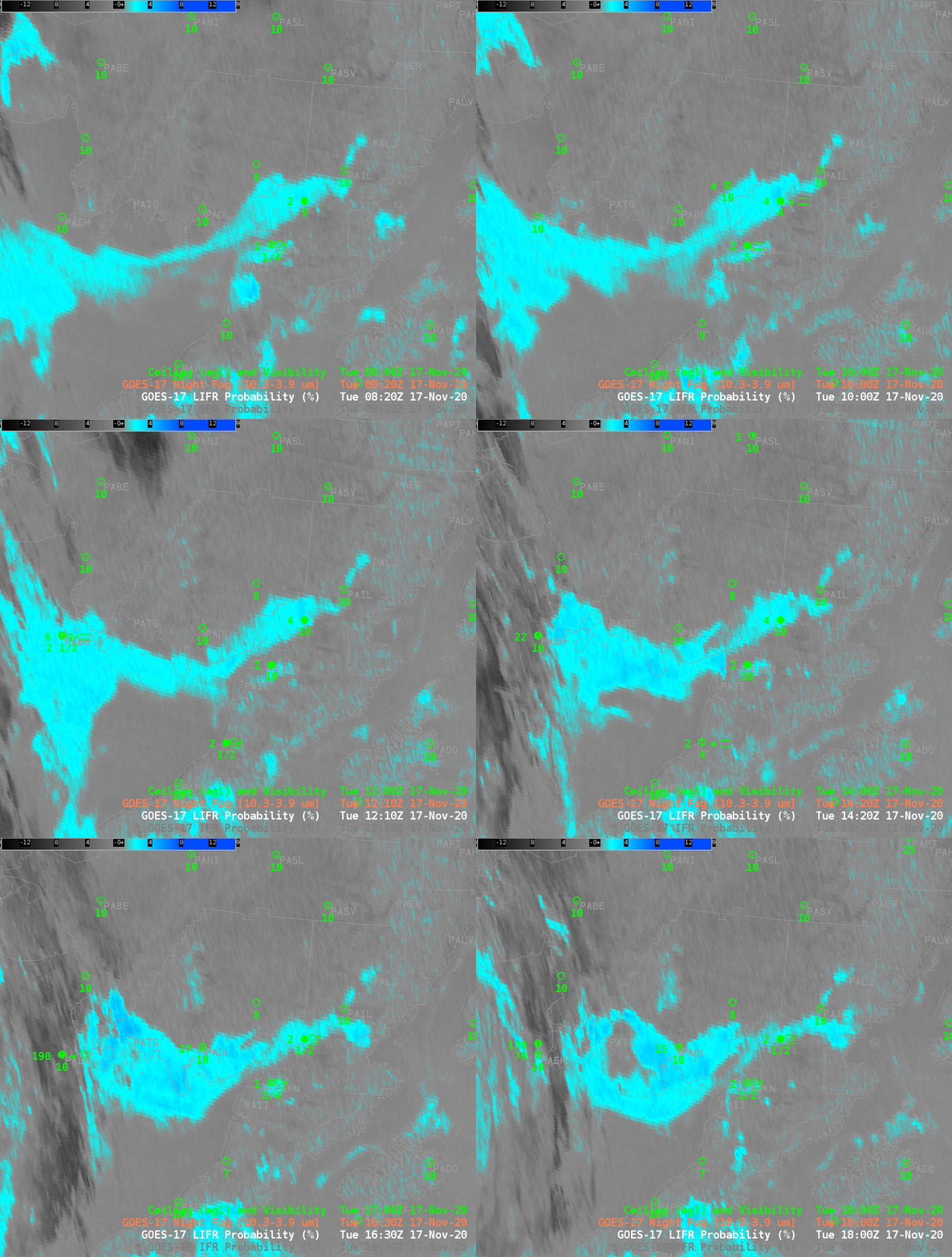
GOES-17 ‘Night Fog’ Brightness Temperature Difference field (10.3 µm – 3.9 µm), 0820-1800 UTC on 17 November 2020 (Click to enlarge)
IFR Probability, Low IFR Probability, and Night Fog Brightness Temperature difference at 1000 UTC on 17 November 2020 (Click to enlarge)

Toggles at 1000 UTC (above) and 1600 UTC (below) of IFR Probability, Low IFR Probability and Night Fog Brightness Temperature Difference, suggest that the greatest likehihood of reduced visibilities are not along the bay shore, but rather inland along the Kvichak River.
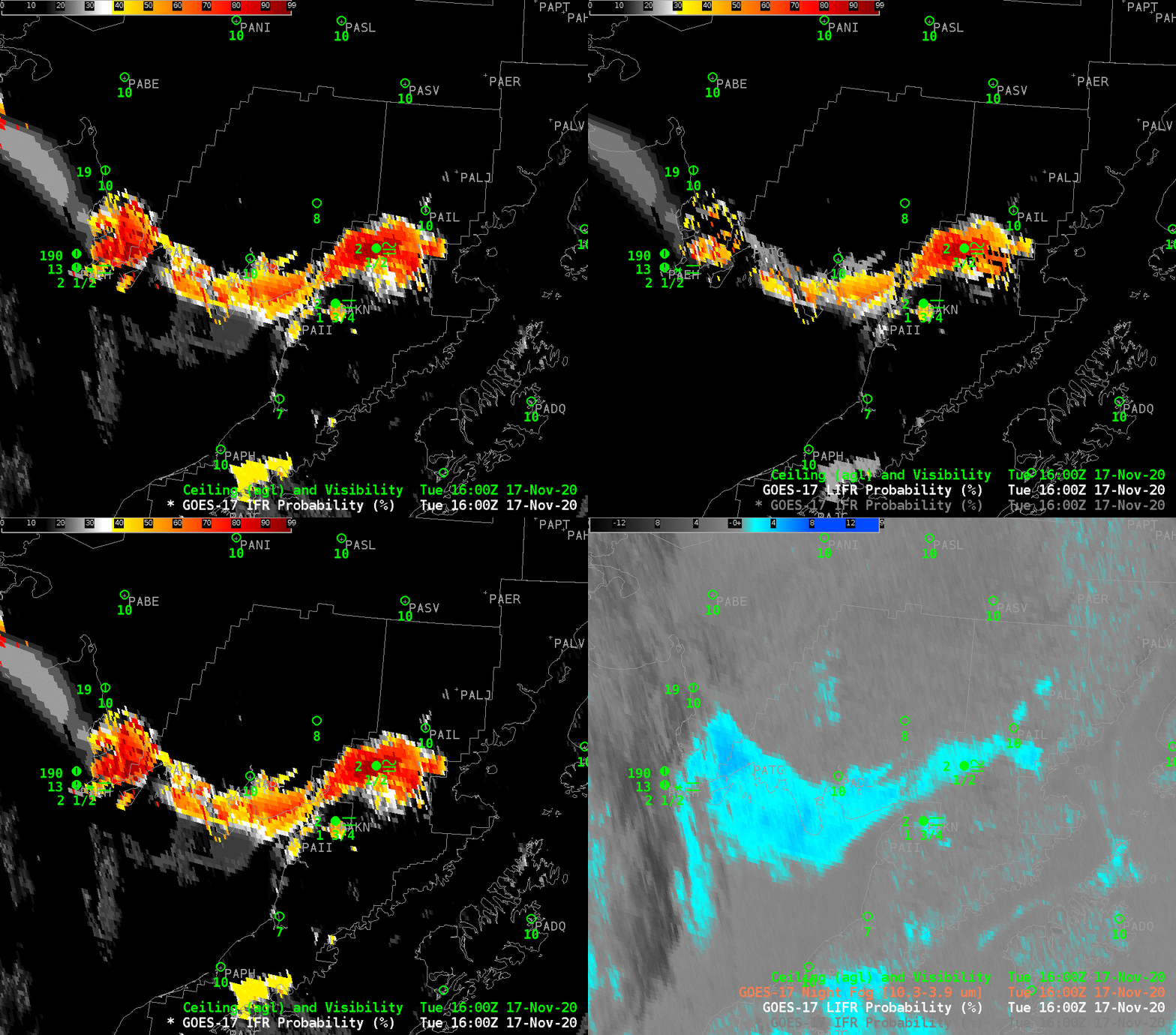
IFR Probability, Low IFR Probability, and Night Fog Brightness Temperature difference at 1600 UTC on 17 November 2020 (Click to enlarge)

Fog in Oregon’s Willamette Valley

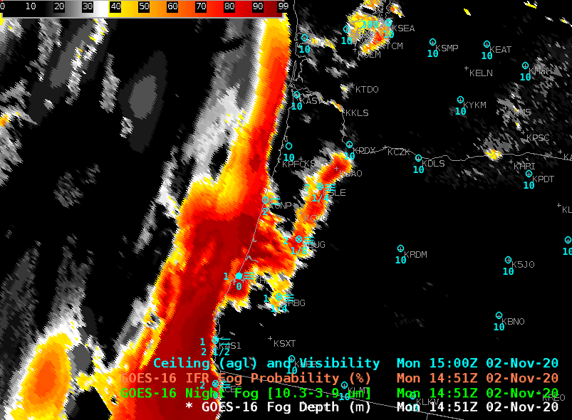
GOES-16 IFR Probability, 1451 UTC on 2 November 2020 along with 1500 UTC observations of ceilings and surface visibility (Click to enlarge)

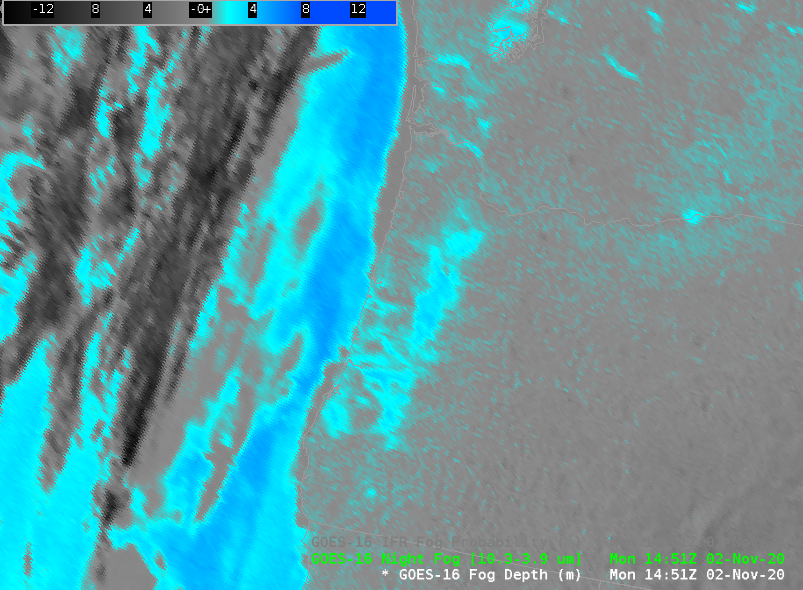
GOES-16 IFR Probability fields, above, show very high IFR Probability values over the Willamette Valley of Oregon to the south of Portland; surface observations in the region show IFR conditions from Salem (KSLE) southward through Eugene (KEUG) to Roseburg (KRBG). IFR Probability is also large along the coast, with IFR conditions reported at Newport (KONP) and North Bend (KOTH). The 10.3 µm – 3.9 µm “Night Fog” Brightness Temperature Difference field, below, also has a modest signal in the Valley, and along the coast, giving a qualitative (but not quantitative) estimate of fog.

GOES-16 Night Fog Brightness Temperature Difference (10.3 µm – 3.9 µm) at 1451 UTC on 2 November 2020 (Click to enlarge)
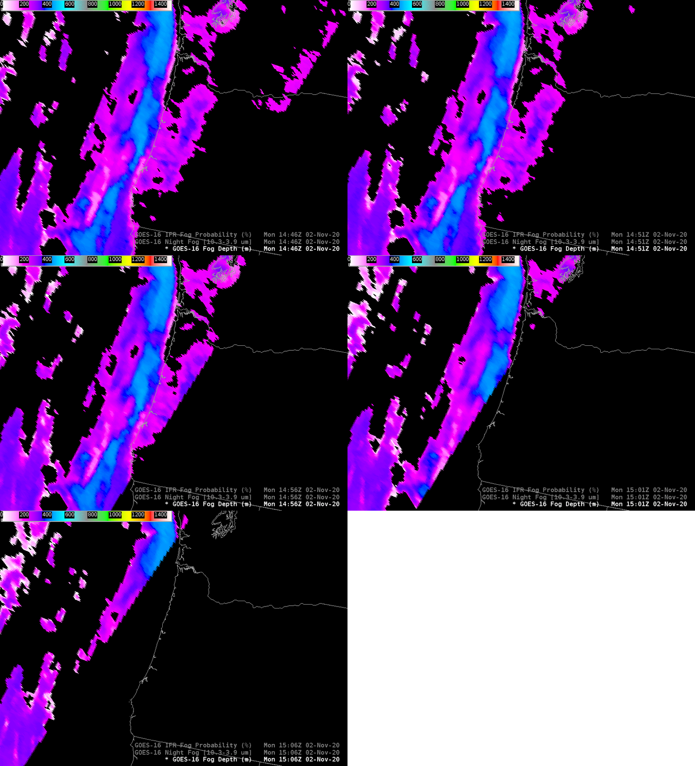
GOES-16 Cloud Thickness (“Fog Depth”) from 1451-1506 UTC on 2 November 2020 (Click to enlarge)

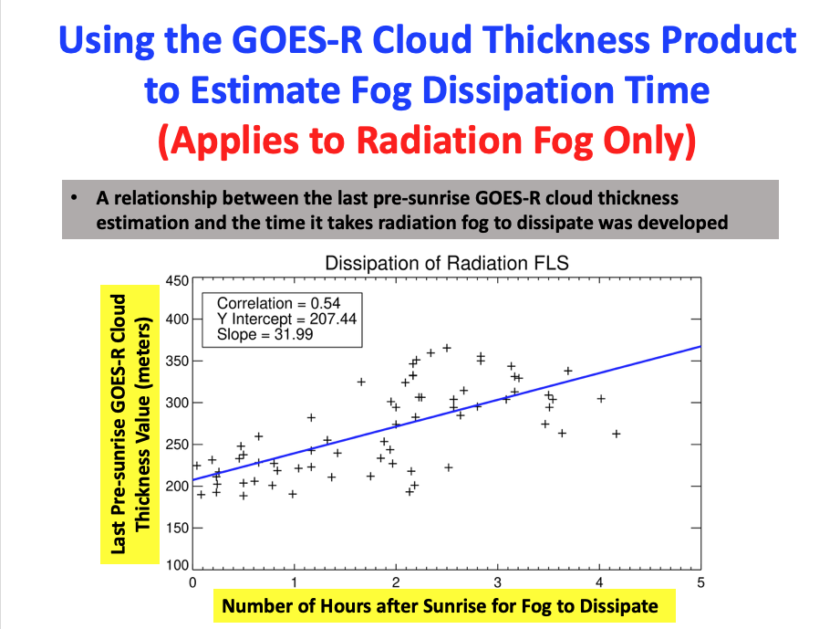
GOES-R Cloud Thickness (labeled as Fog Depth in TOWR-S Build 19) can be used to estimate radiation fog dissipation time. Values are not computed during the time of rapidly-changing reflected solar radiance (i.e., for the times around sunrise and sunset); the last pre-sunrise value can be used in concert with this scatterplot to estimate burn-off times. Values at 1451 UTC in the Willamette valley peak at around 380 m. This suggests a burn-off time (if this is radiation fog and not advection fog) of about two hours according to the scatterplot below, i.e., shortly before 1700 UTC.

Scatterplot: Last pre-sunrise Cloud Thickness value vs. Dissipation Time. (Click to enlarge)

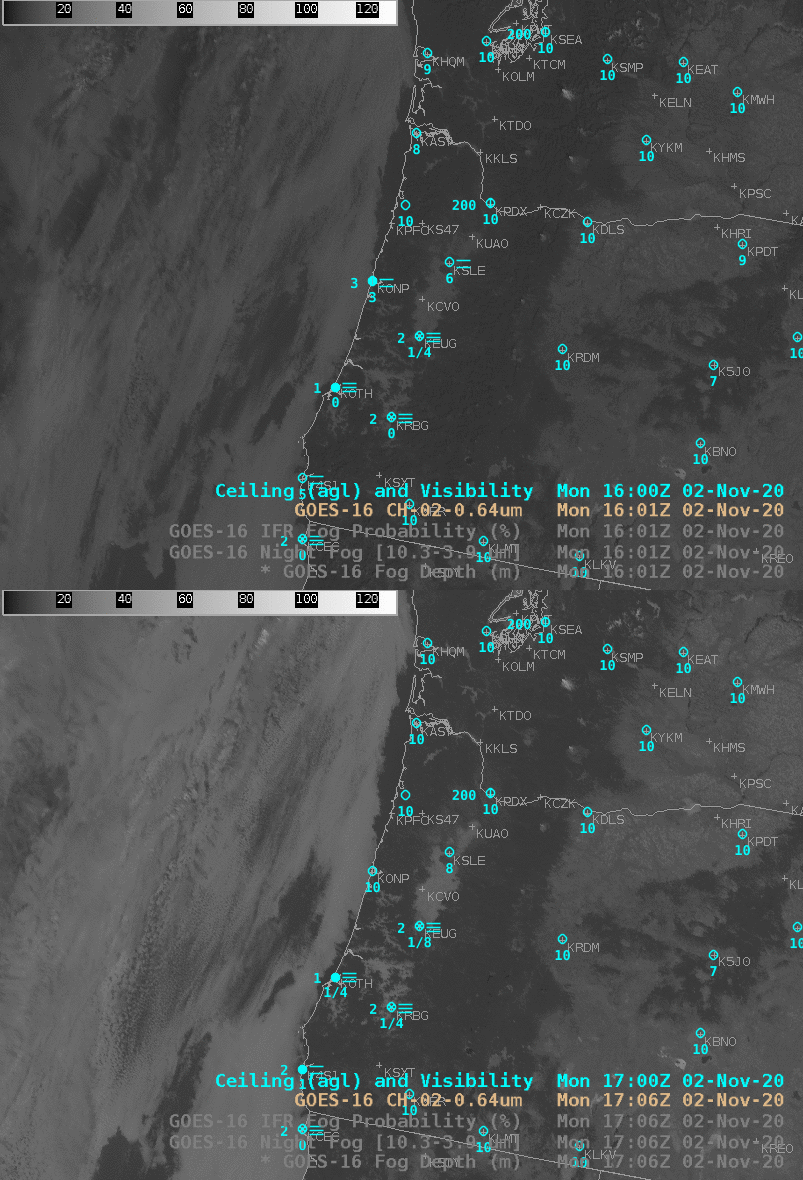
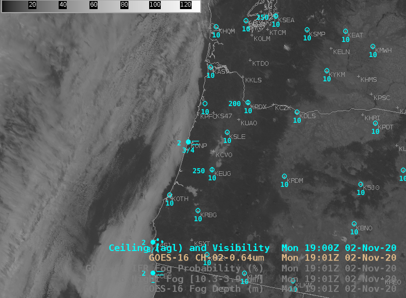
Visible imagery, below, at 1601 and 1706 UTC do show a trend towards clearing. The scatterplot can underestimate clearing time if (1) the sun angle is lower than at the points used to create the scatterplot or (2) if the fog is not strictly a radiation fog. In either event, however, the values from day to day should give useful information. For example, if today’s last pre-sunrise cloud thickness is greater than yesterday’s, then the burn-off time today should be later than yesterday.

GOES-16 Visible (0.64) Imagery and surface observations of ceilings/visibility at 1601 and 1706 UTC on 2 November 2020 (click to enlarge)
GOES-16 Visible (0.64) Imagery and surface observations of ceilings/visibility at 1901 UTC on 2 November 2020 (click to enlarge)

Fog/low stratus dissipated shortly after the 1901 UTC image shown above.