
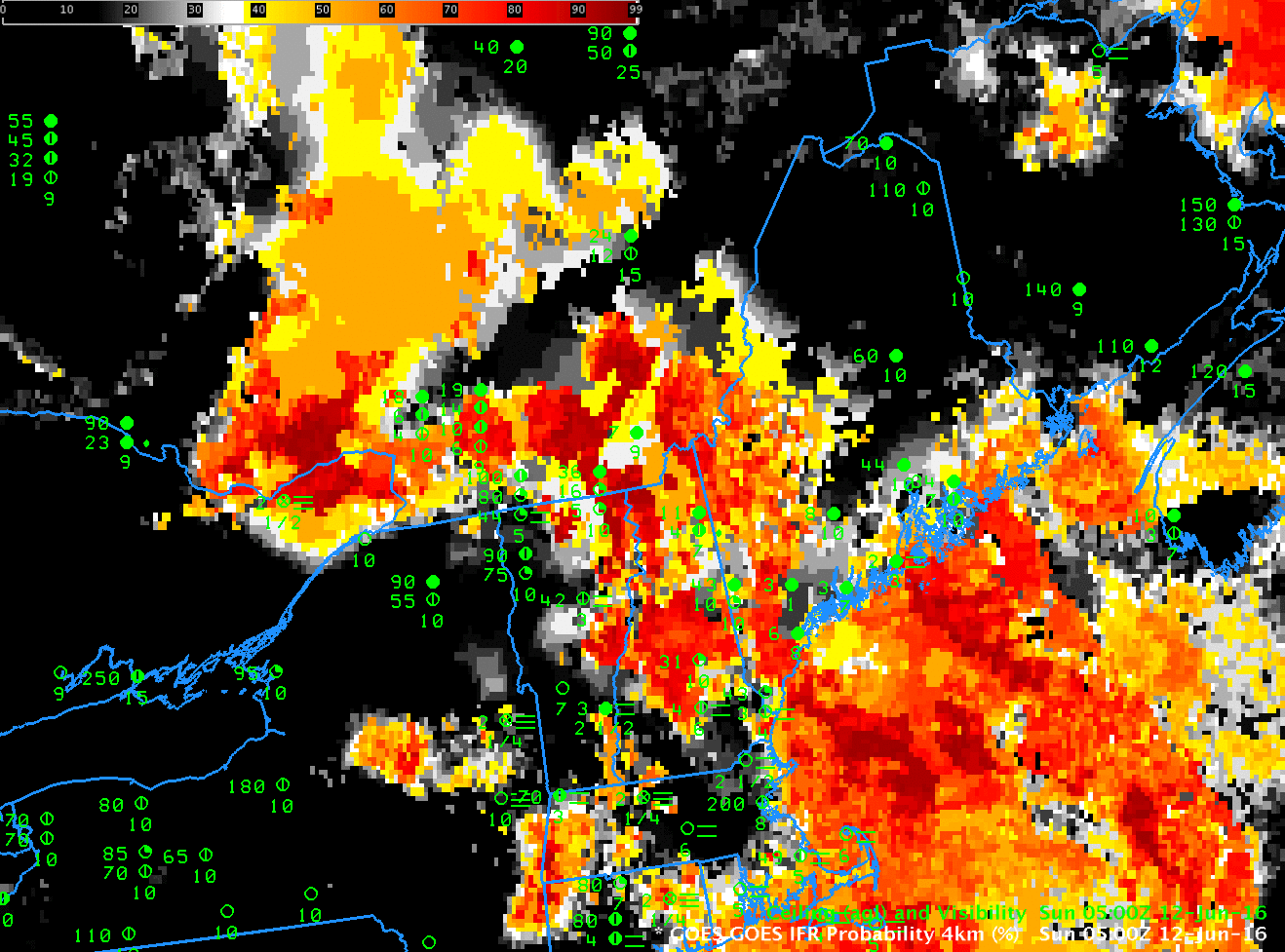
GOES-R IFR Probability, and surface plots of ceilings and visibility, 0500-1215 UTC on 12 June 2016 (Click to enlarge)
IFR Probability fields, above (a slower animation is here), show high probabilities of IFR Conditions over much of Maine, but a definite western edge is also present, moving eastward through New Hampshire and Vermont and reaching western Maine by 1215 UTC. The screen capture below, from this site, shows IFR (station models with red) and Low IFR Conditions (station models with magenta) over much of southern Maine at 1200 UTC on 12 June in advance of a warm front.
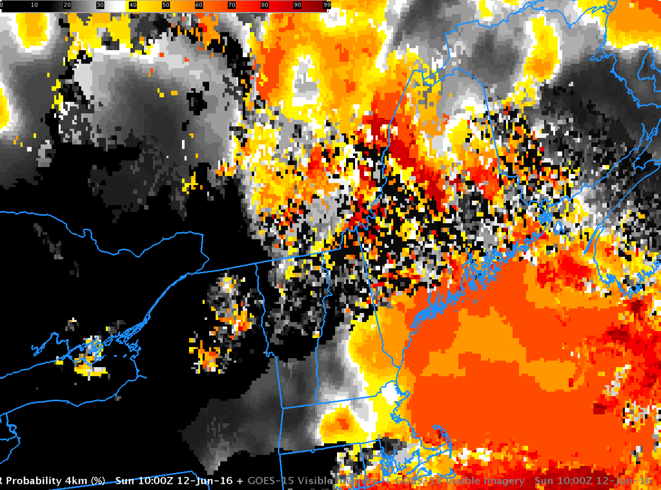
Careful inspection of the IFR Probability animation shows a field at 1000 UTC that is very speckled/pixelated. This likely results from cloud shadowing. The combination of a very low sun and multiple cloud layers resulted in many dark regions in the visible imagery that the cloud masking may have interpreted as clear regions. (Click here for a toggle between Visible Imagery and GOES-R IFR Probabilities at 1000 UTC).
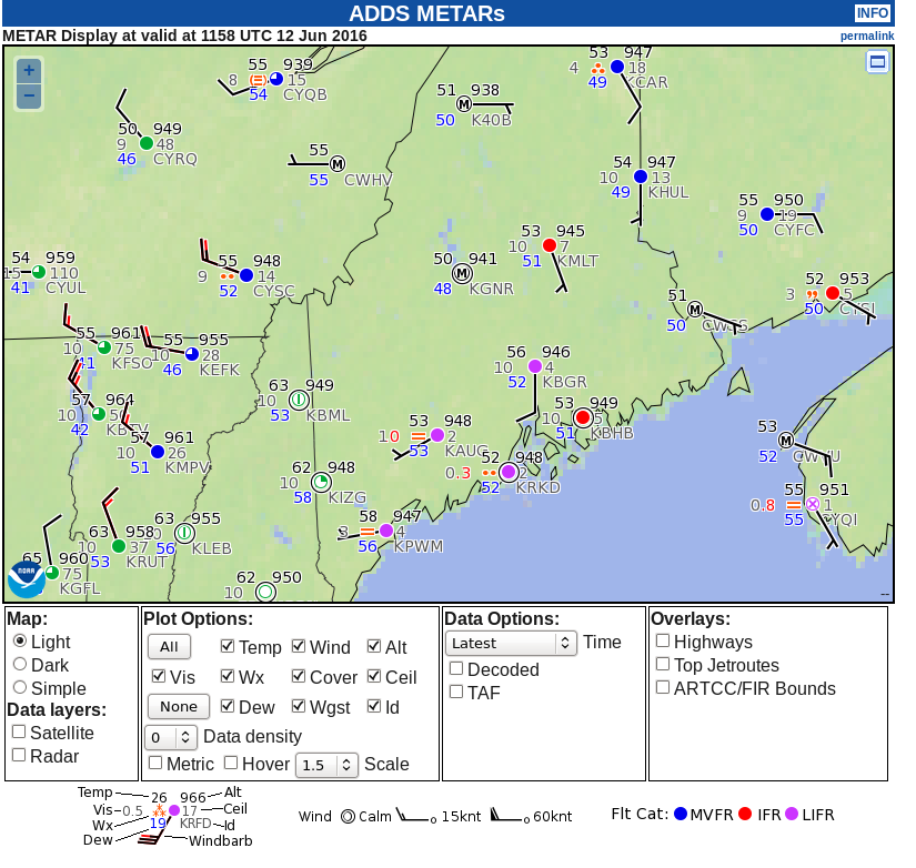
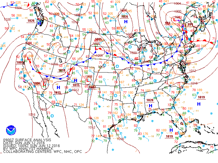
Surface plot at 1200 UTC 12 June 2016. See text for details (Click to enlarge)
Low IFR Probability fields are also computed by the GOES-R Algorithms. Values are typically smaller than IFR Probability. Plots of Low IFR and IFR Probabilities at 0700 and 1215 UTC are shown below.
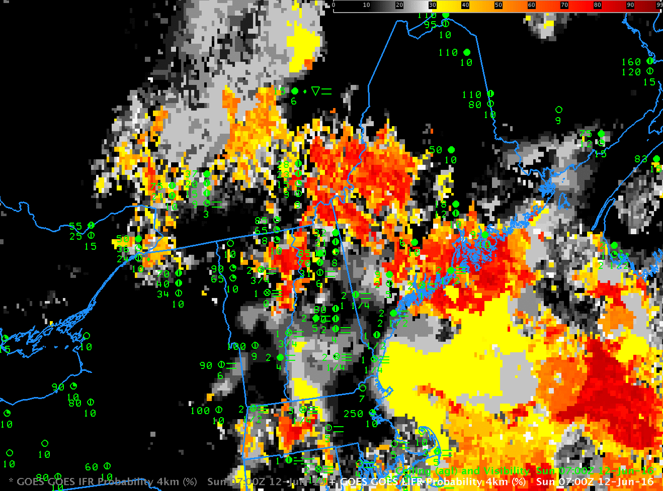
GOES-R Low IFR Probability and GOES-R IFR Probability, 0700 and 1215 UTC (Click to enlarge)