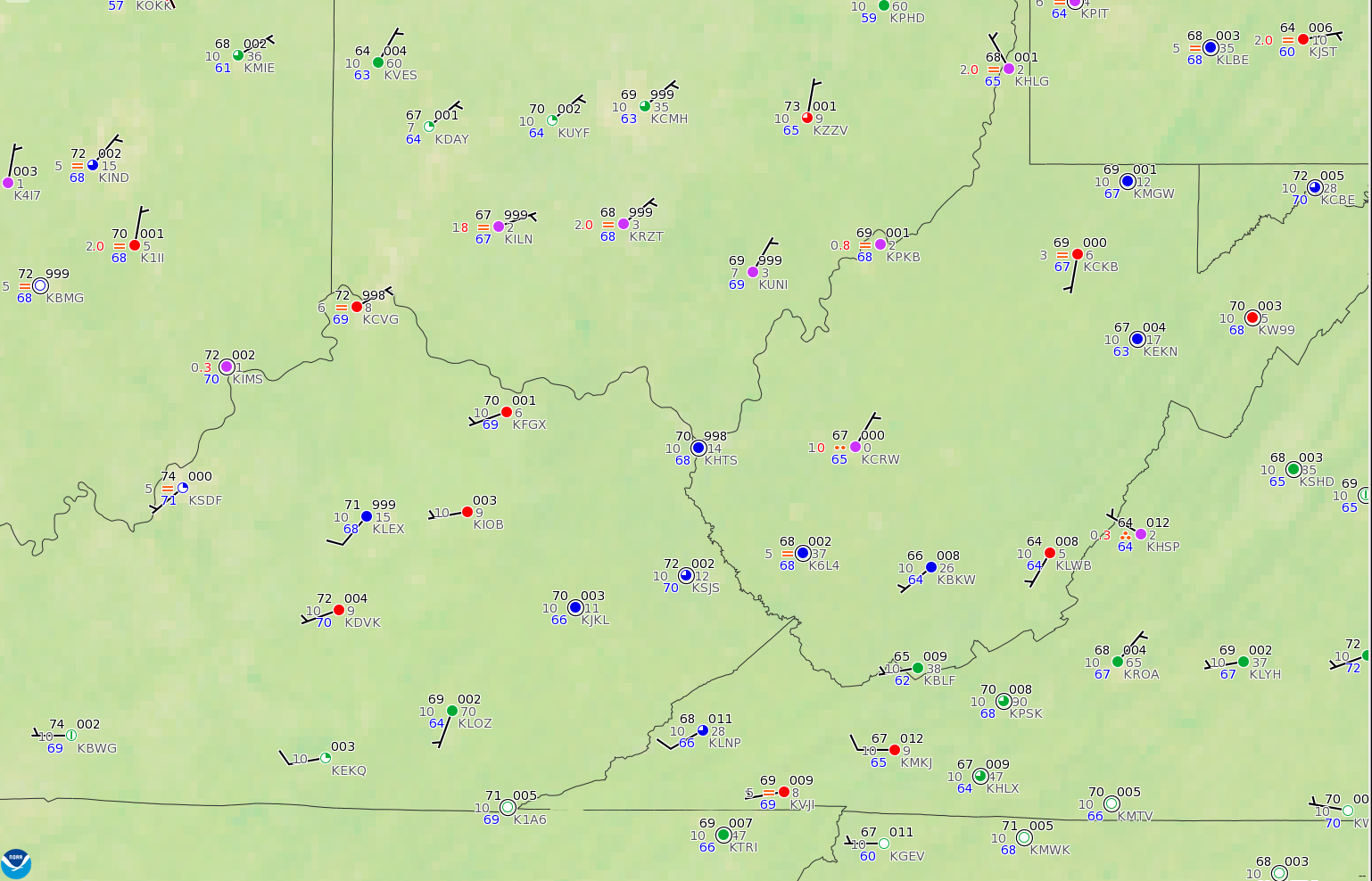
Surface Observations at 1200 UTC on 24 June 2016 (Click to enlarge)
A screen capture from this site at 1215 UTC on 24 June 2016, above, shows IFR Conditions (Red) and Low IFR Conditions (Purple) over the upper Ohio River Valley and surrounding states. The IFR Probability field for the same time, below, shows high probabilities in roughly the same regions that have IFR or Low IFR conditions. The Brightness Temperature Difference field, also displayed in the toggle below, gives little information at this time of day. A benefit of the GOES-R IFR Probability field is that it contains a coherent signal through sunrise.
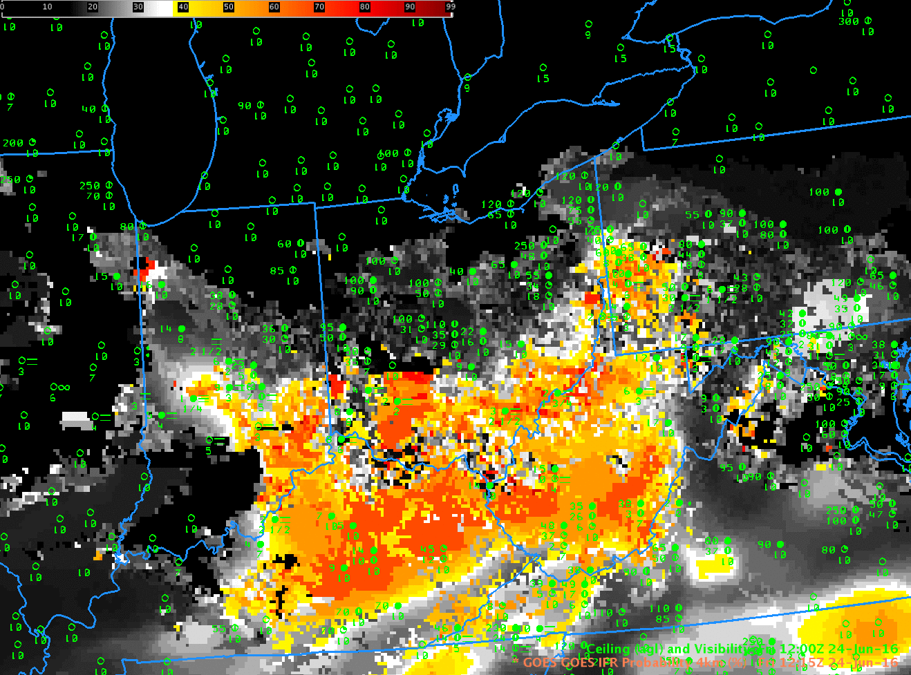
GOES-R IFR Probability fields and GOES-13 Brightness Temperature Difference Fields (3.9 µm – 10.7 µm) at 1215 UTC on 24 June 2016 (Click to enlarge)
The toggle at 0915 UTC, below, before sunrise, shows a second benefit of IFR Probability fields: a useful signal in regions with cirrus clouds. High clouds, of course, prevent GOES-13 from viewing the development of fog/low stratus near the surface. The Rapid Refresh model data on low-level saturation that are part of the IFR Probability Field computations give quality information in regions of cirrus. In the example below, developing IFR conditions are depicted (the yellow enhancement that shows IFR Probabilities around 40%) over much of northern Kentucky and southern Ohio. This is under a region of cirrus (black in the enhancement used for the brightness temperature difference) north of a convective system that sits over southeastern Kentucky and eastern Tennessee.
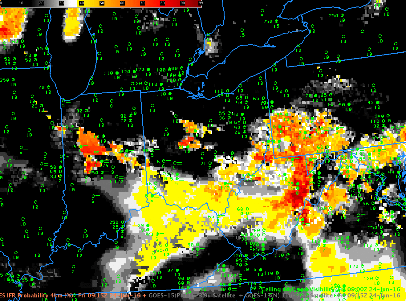
GOES-R IFR Probability fields and GOES-13 Brightness Temperature Difference Fields (3.9 µm – 10.7 µm) at 0915 UTC on 24 June 2016 (Click to enlarge)
The waning full moon provided ample illumination for the Suomi NPP Day/Night Band Imagery, shown below, from 0736 UTC on 24 June 2016. The cirrus shield, mid-level clouds and developing valley fogs are all apparent.

Suomi NPP Day/Night band imagery, 0736 UTC on 24 June 2016 (Click to enlarge)