 |
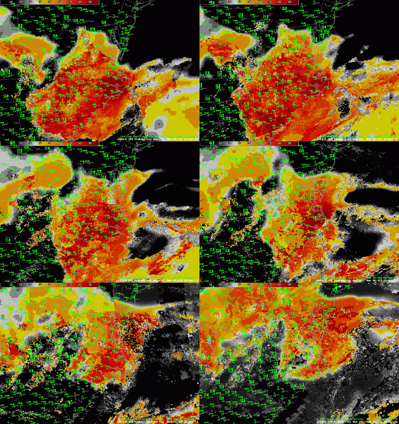
| GOES-R IFR Probabilities computed from GOES-East and Rapid Refresh model output, from 0100 through 1400 UTC on March 25 2013 |
A late winter storm moving through the mid-Altantic states was responsible for an episode of reduced visibilities. The loop above shows two areas of reduced visibilities initially — one over the Piedmont of Georgia, the Carolinas and Virginia, and one over the Ohio River Valley. Visibilities decrease as the higher IFR probabilities move in, and, conversely, increase as the higher probabilities move out. IFR Probabilities over southern Ohio, for example, have a character that suggests the probabilities have been computed chiefly with model data. Probabilities are somewhat reduced, and the fields are not pixelated (as they are over the Carolina Piedmont, for example).
 |
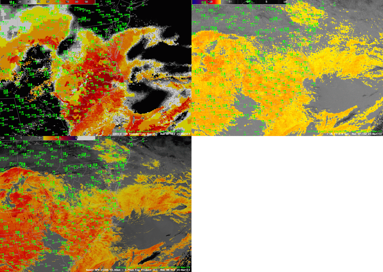
| GOES-R IFR Probabilities computed from GOES-East, Brightness Temperature Difference fields from GOES-East (10.7 µm – 3.9 µm) and from Suomi/NPP (10.8 µm- 3.74 µm) around 0700 UTC on 25 March 2013 |
The animation of the ~0700 UTC IFR Probability and brightness temperature difference field from both GOES-East and from the polar-orbiting Suomi/NPP, above, shows another strength of the IFR Probability product: It screens out regions where high stratus give a signal. The top of a stratus deck and the top of a fog deck may have a very similar brightness temperature difference signal. By fusing the satellite data with a product that includes surface information (such as output from the Rapid Refresh Model), regions with elevated stratus, which clouds do not significantly impact aviation operations, can be removed from the signal. Only regions with actual surface observation restrictions are highlighted in the IFR probability signal above.
