 |
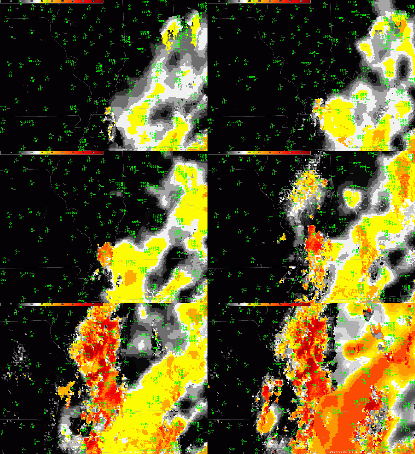
| GOES-R IFR Probabilities computed from GOES-East, hourly from 0215 UTC through 1115 UTC on July 5 2013 |
GOES-R IFR Probabilities show a characteristic increase over central Illinois as radiation fog develops in the early morning hours of July 5 2013. Probabilities are initially low, but gradually increase, and spread, as the fog develops. The IFR probability field over Tennessee, Indiana and Kentucky has the characteristic flat look of a field produced mainly from model fields: the probability field is flat, and IFR probabilities are low. There are regions — such as near Nashville at the end of the animation — where the field includes satellite data; IFR Probabilities there are larger and the IFR Probability field has a more pixelated appearance.
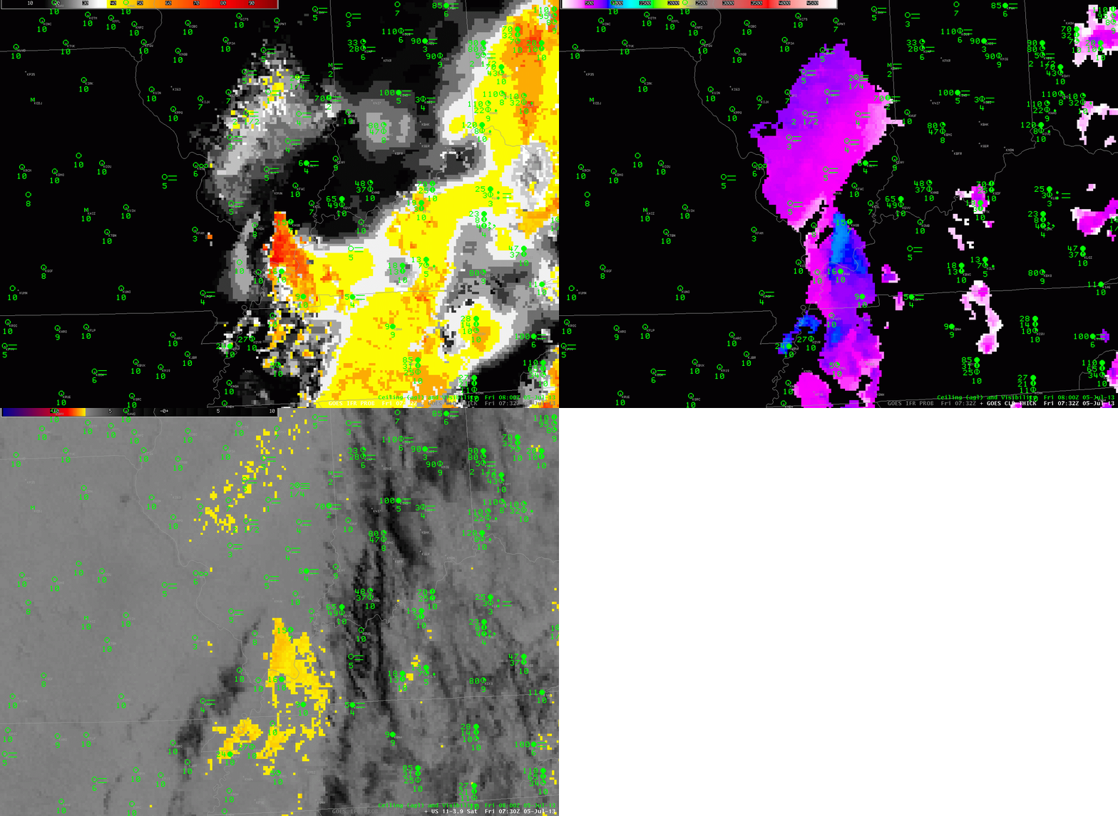
If multiple cloud layers are present, you should not expect the GOES-R Cloud Thickness product to yield a value. GOES-R Cloud Thickness diagnoses the thickness of the highest water-based cloud in non-twilight conditions. If ice clouds (or mixed phase) clouds are present, cloud thickness will not be computed. The toggle below shows cloud thickness, GOES-R IFR Probabilities, and the Brightness Temperature Difference (10.7 µm – 3.9 µm)
 |
| GOES-R IFR Probabilities, GOES-R Cloud Thickness, and GOES-East Brightness Temperature Difference, 0730 UTC on 5 July 2013 |
There a several things of note in the image above. IFR Probability field in central Illinois have higher values south of the peak in the brightness temperature difference field, where the lowest visibilities and ceilings are reported. GOES-R Cloud Thickness is unavailable in regions underneath the high clouds in the eastern part of the imagery — over Tennessee and Kentucky, except where there are holes in the clouds. Note how these regions of diagnosed GOES-R Cloud Thickness overlap with regions of pixelated GOES-R IFR Probability fields. In both fields, Satellite data are being used for the computation.
