 |
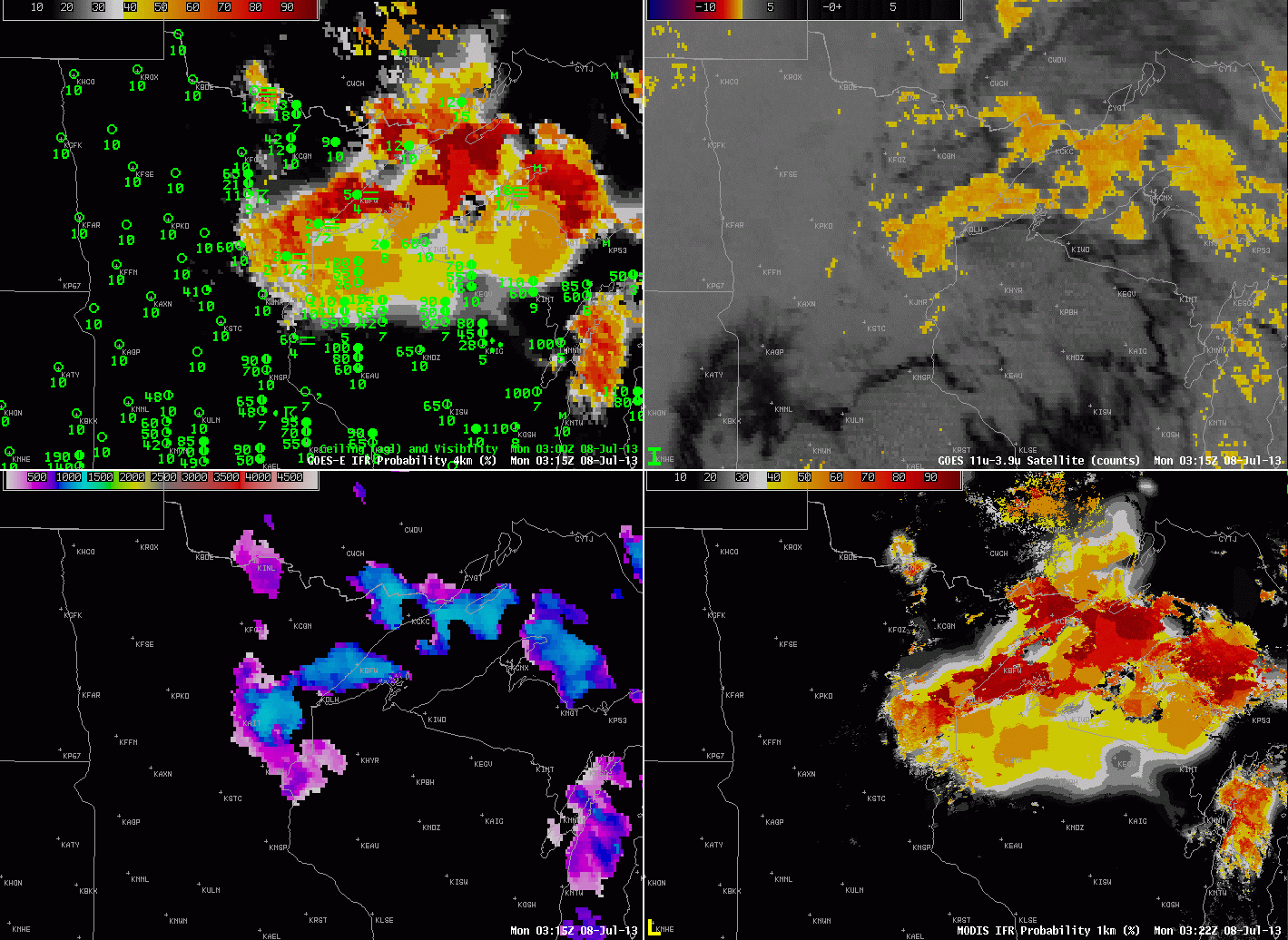
| GOES-R IFR Probabilities computed from GOES-East, and surface observations of ceilings/visibilities (Upper Left), GOES-East Brightness Temperature Difference (10.7 µm – 3.9 µm) (Upper Right), GOES-R Cloud Thickness computed from GOES-East (Lower Left), GOES-R IFR Probabilities computed from MODIS (Lower Right) |
The combination of cold Lake surface temperatures in the 40s and 50s over Lake Superior and mid-Summer dewpoints in the 60s to near 70 is a recipe for fog over the upper midwest. North winds behind a complex of thunderstorms fostered the development of fog and low stratus over the upper midwest early in the morning on July 8th, as shown in the imagery above.
The GOES-R IFR Probability fields seamlessly track the expansion of fog/low stratus in the region around western Lake Superior; highest probabilities are confined to regions where IFR or near-IFR conditions are observed. The IFR Probabilities also downplay regions where the brightness temperature difference field is showing a signal (northwest Minnesota) but where visibility obscurations are small.
IFR Probabilities are not as large over southern upper Michigan or over north-central Wisconsin, regions where multiple cloud layers mean that the satellite component does not contribute to IFR Probability computation, resulting in a smaller value. Note that Cloud Thickness is not initially computed there either: Cloud Thickness describes the thickness of the lowest water-based cloud layer in non-twilight conditions. If there are multiple cloud layers that include mixed-phase of ice clouds, cloud thickness is not computed. Note also that cloud thickness is not computed in the hours around sunrise (i.e., during twilight conditions).
By 1702 UTC, the final image, the Summer Sun has burned off much of the fog and low stratus, with the exception being along the shorline of Lake Superior. MODIS-based IFR Probabilities have much sharper edges because of the higher resolution of the MODIS instrument compared to the GOES Imager.