 |
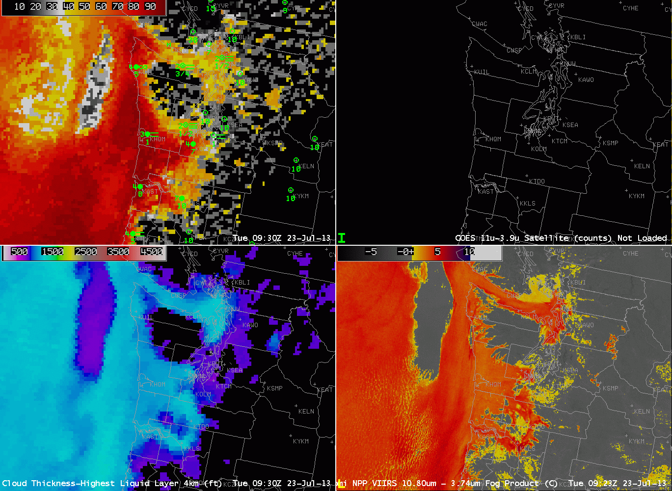
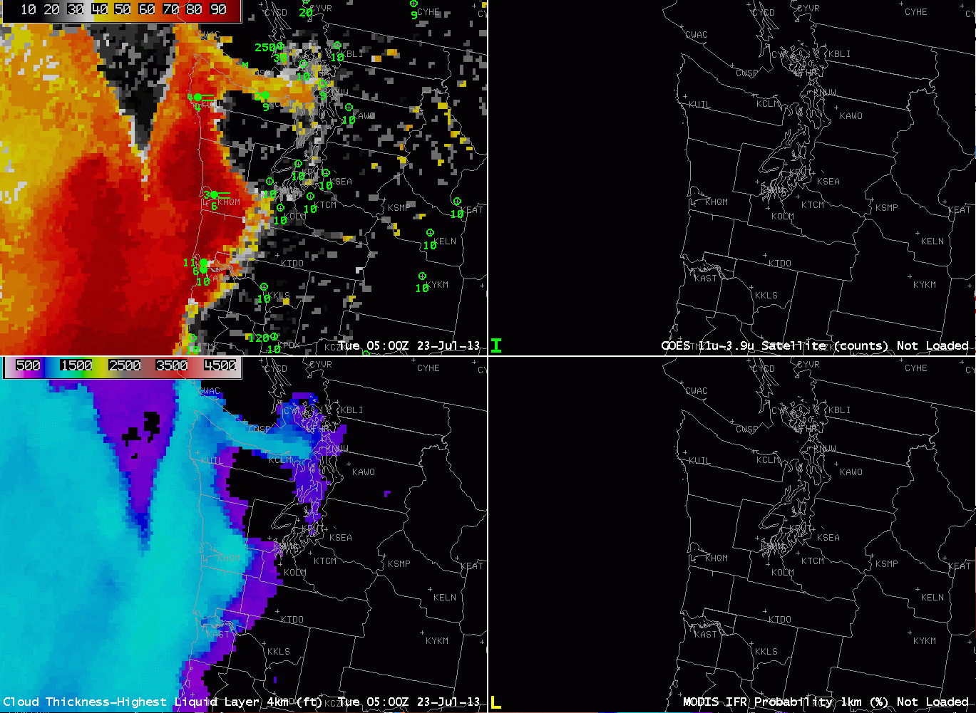
| GOES-R IFR Probabilities computed from GOES-West (Upper Left), GOES-West Brightness Temperature Difference (10.7 µm – 3.9 µm) (Upper Right), GOES-R Cloud Thickness from GOES-West (Lower Left), GOES-R IFR Probabilities computed from MODIS (Lower Right), hourly from 0500 through 1200 UTC on 23 July 2013. |
Hourly GOES-R IFR Probabilities ably capture the creep of low fog and stratus into Puget sound from the north — through the strait of Juan de Fuca, and from the south, with low clouds eventually surrounding the Olympic Mountains. Part of the input into the GOES-R IFR Probability algorithm is the brighness temperature difference shown in the upper right, and note that it used alone overpredicts where low clouds/fog might be occurring. Including Rapid Refresh data allows the GOES-R algorithm to restrict — correctly — the IFR conditions to where they are most widespread.
Suomi-NPP data from the VIIRS instrument includes a Day/Night band that on July 23rd, when the moon was approaching full, neatly outlines both the cloudy regions — where moonlight is reflected off clouds — and those regions where light is being emitted (that is, cities).
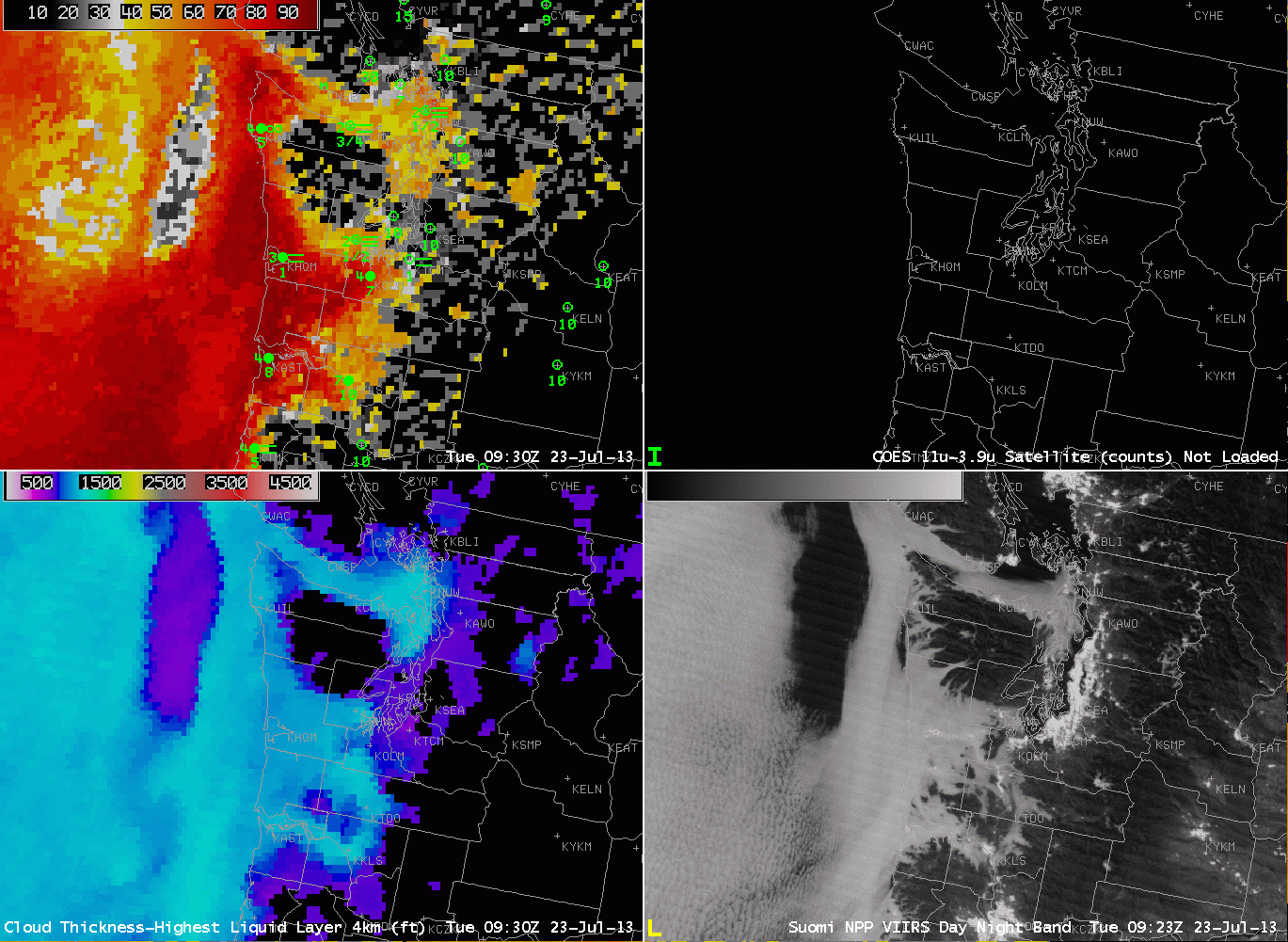 |
| As above, but with the VIIRS Day/Night band in the bottom right, at 0923 and 1103 UTC. |
Suomi/NPP VIIRS data also includes 10.8 and 3.74 µm imagery, so a brightness temperature difference product can be computed (work is in progress to incorporate Suomi/NPP data into the GOES-R algorithm suite so an NPP-based IFR probability can be developed. The toggle below compares the day/night band data with the brightness temperature difference produce at 0923 UTC.