 |
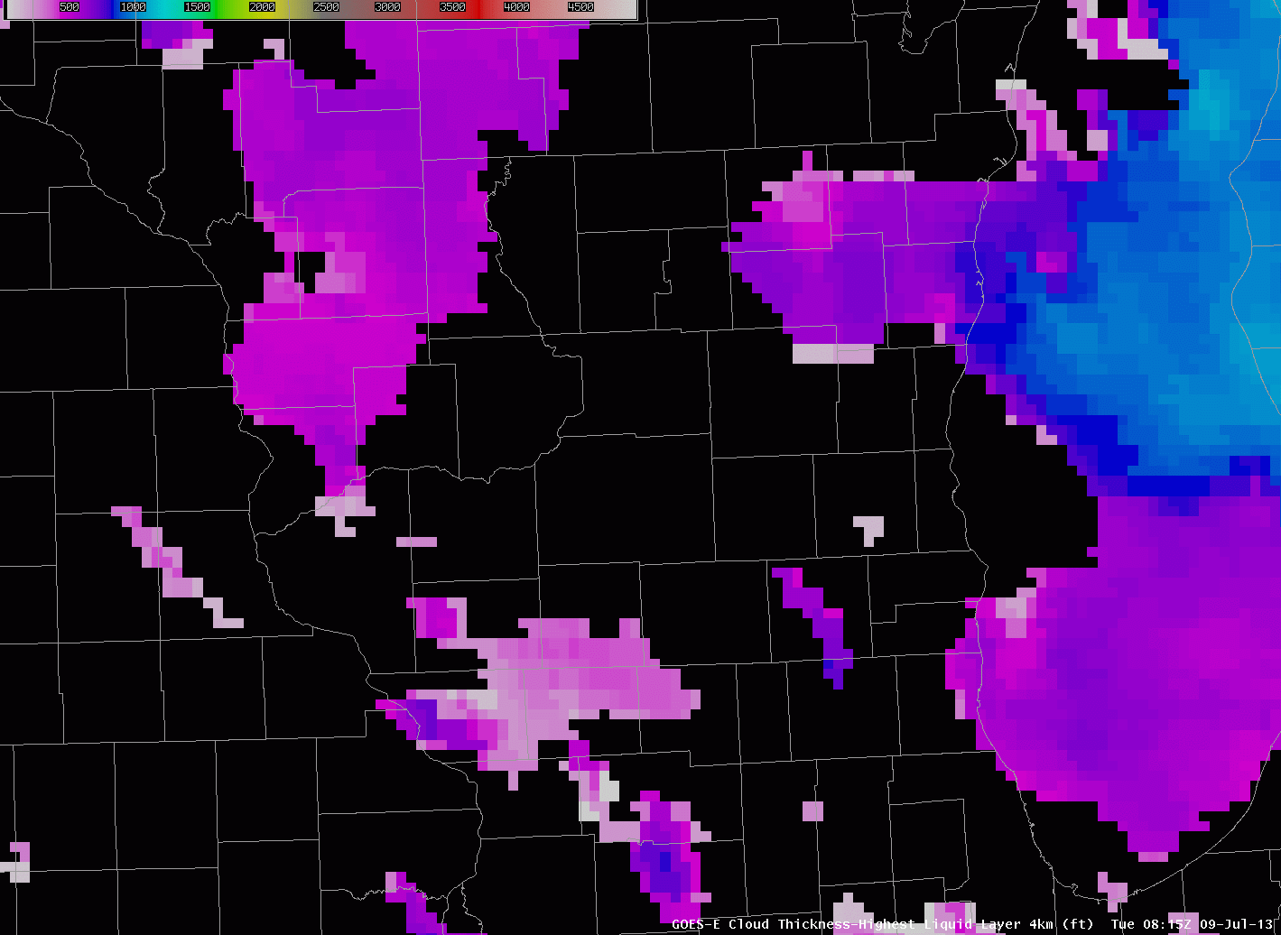
| GOES-R Cloud Thickness computed from GOES-East and from MODIS data, ~0815 UTC 9 July 2013 |
The resolution and view angle of MODIS, compared to the GOES Imager, means that smaller features are better resolved and more accurately navigated. In the example above, the Kickapoo River in Vernon, Richland and Crawford Counties in southwest Wisconsin is clearly delineated in the MODIS product, with a small ribbon of values from 800-1000 feet, but not in the GOES where values are closer to 600. Differences along the coast of Lake Michigan are also evident. MODIS detects a thick cloud bank off the coast of Sheboygan County (the cloud thickness is near 1000 feet); GOES detection has thicknesses of 800 feet in that region, but the values are shifted onshore because of parallax and the co-registration error that exists between the 10.7 µm and 3.9 µm channels on the GOES-13 Imager.
If you are using Cloud Thickness to estimate fog dissipation, the difference between 1000 and 800 feet equates to 60-90 minutes.