 |
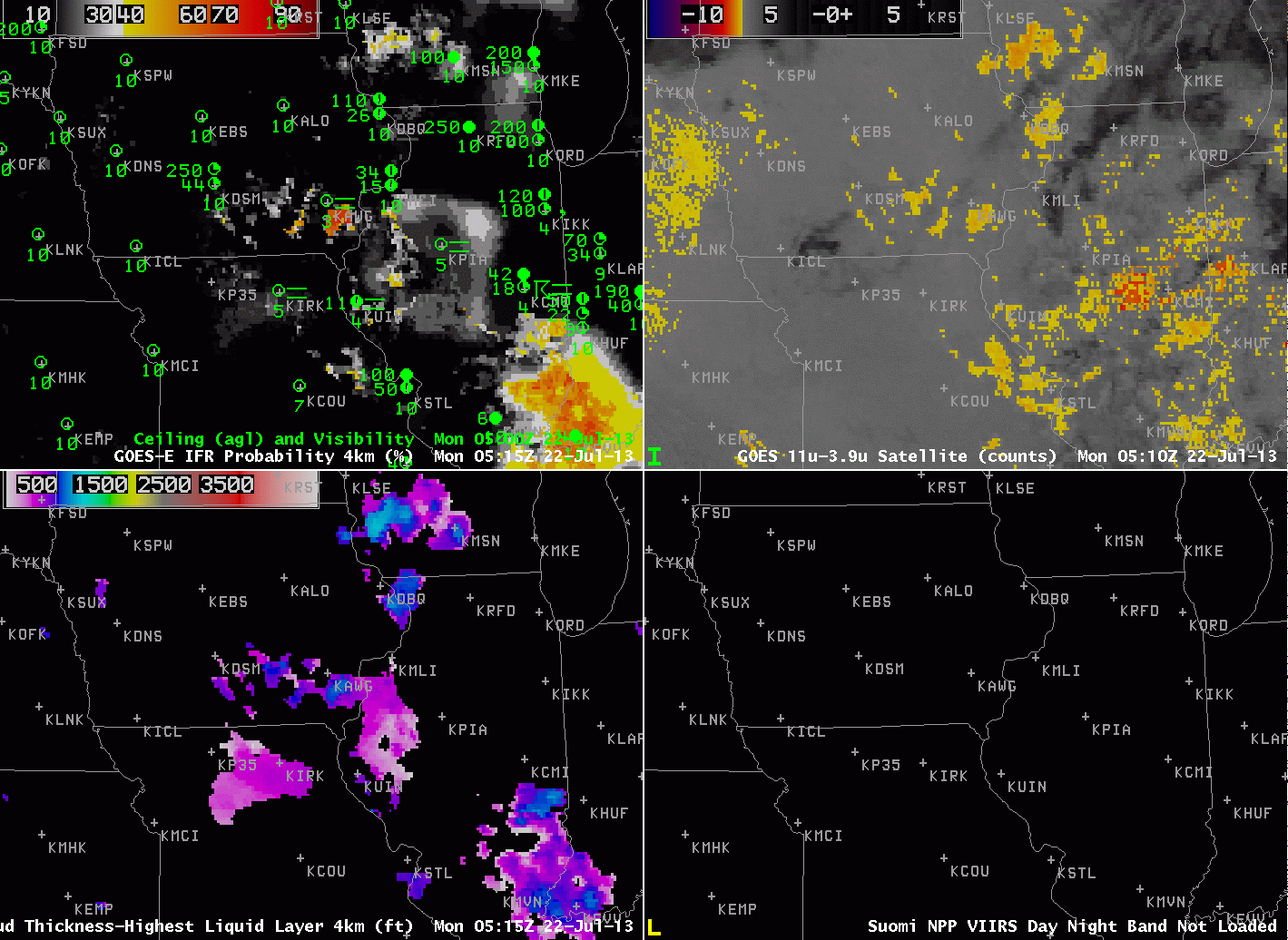
| GOES-R IFR Probabilities (Upper Left) computed from GOES-East data, Brightness temperature difference (GOES-East, 10.7 – 3.9 ), GOES-R Cloud Thickness (Lower Left), Suomi-NPP Day/Night Band (Lower Right). All images hourly, 0515 UTC through 1115 UTC on 22 July 2013. |
When fog forms overnight because of radiational cooling to the dewpoint, the thickness of the fog is related to the time it will take for the fog to dissipate. In general, thick fog dissipates more slowly than thin, and because thick fog is generally surrounded by thinner fog, a region of fog/low stratus will generally erode from the outside in. The animation above shows the gradual development and expansion of fog overnight over Iowa, Illinois and Missouri, with thicknesses over southeastern Iowa eventually reaching values of 1100 feet!
The relationship between time of dissipation and fog depth is shown on this chart, where the depth is the last pre-twilight image. For 22 July 2013, that image is at 1045 UTC, shown below. A value of 1100 feet corresponds to a dissipation time of 2-3 hours after sunrise.
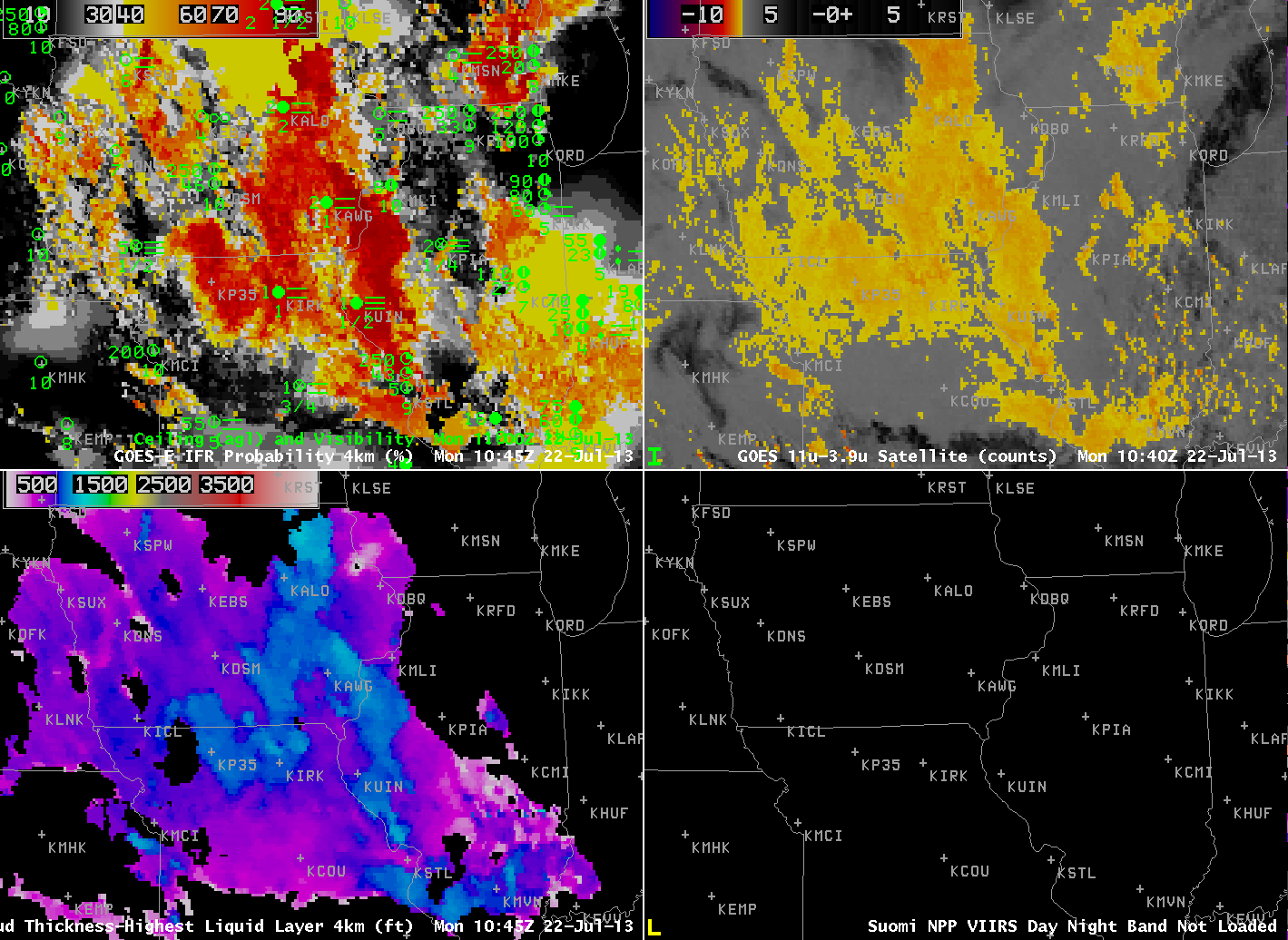 |
| As above, but for 1045 UTC 22 July 2013 |
The visible animation, below, shows dissipation between 1400 and 1500 UTC.
 |
| GOES-13 Visible imagery, 1215 through 1545 UTC 22 July 2013 |
Suomi/NPP data showed a snapshot of the fog development in this region at ~0800 UTC.
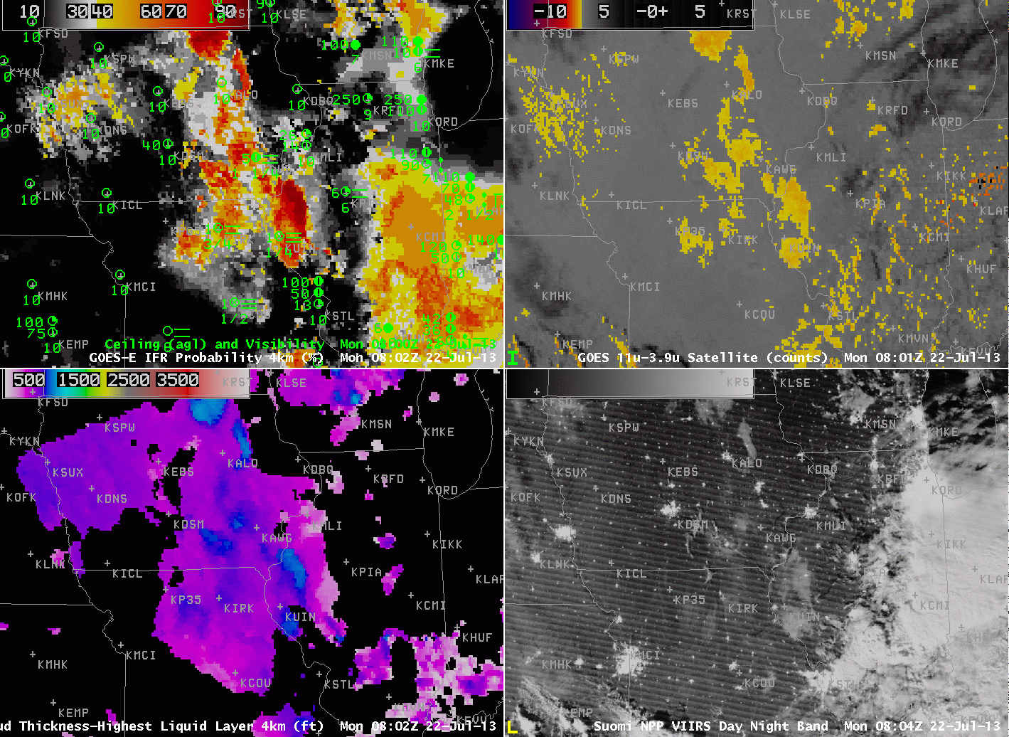 |
| As above, but with a toggle of the Day/Night band and a Brightness Temperature Difference, all imagery at 0802 UTC 22 July 2013. |