 |
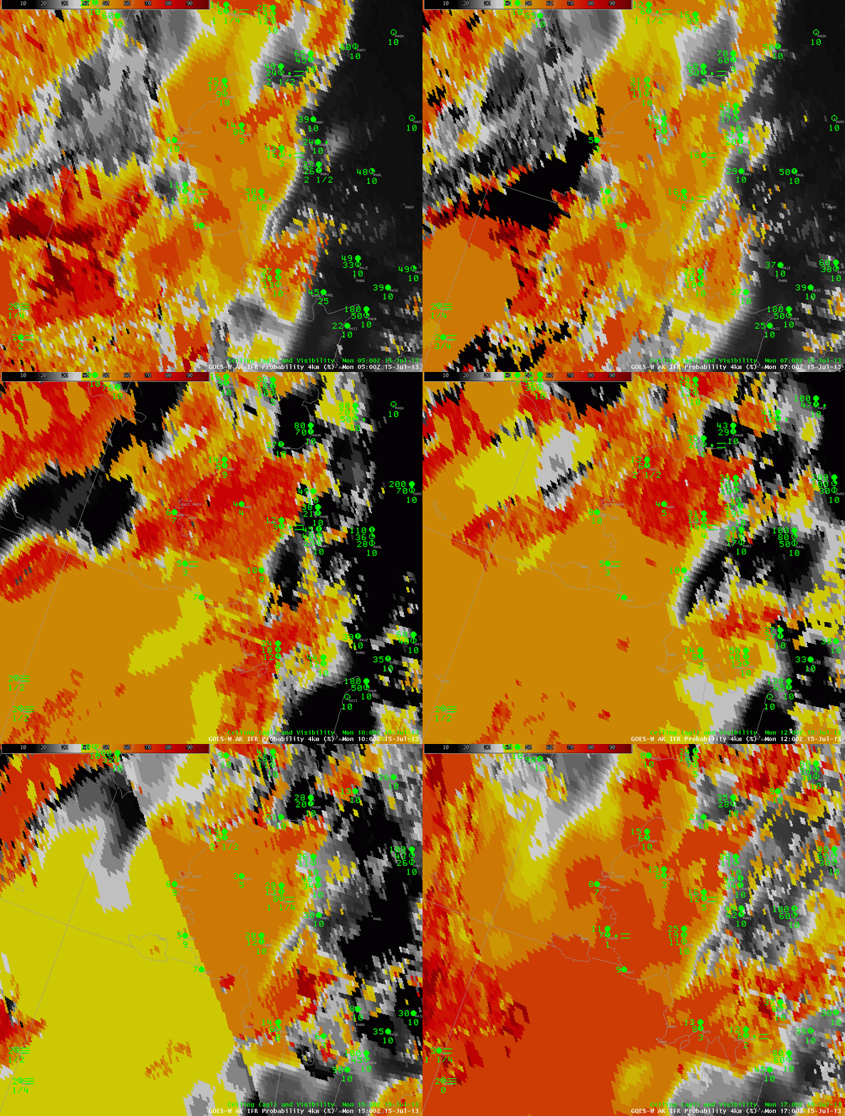
| Hourly GOES-R IFR Probability fields over southwest Alaska, 0500 to 1700 UTC 15 July 2013 |
The IFR Probability fields over southwest Alaska early on July 15 2013 show the influence of multiple cloud layers moving northward out of Bristol Bay and the Bering Sea starting near 0900 UTC. IFR probabilities drop (because satellite data are not included as predictors when multiple cloud layers exist), and the field becomes flatter. That is, it has less horizontal variability (especially compared to its pixelated nature when satellite data are included). IFR conditions are largely confined to within the region of high IFR probabilities.
Two obvious boundaries are present in the field. At 0800 UTC, a boundary extends southwest to northeast, with higher values to the north and west. At 1500 UTC, a boundary extends southeast to northwest with higher values to the north and east. In both cases, this line is the terminator, and daylight is occurring north of the line. In general, IFR probabilities increase during the day (where they are diagnosed) because the cloud-clearing algorithm operates with a lot more certainty when visible imagery can be used to identify clouds.
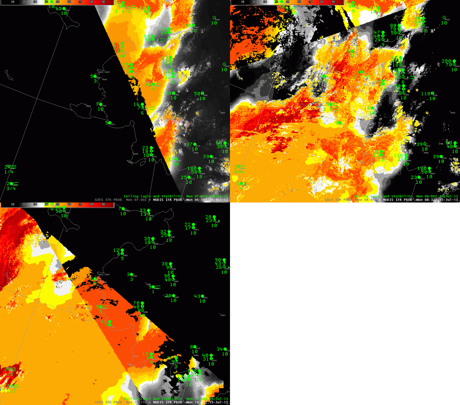
MODIS data can be used in Alaska because Alaska’s high latitude ensures that MODIS overpasses are frequent (especially along the north slope of Alaska). Three overpasses could be used between 0700 and 1415 UTC over this small region of southwest Alaska to give high-resolution depictions of IFR probabilities. Using these high-resolution images with the high temporal resolution available from GOES-West gives a full description of the IFR Probability field over Alaska. The 0832 UTC image suggests multiple cloud layers are still over Bristol Bay/the Bering Sea, and the 1415 UTC image shows both the day-night boundary and an IFR Probability field determined largely by model data.
 |
| MODIS-based GOES-R IFR Probabilities over southwest Alaska, 0654 UTC, 0832 UTC and 1415 UTC 15 July 2013 |
