 |
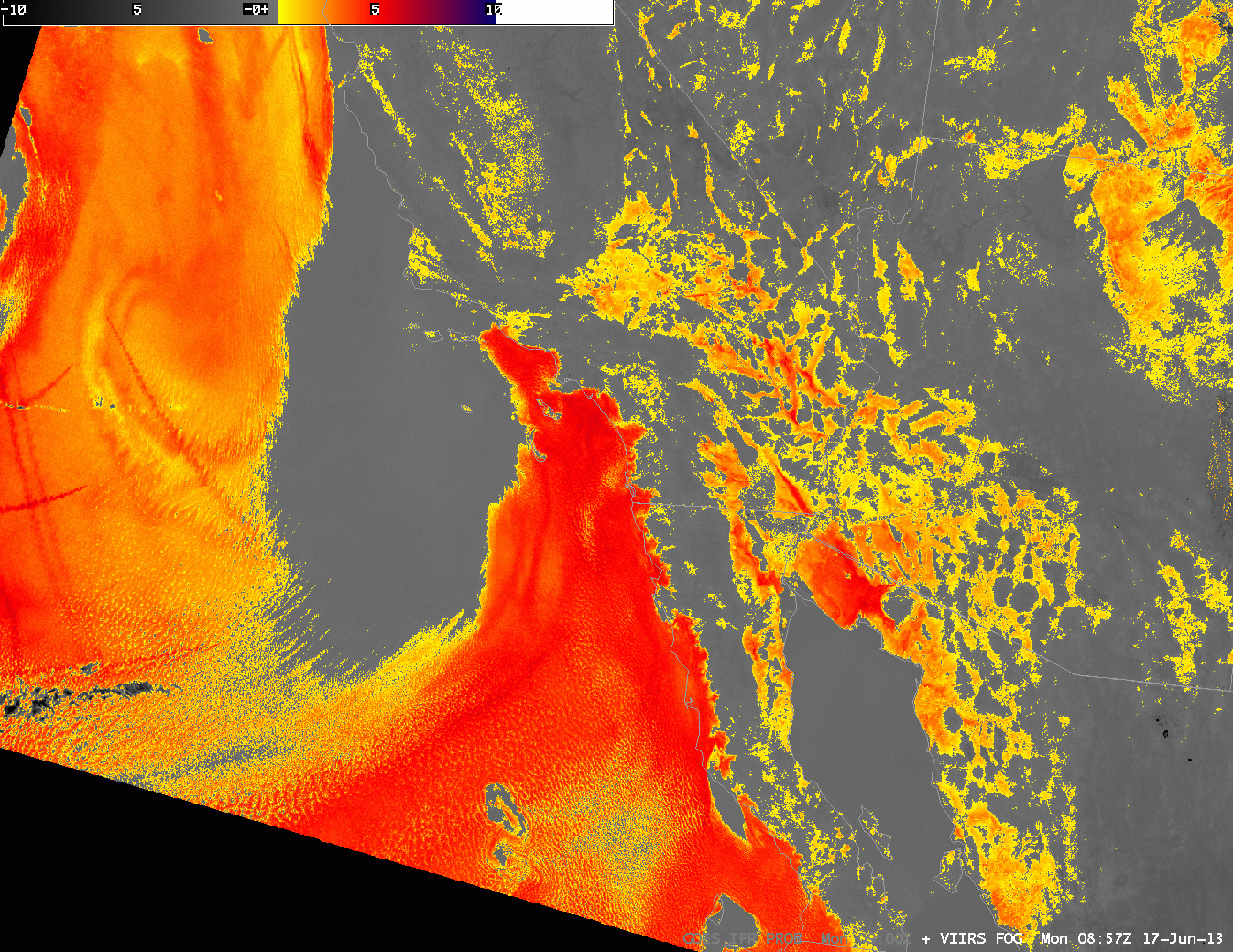
| Suomi-NPP VIIRS imagery at 0857 UTC 17 June 2013. Imagery includes the Day/Night band (including regions north of Southern California within the Stray Light zone) and the brightness temperature difference between 11 µm and 3.74 µm |
There are a variety of ways to detect fog and low stratus using satellites. The imagery above uses VIIRS data aboard the Suomi/NPP satellite. Both the Day/Night band and the brightness temperature difference product show a region of clear skies west of the Channel Islands, with low clouds hugging the coast from Los Angeles southward. There are also low cloud signals in the brightness temperature difference field over the deserts of California, Arizona and Mexico.
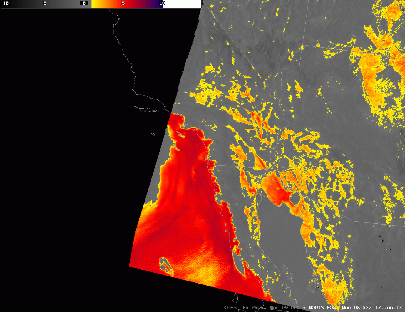 |
| MODIS-based imagery at 0853 UTC 17 June 2013. The brightness temperature difference (10.8 µm – 3.9 µm ) and MODIS-based GOES-R IFR Probabilities |
MODIS data also hints at a clear pocket west of the Channel Islands, and shows fog/stratus extending southward from Los Angeles along the coast. Whereas the brightness temperature difference also shows a signal over the deserts of California, Arizona and Mexico, the GOES-R IFR probability field suggests probabilities for IFR conditions are enhanced only along the north coast of the Gulf of California. The other signals over land are likely related to emissivity property differences in the dry soils over the deserts. MODIS data does show the sharp edge to the fog/low stratus deck that has moved onshore over coastal northern Baja California. That sharp edge demonstrates an advantage of 1-km MODIS data.
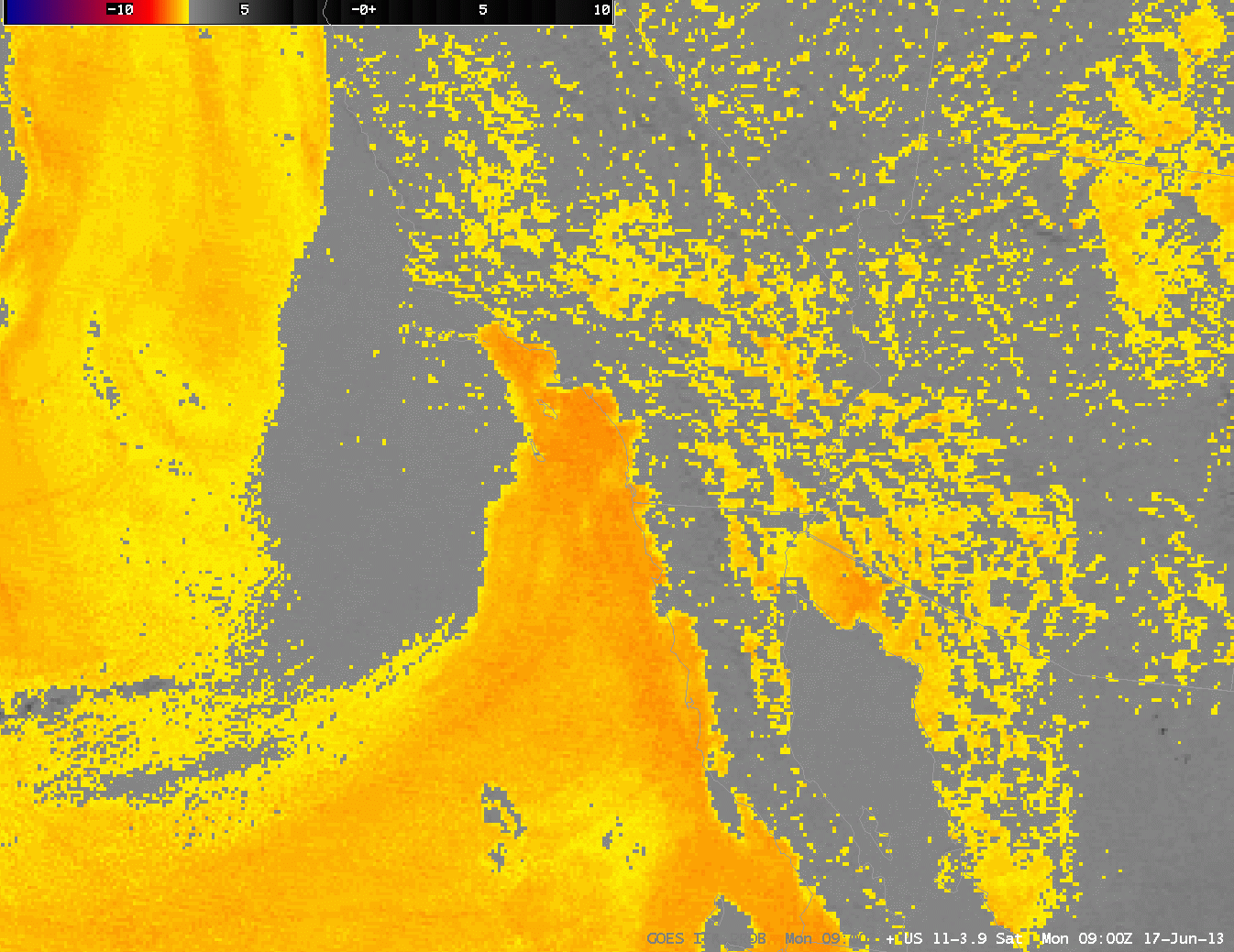 |
| GOES-West Brightness Temperature Difference (10.7 µm – 3.9 µm ) and GOES-R IFR Probabilities computed from GOES-West data, 0900 UTC 17 June 2013 |
GOES-West data also suggest a clear spot west of the Channel Islands, with fog and low stratus that extends southward along the coast from Los Angeles. The brightness temperature difference signal over the deserts of the southwest is not in the IFR probability field because the Rapid Refresh model data does not show low-level saturation (save for that small region along the north coast of the Gulf of California). The cloud edge along the Pacific Coast is not quite so sharp as it is in the MODIS data because the pixel size of GOES is larger. GOES data does have an advantage over MODIS, however: it views the scene every 15 minutes so temporal changes can be monitored.