 |
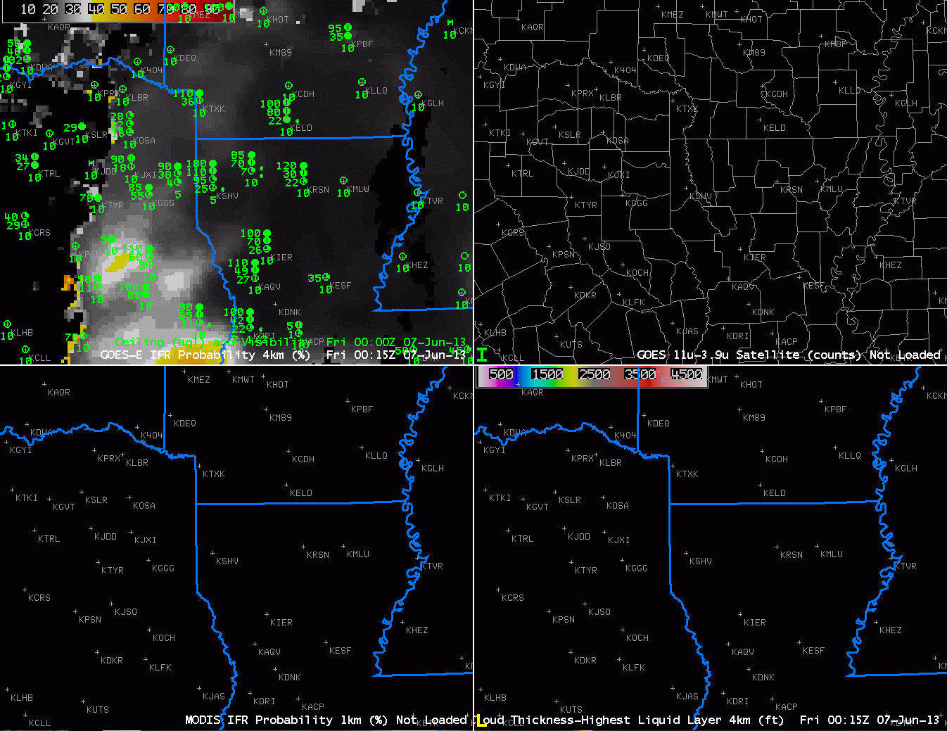
| GOES-R IFR Probabilities computed from GOES-East (Upper Left), GOES-East Brightness Temperature Difference (Upper Right), GOES-R IFR Probabilities computed from MODIS data (Lower Left), GOES-R Cloud Thickness computed from GOES-East (Lower Right), every half hour from 0015 UTC to 1615 UTC on June 7 2013 |
GOES-R IFR Probabilities are shown for northwest Louisiana and surrounding states. At the beginning of the animation, GOES-R fields are mostly model-based over much of Louisiana — the north-south oriented edge of high clouds is plain in the brightness temperature difference field starting around 0315 UTC, and the GOES-R IFR Probability field over Louisiana has the characteristic flat look of a field produced from mostly model (Rapid Refresh) data. Note also that the Cloud Thickness product is not shown when high clouds are present. It is computed only for low clouds in non-twilight conditions.
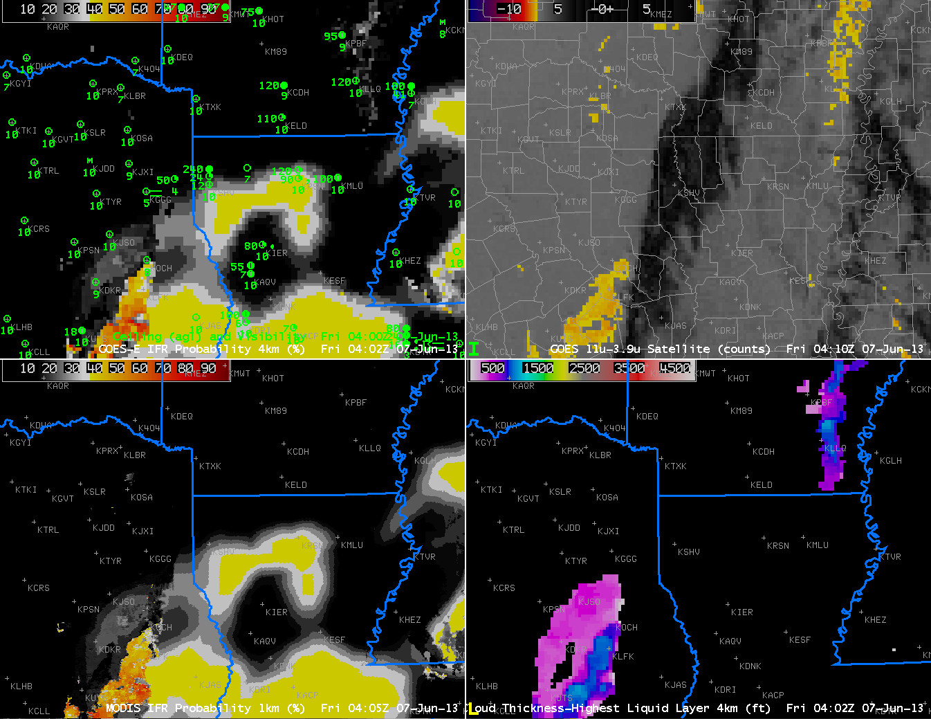
As the high and mid-level clouds move to the east, two things happen to the GOES-R fields. One, the Cloud Thickness field starts to show values. And second, the GOES-R IFR Probability field starts to acquire the pixelated character that is common when satellite data are part of the field.
The are of high IFR probabilities is smaller than the region of enhanced brightness temperature difference, which at 0900 UTC covers much of Louisiana and Arkansas. Over Arkansas, however, model data are de-emphasizing the possibility of reduced surface visibilities. The low clouds there are stratus, off the ground, not fog. Thus the IFR probability field gives a more accurate representation of where visibility restrictions at the surface are possible. This is an important consideration in aviation forecasting.
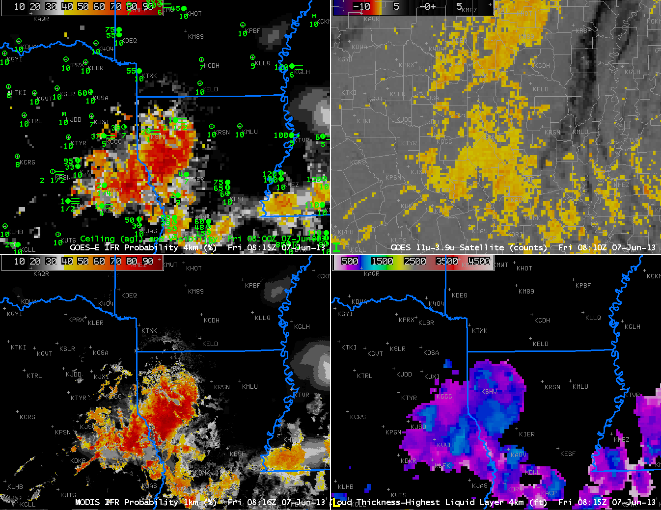 |
| As above, but for 0400 UTC (top) and 0815 UTC (bottom) |
IFR Probabilities computed from MODIS data (lower left) show very similar areal coverage compared to the GOES-Based IFR probability fields, but small-scale variations in the field are much more evident, as should be expected given the difference in pixel footprint between the two satellites.