 |
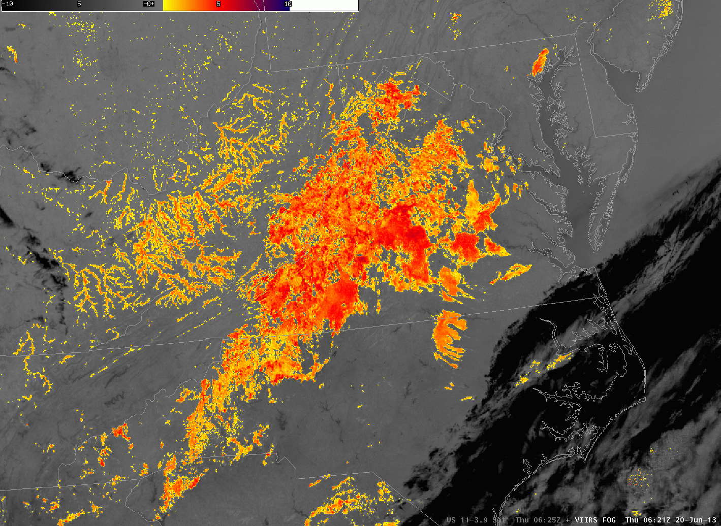
| Brightness Temperature Difference (11µm – 3.74µm) at 0621 and 0750 UTC on 20 June 2013. Data from VIIRS instrument on Suomi/NPP |
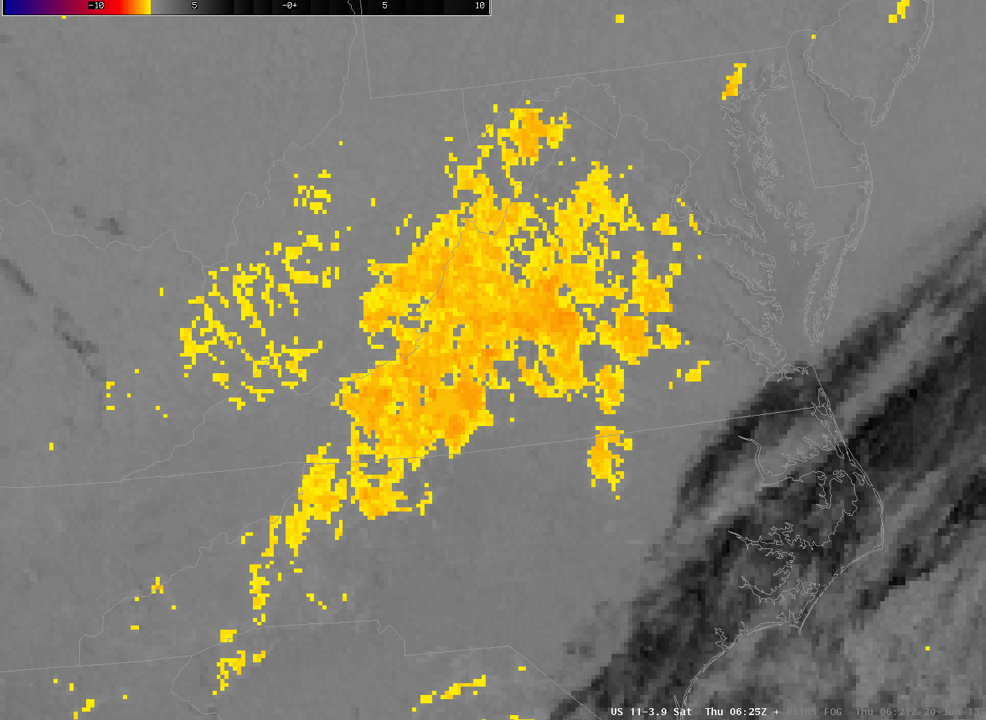 |
| Brightness Temperature Difference (10.7 µm – 3.9 µm) at 0625 and 0755 UTC on 20 June 2013. Data from Imager GOES-East. |
The GOES Imager, with a nominal (sub-satellite point) resolution of 4 km, has trouble detecting fog when that fog forms over very narrow valleys, as are common over the central Appalachians of the eastern United States. Compare the views from the GOES Imager (the bottom images) to the view from the Suomi/NPP VIIRS instrument that has 1-km resolution. VIIRS is much better able to capture the dendritic nature of valley fog, and also to detect it at all when the horizontal scale is very small (for example, the southwest-to-northeast oriented valleys in extreme southwest Virginia). Thus, a signal will appear first in the high-resolution 1-km polar orbiter data, sometimes several hours before it appears in the coarser-resolution GOES Imager data.
These resolution issues that are apparent in the Brightness Temperature Difference fields, above, the traditional method of detecting fog and low stratus, carry over to the GOES-R IFR Probability fields. Imagery below, from 0745 UTC on 20 June 2013 suggests that the higher-resolution MODIS data better captures the structure of fog in mountain valleys. Note also the horizontal shift in the field that occurs because of the GOES parallax shift.
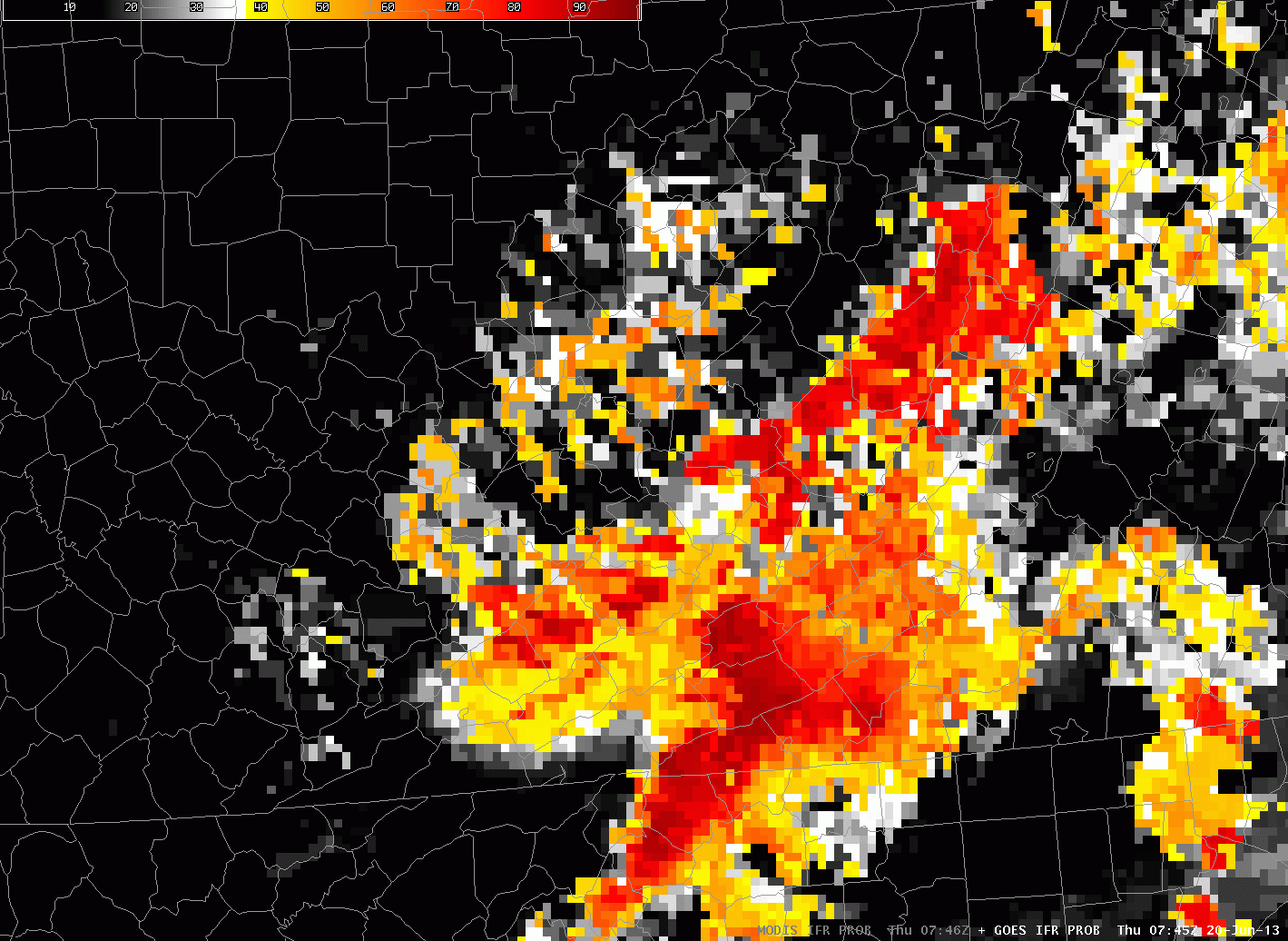 |
| GOES-R IFR Probability fields computed from GOES-East and from Aqua MODIS data, 0745 UTC on 20 June 2013 |