 |
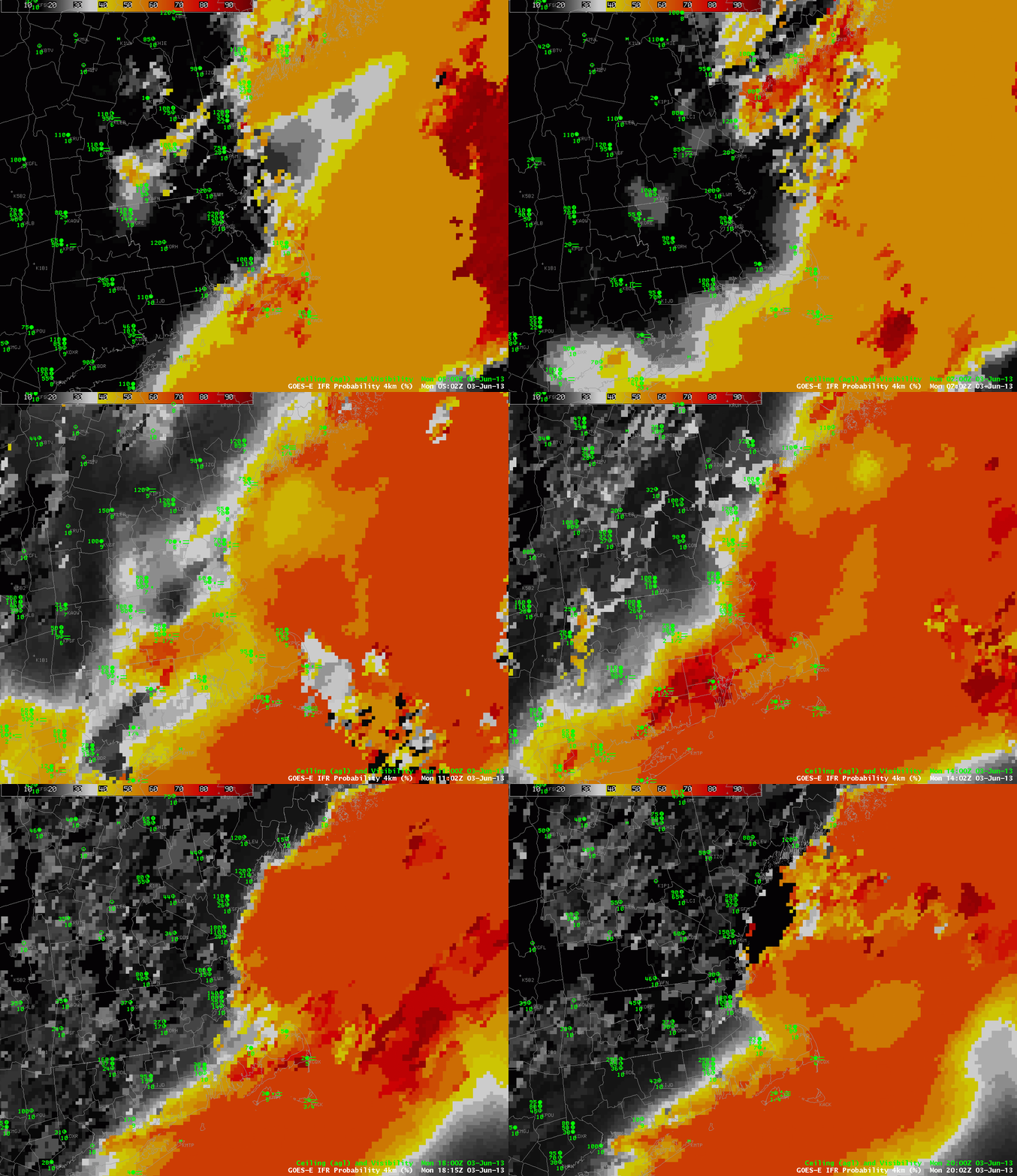
| GOES-R IFR Probabilities, hourly, from 0500 UTC through 2002 UTC 3 June 2012 |
A cold front moving through eastern New England has drawn 60-degree dewpoints into that region of the country. When that moist air then moves over the cold shelf waters and cold waters of the Gulf of Maine, fog and low stratus develop. The GOES-R IFR Probability Field ably captures the regions of restricted visibility over coastal and offshore New England. It also depicts the sharp northern edge of the restricted visibilities over Connecticut and Rhode Island. The IFR probability field in the animation above is derived mostly from model data; this is evident from the smooth nature of the field. There are regions that are more pixelated within the smooth field. These are regions where holes in the high cloud field associated with the front allow the satellite to see low water-based clouds.
