 |
| VIIRS Day/Night Band (from Suomi/NPP), GOES-R IFR Probabilities (From GOES-West) and ceilings/visibilities, all near 0900 UTC on 30 April 2013 |
Day/Night imagery produced from VIIRS data on Suomi/NPP easily shows the large extent of marine stratus off the west coast of southern California at 0900 UTC on 30 April 2013. That stratus may or may not be associated with low ceilings and reduced visibility that accompany IFR conditions. A fused product that incorporates surface-based data will show where IFR conditions are most likely, and that is shown above as well. Data from GOES-West and Rapid Refresh model output are combined to predict where IFR conditions are most likely. Plotted observations of ceilings and visibilities confirm that the highest probabilities neatly overlay observed IFR conditions. It is important to note that not all of the region covered by the marine stratus observed by the Day/Night band has IFR conditions.
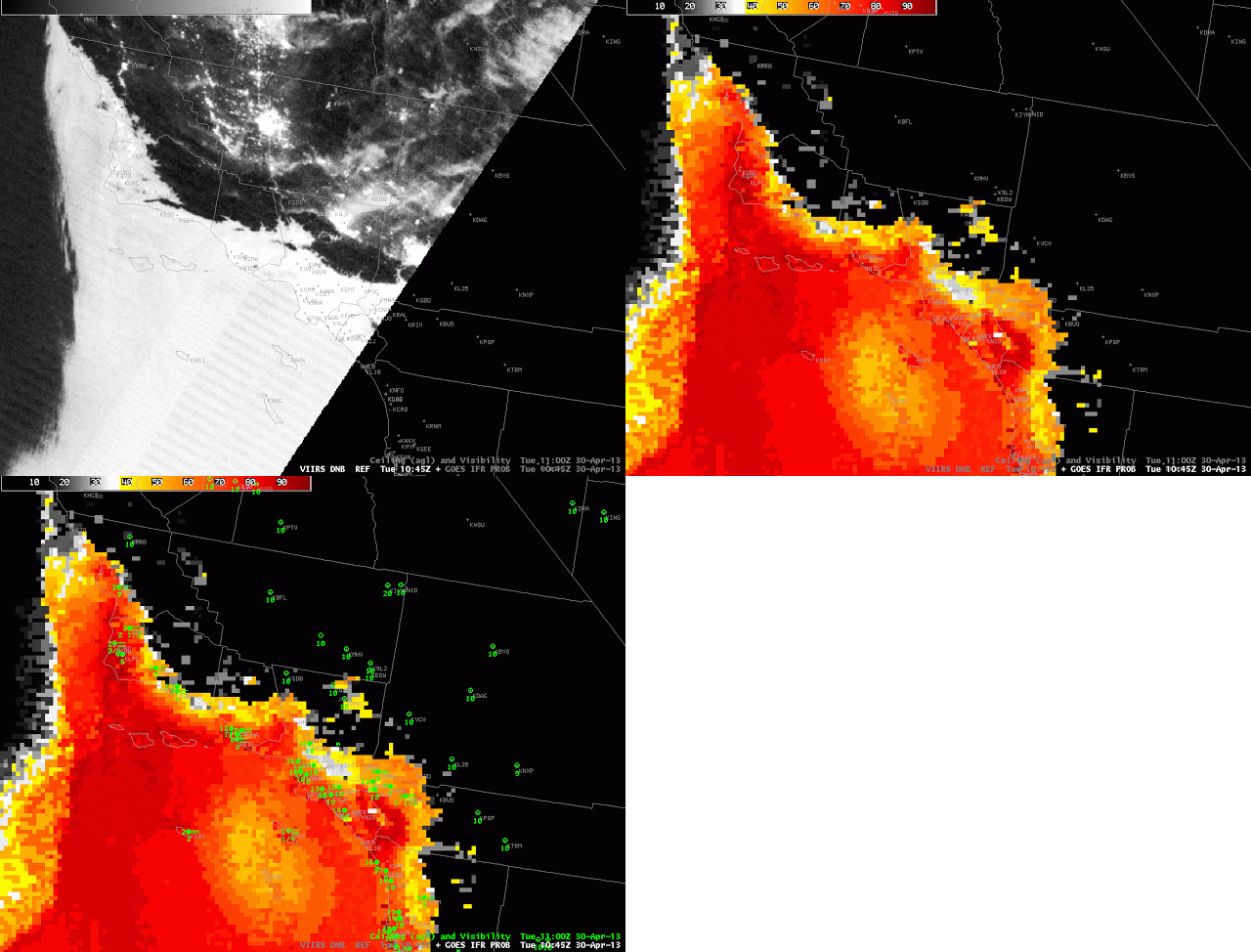
The careful viewer may have noted that the IFR Probability fields over the ocean are quite high in regions where the Day/Night band shows no clouds at 0900 UTC. GOES-R IFR Probabilities can be artificially enhanced in regions of Stray Light contamination in the GOES-West imager 3.7 data. This contamination occurs around 0900 UTC at this time of year. Note that by 1045 UTC (below), the stray light contamination has passed, and IFR probablilities over the ocean more properly align with the Day/Night band-observed cloud edges.
 |
| As above, but for 1045 UTC 30 April 2013 |
A similar set of imagery from 1045 UTC shows a general reduction in the predicted area of IFR probabilities, although the region of highest IFR probabilities, along the coast, persists and as do IFR conditions.
There was also fog over Monterey Bay on this morning. Click here to read about it.
