 |
| Toggle between the traditional brightness temperature difference field from GOES-East and the GOES-R IFR Probabilities, 1000 UTC on 19 April 2013 |
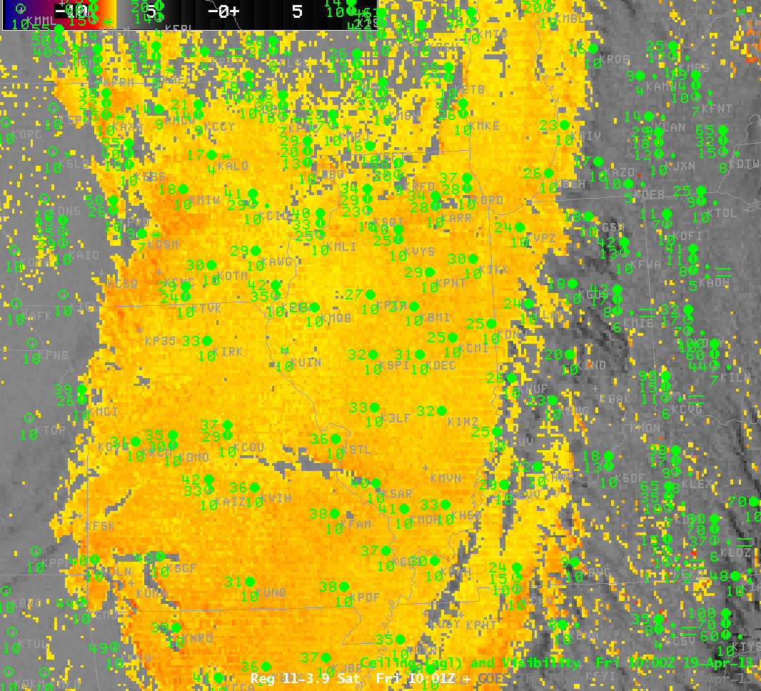
A significant shortcoming to the traditional method of detecting fog, the brightness temperature difference between 10.7 and 3.9 microns, which difference arises because of differences in the emissivity properties of water-based clouds at the two wavelengths, is that stratus decks and fog banks look very similar when viewed from a satellite. In this example from early morning on April 19th, low-level moisture trapped near the surface behind a significant rain-producing cyclone has allowed the formation of clouds over Missouri. But the brightness temperature difference field cannot say if these clouds are an aviation hazard. The surface observations of ceilings and visibilities show that ceilings are high and visibilities are unobstructed. The GOES-R IFR probability field correctly minimized the influence of the satellite signal in this region, because the Rapid Refresh Model does not predict conditions consistent with fog and low stratus.
There are reduced visibilities and lowered ceilings near the cold front that at 1000 UTC was pushing into western Ohio, and these are correctly suggested by the IFR probability fields. Multiple cloud layers there preclude the detection of low-level clouds by the traditional brightness temperature difference method.
In this case, the IFR Probabilities did a good job of eliminating the false positive from the brightness temperature difference over Missouri — where IFR conditions were absent — and of rectifying the false negative from the brightness temperature difference over Ohio — where IFR and near-IFR conditions were found.