 |
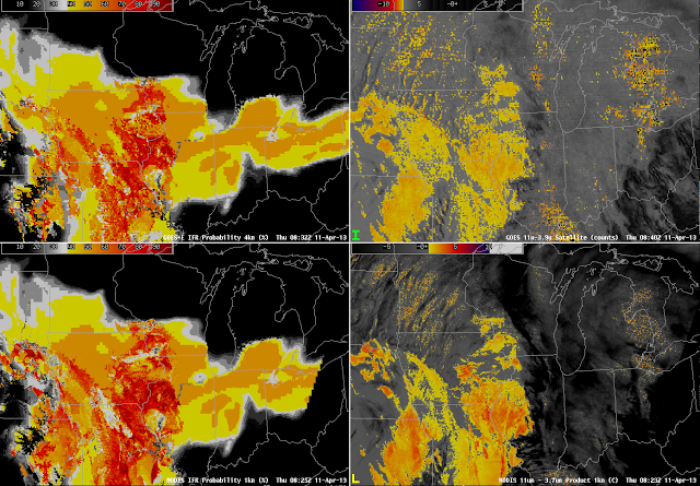
| GOES-R IFR Probabilities (Left) and Brightness Temperature Differences (Right) Computed from GOES-East (Top) and MODIS (Bottom) |
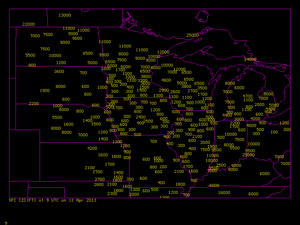
The multiple cloud layers that are common with an extratropical cyclone preclude identification of fog/low clouds by traditional brightness temperature difference methods because low clouds are overlain by mid-level and higher clouds. Thus, the satellite is unable to view them. In the images above from early morning on 11 April over the midwest, both GOES and MODIS detect low clouds over southern Iowa and Missouri. The GOES-R IFR Probability fields show enhanced probabilities over a larger region that stretches from northern Ohio westward to southwestern Minnesota, and southward from Iowa to Missouri. Observed ceilings show IFR (or near-IFR) conditions from northwest Ohio westward to northern Iowa. Regions of model-based enhanced IFR probabilities capture this region of IFR conditions. IFR ceilings also exist under the region where the traditional brightness temperature difference field has a strong signal. When interpreting the IFR probability fields, it is important to recognize the differences that arise due to differences in the predictors used (for example, between the higher IFR probabilities over southeast Iowa — where satellite and model data are used — and the lower probabilities over north central Iowa where only model data are used).
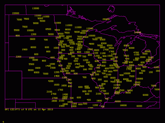 |
| Observed Ceilings, in feet, over the midwest, 0900 UTC on 11 April 2013 |