 |
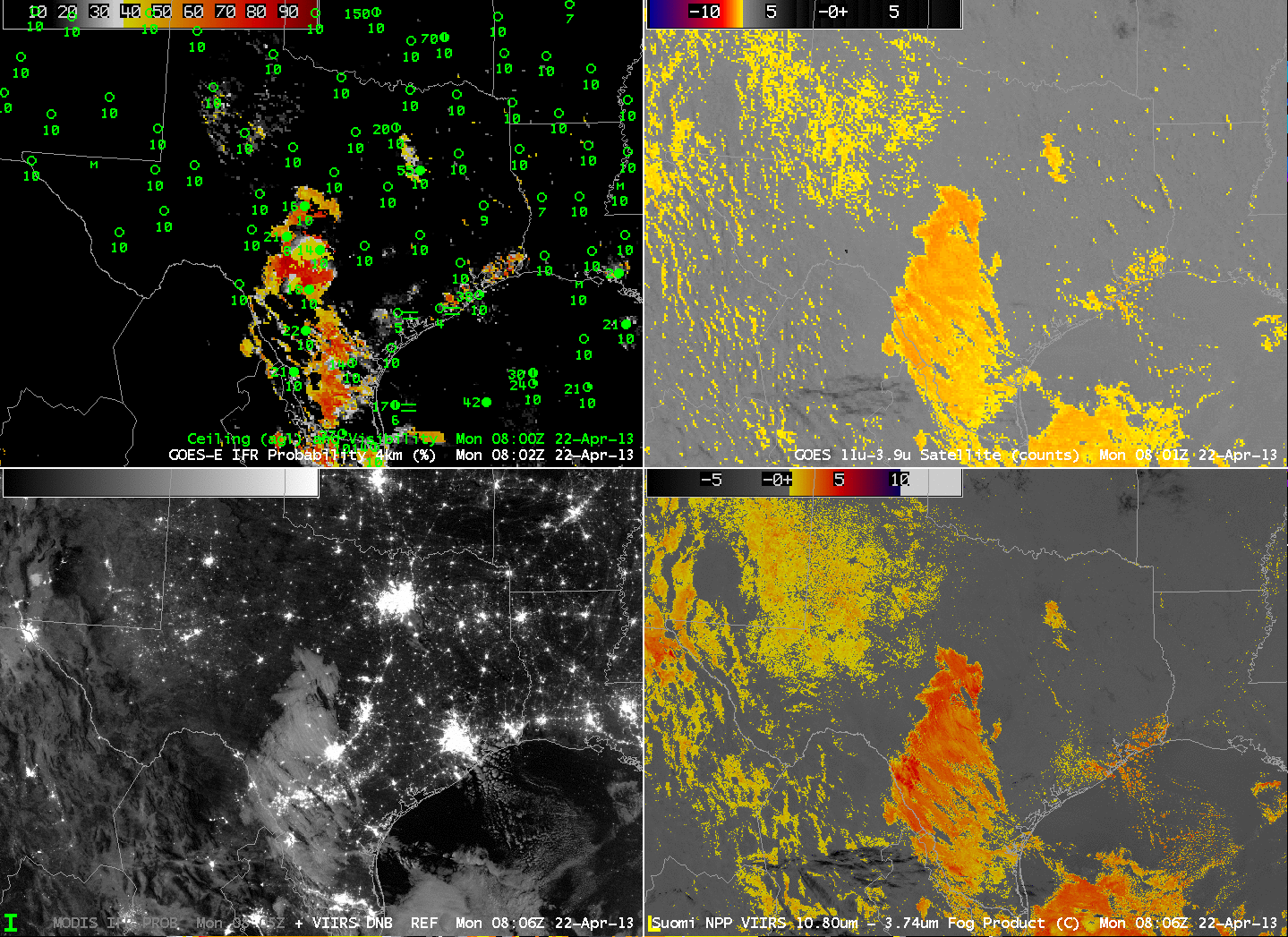
| GOES-R IFR Probabilities (Upper Left) computed with GOES-East data, GOES-East Brightness Temperature Difference (10.7µm – 3.9µm) (Upper Right), Toggle between MODIS-based IFR Probabilities and Suomi-NPP Day-Night band imagery (Lower Left), Suomi-NPP Brightness Temperature Difference (Bottom Right) (10.8 µm- 3.74µm), all imagery around 0800 UTC |
Stratiform clouds developed overnight in return flow from the Gulf of Mexico. Some of the stratus was elevated, and some was closer to the surface creating IFR conditions. The GOES imagery above captures the area of low clouds that are also visible in the Day/Night band — but the MODIS IFR Probability field suggests a difference in the stratus field near San Antonio. Probabilities are far higher north of San Antonio’s latitude than south. Surface observations suggest that IFR conditions are more likely where the MODIS-based IFR probabilities are highest. (This demarcation line in the IFR Probability is far more noticeable in MODIS than in GOES).
Note that the GOES Brightness Temperature Difference field has a positive signal that is near the north-south oriented lakes in eastern Texas and western Louisiana, and that signal is absent from the VIIRS Brightness Temperature Difference field. There is a misalignment between the 3.9 and 10.7 µm channels on GOES-13 (as discussed here) that has a maximum near 0900 UTC and that results in a false signal of low clouds. This co-registration error can propagate into the IFR Probability field in regions where the Rapid Refresh is suggesting near-saturation at lower levels.
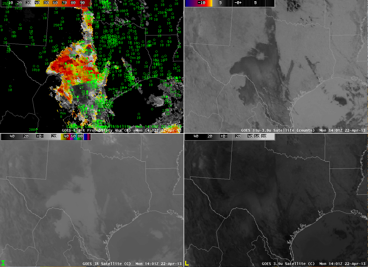 |
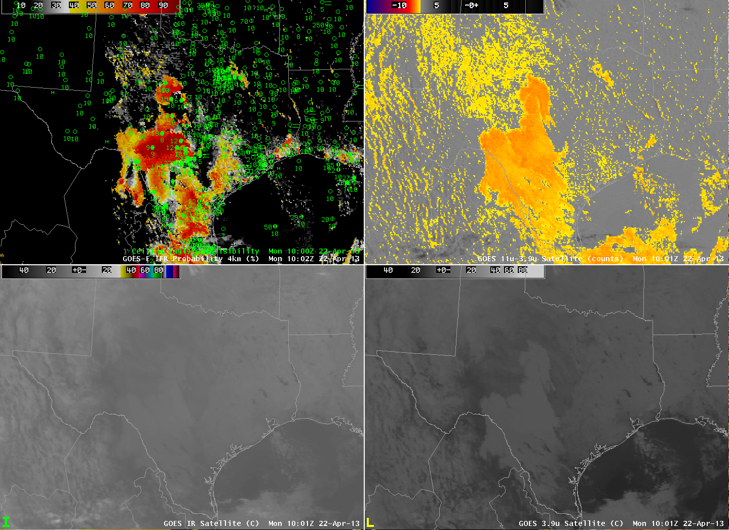
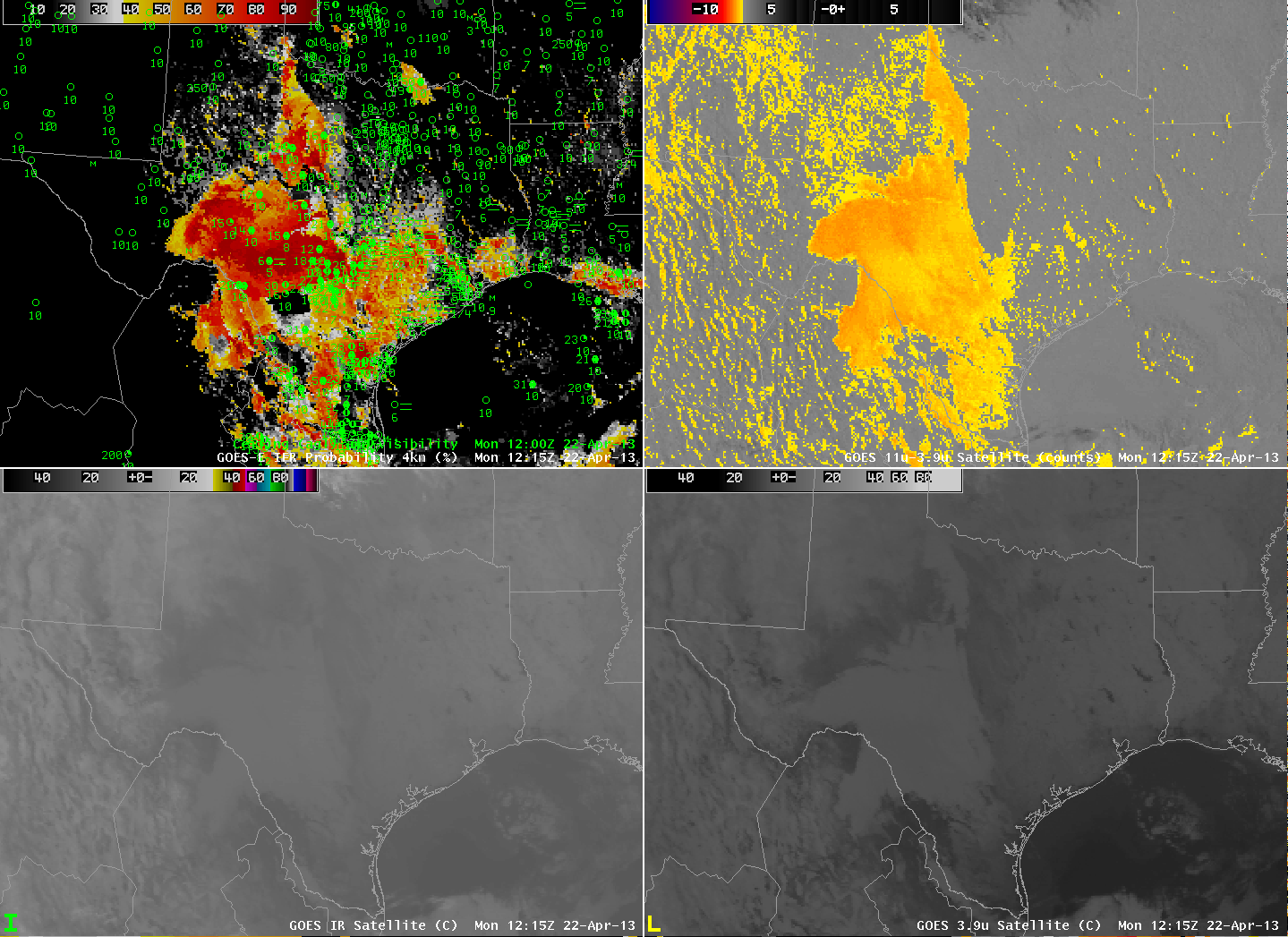
| GOES-R IFR Probabilities (Upper Left) and surface observations of ceilings and visibility, GOES-East Brightness Temperature Difference (10.7 – 3.9) (Upper Right), Brightness Temperature at 10.7 (Lower Left) and 3.9 (Lower Right) at 1000 UTC (top image), 1215 UTC (middle image) and 1402 UTC (bottom image). |
The demarcation between regions with IFR conditions and MVFR/VFR conditions becomes more distinct in the GOES-based IFR probability fields at 1000, 1200 and 1400 UTC, as shown above. At all three times, the IFR probability field more accurately portrays the region of clouds that is most likely affecting aviation by displaying IFR conditions.