 |
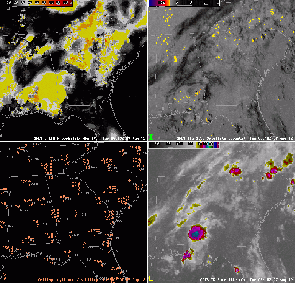
| GOES-R IFR Probabilities (from GOES-East) (upper left), GOES-East Brightness Temperature Difference 11 µm – 3.9 µm (upper right), Plot of Ceiling (AGL) and visibility (lower left), Enhanced 11 µm brightness temperature (lower right) from 0815 UTC from 1845 UTC on 7 August 2012 |
When atmospheric conditions support multiple cloud layers and low-level fog, the heritage method of fog/low cloud detection (the brightness temperature difference between the 10.8 and 3.9 µm channels) will yield little information because the highest cloud will likely include ice, and the brightness temperature difference exploits emissivity differences in water clouds. In these regions, the model output is vital to predict IFR probabilities. Because satellite predictors are giving no information in these regions, however, the overall probabilities are likely to be lower than the case where both satellite and model suggest the presence of fog. Expect the highest probabilities when both satellite model suggest the presence of fog. If only one of the predictors (satellite data or model data) suggests the presence of fog, IFR probabitilies will be lower.
In the example above, periodic episodes of IFR conditions are occurring over Georgia. Most of the IFR probability signal is coming from the Rapid Refresh, and there are hints that the model output is not quite reproducing the observed weather. If satellite data are not used as a predictor in the GOES-R IFR Probability product (because of high clouds), interpretation of the GOES-R IFR product is complicated by Rapid Refresh performance.