 |
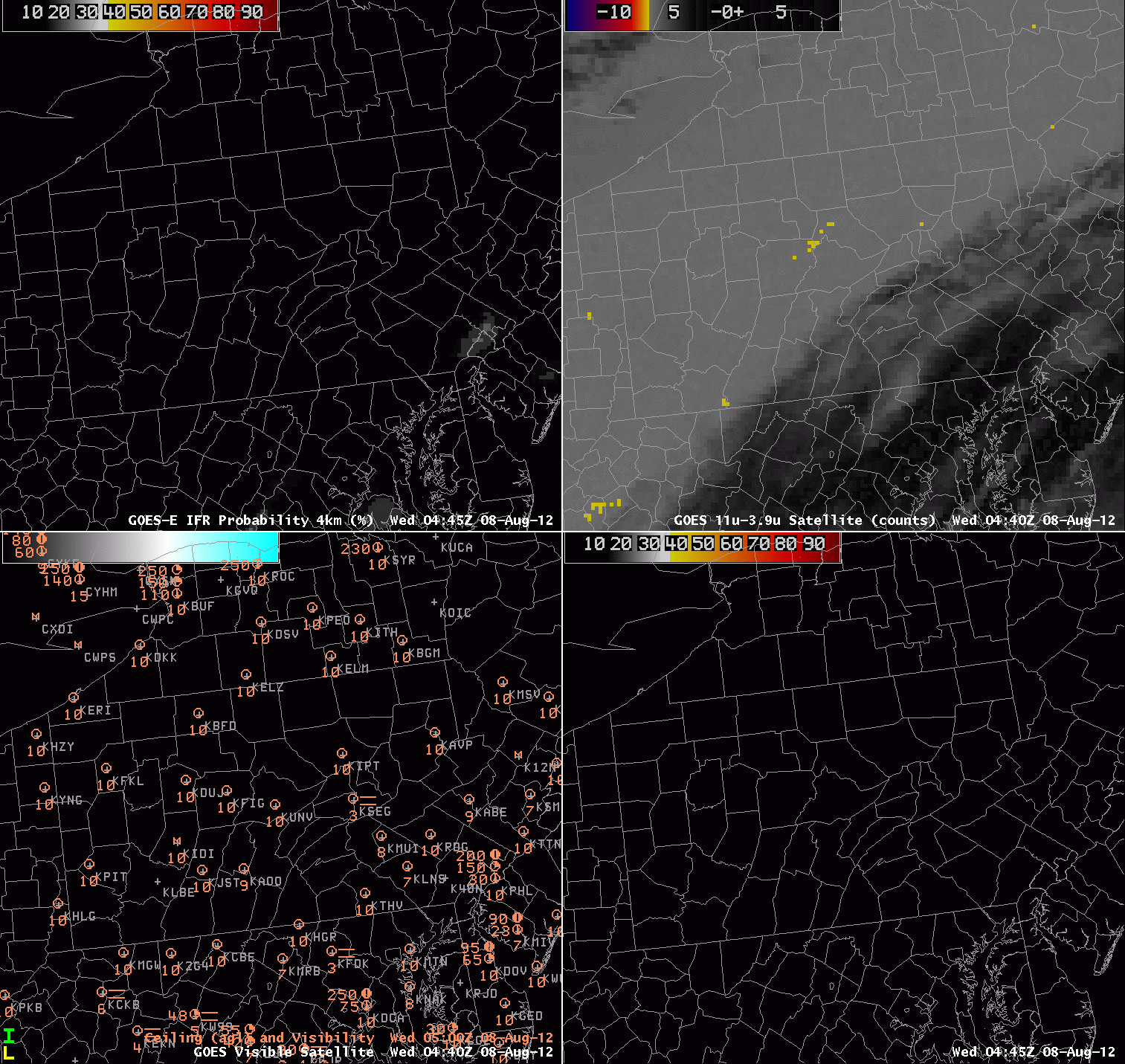
| Animation of GOES-R IFR probabilities computed from GOES-East (upper left), Brightness Temperature difference (11 – 3.9) from GOES-East (upper right), Surface visibilities and ceilings and GOES-East Visible imagery (lower left), GOES-R IFR probabilities computed from MODIS (lower right) |
Radiation fog that forms first — or only — in river valleys is a challenge to detect. In the example above from Pennsylvania for the morning of August 8 2012, the satellite signal starts to appear over the West Branch of the Susquehanna around 0500 UTC. It is very unlikely that a numerical model with a horizontal resolution of (only) 13 km — such as the Rapid Refresh — will be able to forecast the development of such a small-scale feature, so the satellite observations are key. Nominal 4-km resolution of the infrared channels is the principle limiting factor in detection.
The presence of high clouds over southeast Pennsylvania precludes the detection by satellite of low clouds/fog, so the GOES-R IFR product there is driven primarily by model output, and the scale of the river fogs are simply too small to be simulated in the model. Fog probabilities do increase near Selinsgrove (KSEG) around daybreak because the model relative humidity does reach high enough values. This also happens over southeast Pennsylvania. Typically, model relative humidities in the lowest kilometer of the model must be greater than 80-85% for a strong GOES-R IFR signal to be present.
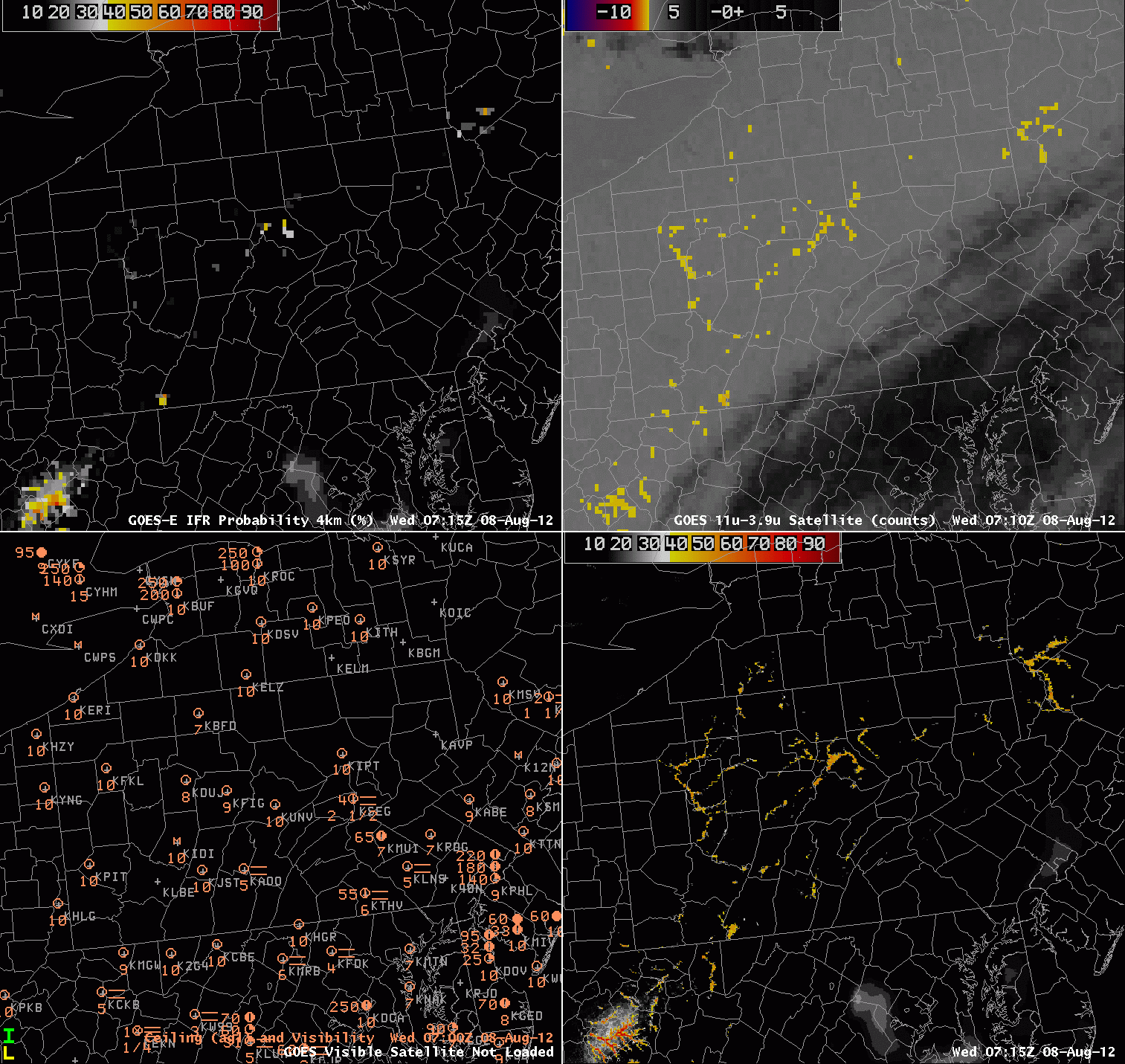 |
| GOES-R IFR probabilities computed from GOES-East (upper left), Brightness Temperature difference (11 – 3.9) from GOES-East (upper right), Surface visibilities and ceilings and GOES-East Visible imagery (lower left), GOES-R IFR probabilities computed from MODIS (lower right), all valid at 0700-0715 UTC 8 August 2012 |
Note that at 0715 UTC there is a comparison between the better resolution of the MODIS imagery. When GOES-R is operational, resolution will be in between that of current GOES and MODIS. The MODIS GOES-R IFR probabilities are much higher, and show the different river valleys far more cleanly than present GOES.