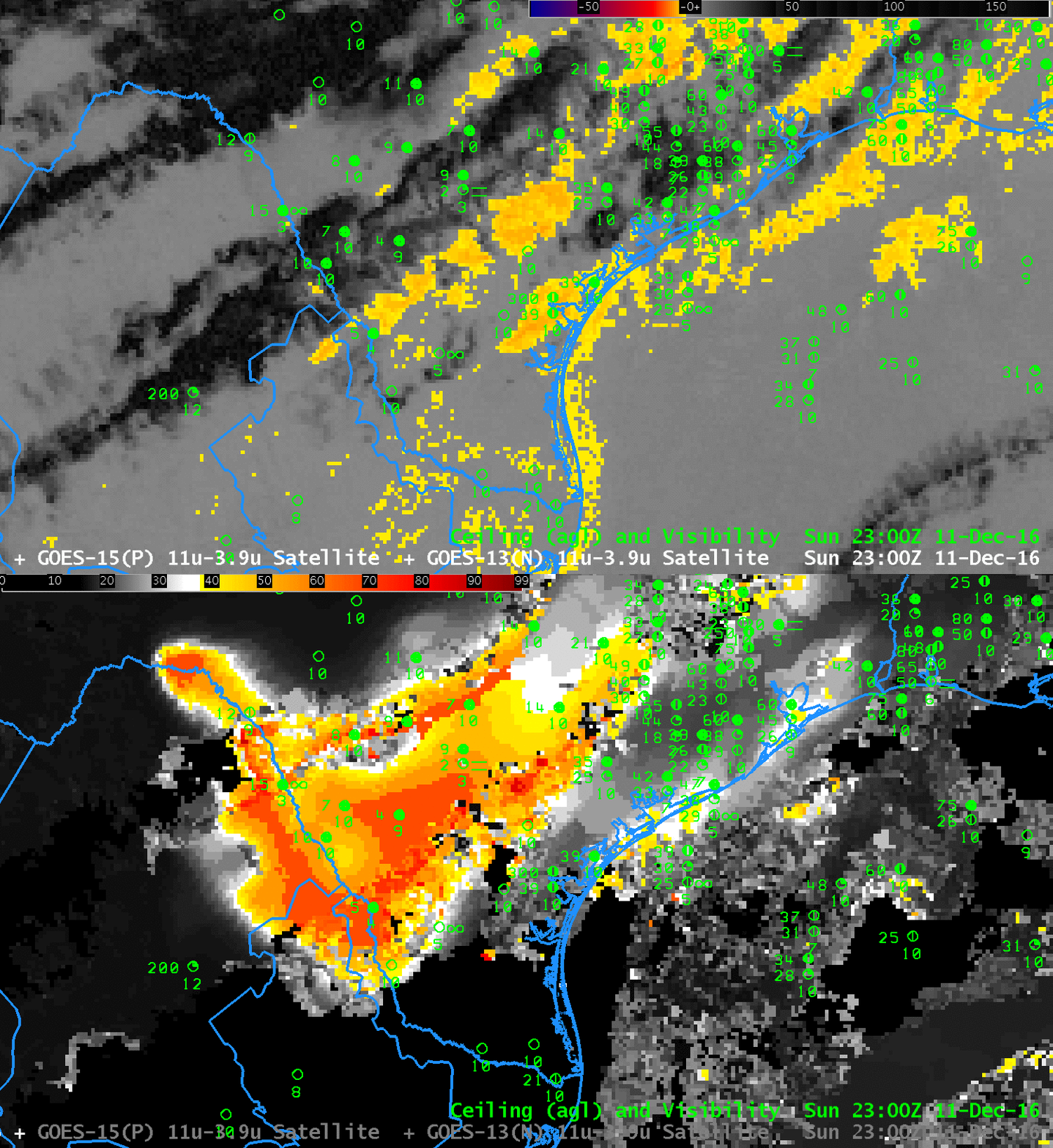
Toggle between Brightness Temperature Difference (3.9µm – 10.7µm) and GOES-R IFR Probability fields, 2300 UTC on 11 December 2016 (Click to enlarge)
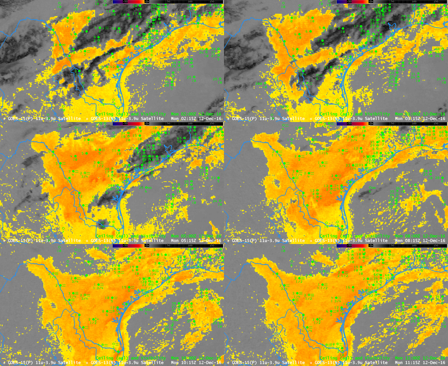
Dense Fog developed over south Texas during the early morning of 12 December 2016 (IFR Sigmet from this website shown here ; Advisories from the weather.gov website shown here). The toggle above shows in the brightness temperature difference field a signature of high clouds — and where those high clouds exist, IFR Probability fields rely on Rapid Refresh Model data to diagnose where IFR conditions might be occurring, or where IFR conditions might develop. The animation of Brightness Temperature Difference fields from 0215 through 1115 UTC, below, shows that the high clouds over south Texas diminished with time: by 0815 UTC only low stratus is present over south Texas. But is that stratus also hugging the ground — that is, is it fog? From the satellite’s perspective, the top of a stratus deck and the top of a fog bank can look very similar.

GOES-13 Brightness Temperature Difference (3.9µm – 10.7µm), 0215 through 1115 UTC on 12 December (Click to enlarge)
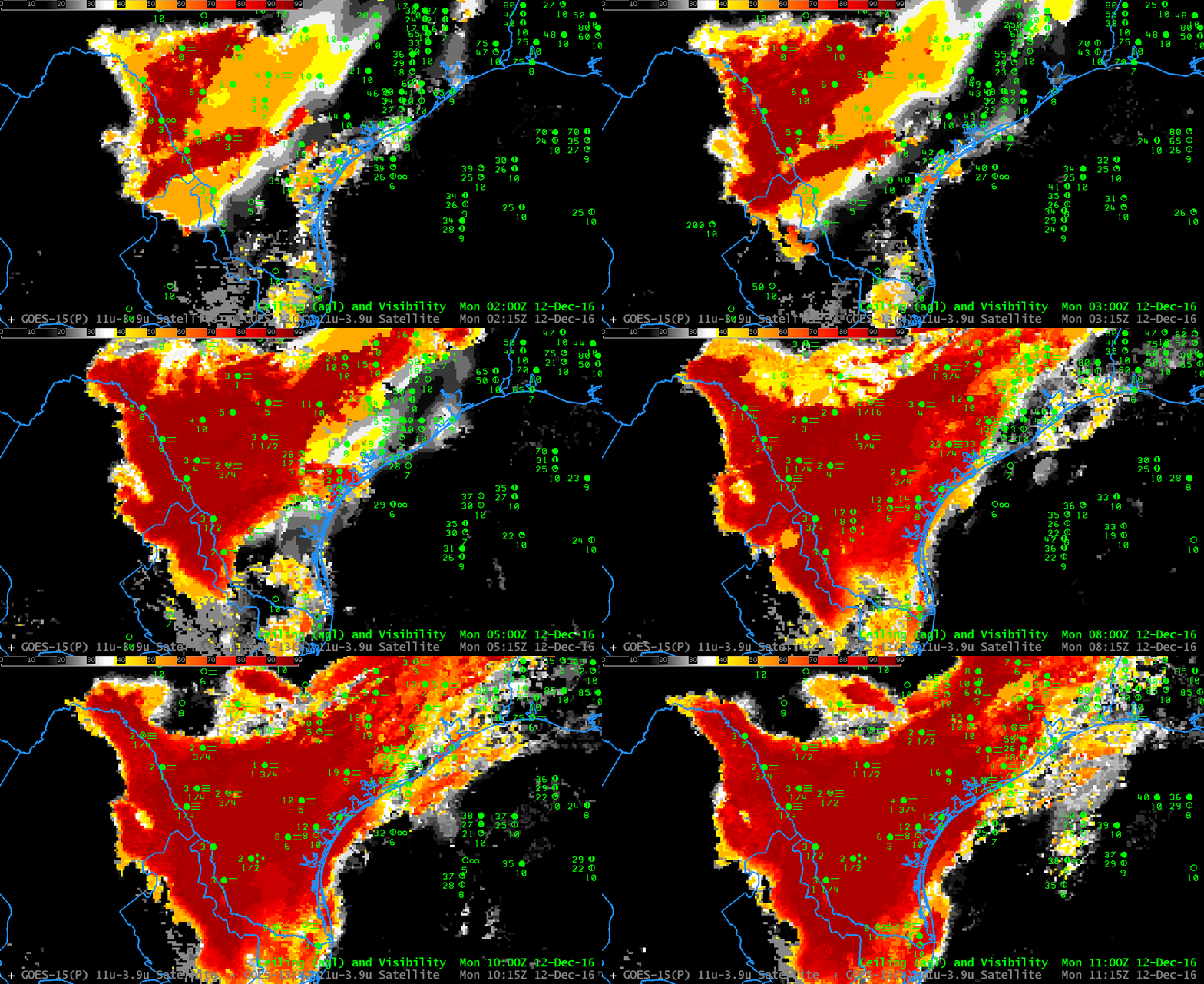
GOES-R IFR Probability fields give a more complete estimate about the presence of fog/low stratus because Rapid Refresh data and satellite data are used to diagnose the probability of IFR conditions. If the Rapid Refresh model shows low-level saturation, then the presence of stratus clouds also likely indicates the presence of fog; conversely, if the Rapid Refresh Model does not show low-level saturation, then the presence of stratus cloud need not indicate the presence of fog. IFR Probability fields below, from 0215 through 1115 UTC, start off regions with uniform values where only Rapid Refresh data are used in the algorithm — where high clouds block the satellite view of low clouds/fog. As the high clouds dissipate, the field acquires larger values because there is higher confidence of the presence of clouds (in part because satellite data can be used to observe them). In addition, these larger values have pixel-sized variability because of variability in the satellite observations.
IFR conditions are observed latest over far south Texas — this is also where IFR Probabilities are slowest to reach large values.

