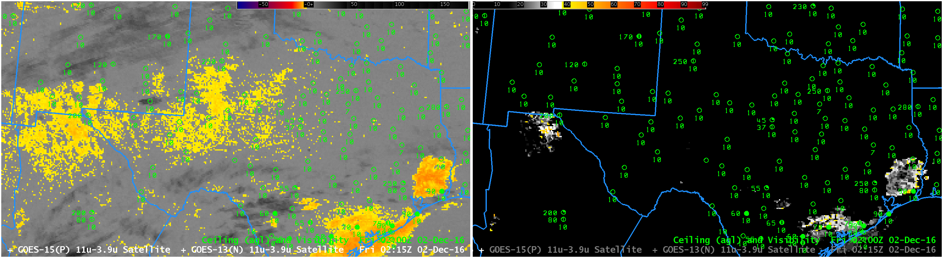
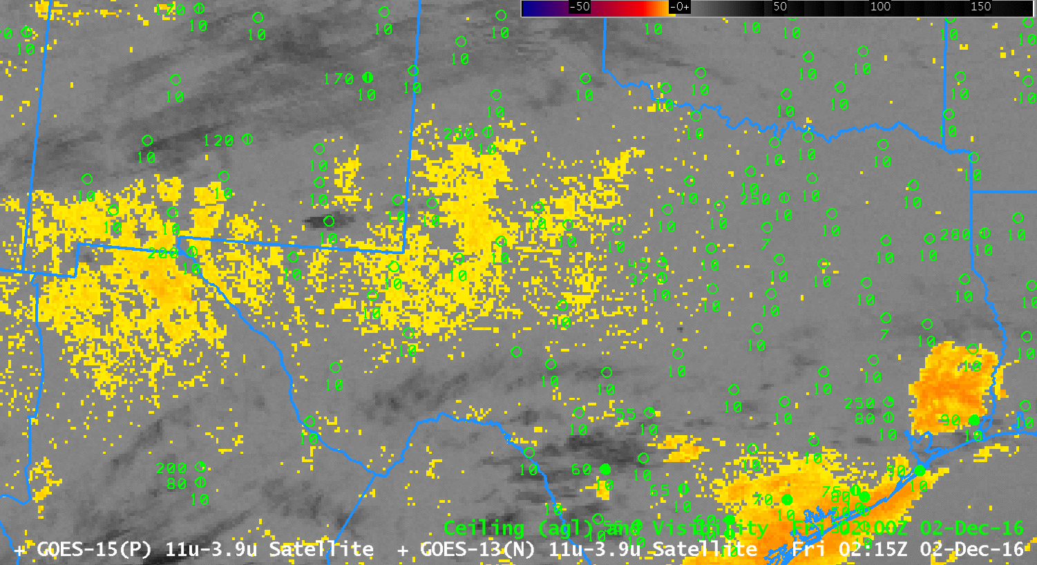
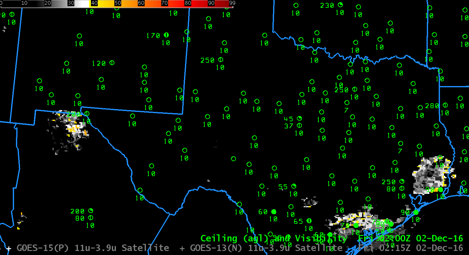
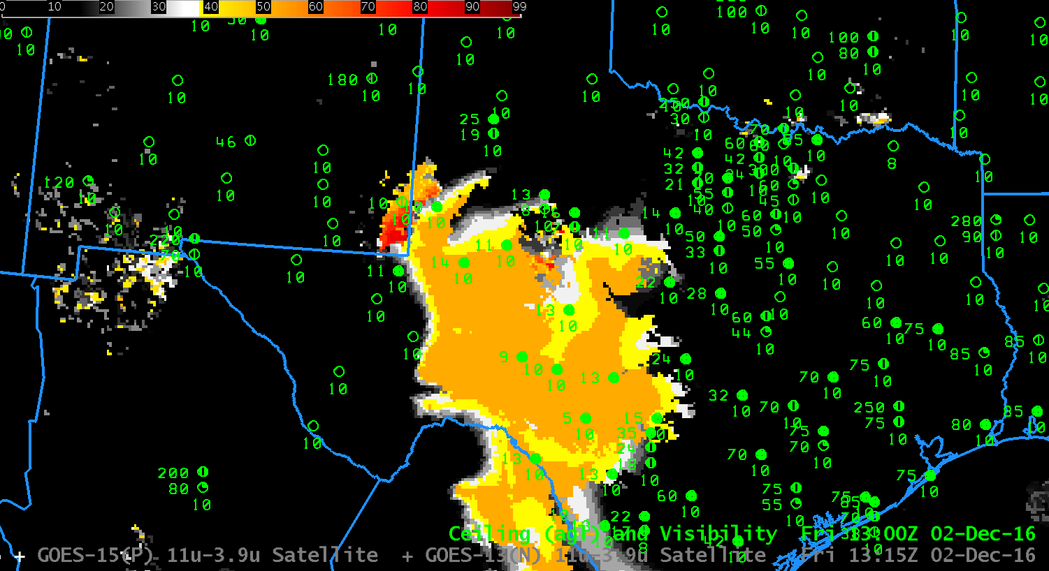
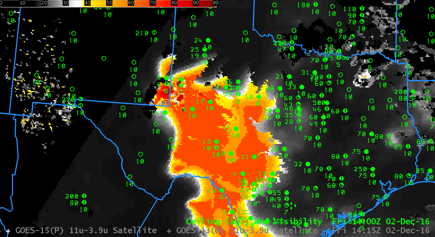
GOES-13 Brightness Temperature Difference (3.9 µm – 10.7 µm, left) and GOES-R IFR Probability Fields (Right), hourly from 0215 through 1415 UTC on 2 December 2016 (Click to enlarge)
Near-IFR and and IFR Conditions developed over the High Plains of Texas on 2 December 2016, and a SIGMET for IFR conditions was issued as shown below.
The animation above shows plentiful cirrus (in the brightness temperature difference enhancement used in the imagery on the left, above, cirrus clouds are dark) over south Texas, with occasional breaks. This makes continual monitoring via satellite of the developing stratus/fog field problematic: the satellite cannot monitor what it is blocked from being observed by intervening cloud layers — in this case cirrus. (Click here for a brightness temperature difference only animation; Click here for an IFR Probability only animation) Because IFR Probability fields include model-based data about saturation in the lower troposphere, in the form of Rapid Refresh model output, a useful and coherent signal can be generated underneath cirrus clouds. The GOES-R IFR Probability signal can be better used for situational awareness and anticipation of the development of the IFR conditions shown below.
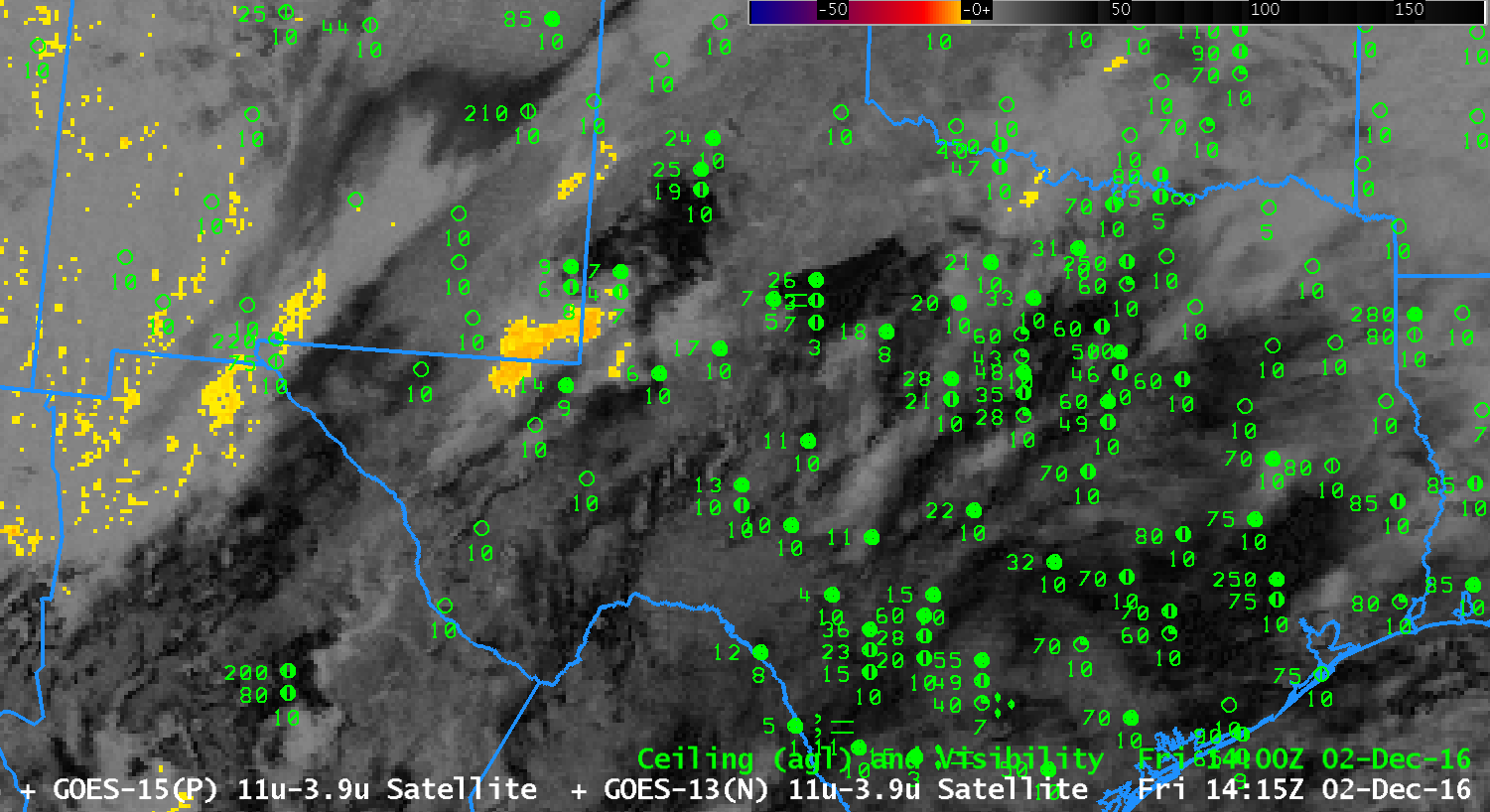
In the animation above, note the change between 1315 and 1415 UTC fields — in the Brightness Temperature Difference fields (1315 UTC ; 1415 UTC), this change arises because of increasing amounts of reflected solar 3.9 µm radiation: this causes a sign change in the brightness temperature difference. For IFR Probability fields (1315 UTC ; 1415 UTC), the change occurs because the Predictors used at night (1315 UTC) and during the day (1415 UTC) are different.
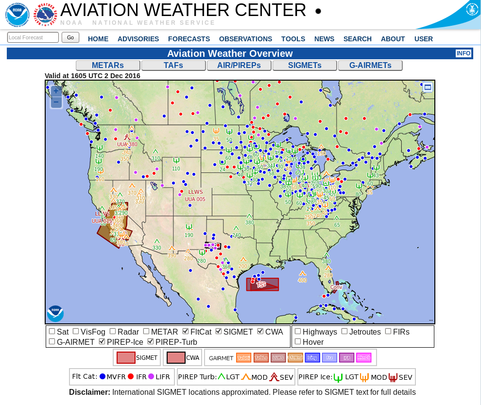
1605 UTC screen capture from Aviation Weather Center. Note IFR Sigmet over west Texas (Click to enlarge)