
GOES-R IFR Probability computed with GOES-13 and Rapid Refresh Model Data, hourly from 0215 through 1415 UTC on 20 December 2016 (Click to enlarge)
Widespread IFR Conditions developed across Mississippi, Alabama, Georgia and neighboring states on Tuesday morning 20 December, as evidenced by the Aviation Weather Center website screen grab at the bottom. GOES-R IFR Probabilities captured the evolution of the low ceilings and reduced visibilities. In particular, note in the animation above the westward progress of the higher IFR probabilities through Mississippi; IFR conditions develop at, for example, Jackson (KJAN), Greenwood (KGWO) and Oxford (KUOX) as the high probabilities move over the station. Its motion was useful as a forecast tool on this morning.
The GOES-R IFR Probability field has noticeable stripes in it at the end of the animation. This occurs because high clouds have overspread the low stratus/fog. When that happens, satellite data can no longer be used as a predictor in the IFR Probability algorithm because the satellite can no longer view the low clouds; Rapid Refresh data alone are driving the values. The toggle between the brightness temperature difference field (3.9 µm – 10.7 µm) and the IFR Probability field, below, from 1115 UTC on 20 December, shows the effect. Where fog/stratus are present (yellow in the enhancement used for the brightness temperature difference field), IFR Probability values are larger because satellite and model data can be used to compute IFR Probability. Where high clouds are present (dark grey in the brightness temperature difference enhancement), only Rapid Refresh data can be used.
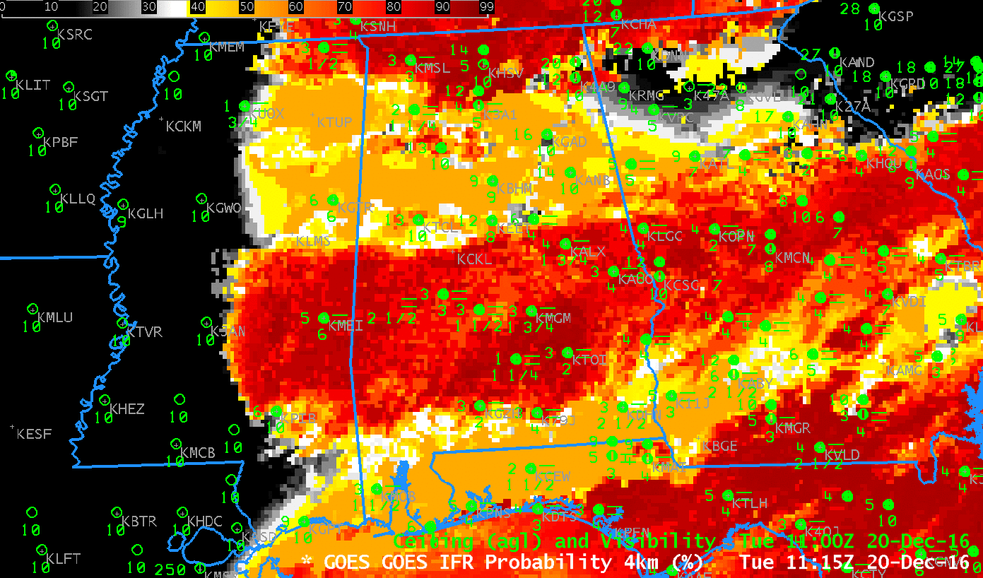
GOES-R IFR Probability and GOES-13 Brightness Temperature Difference (3.9 µm – 10.7 µm) fields, 1115 UTC on 20 December 2016 (Click to enlarge)

Aviation Weather Center website screengrab, 1443 UTC on 20 December 2016 (Click to enlarge)