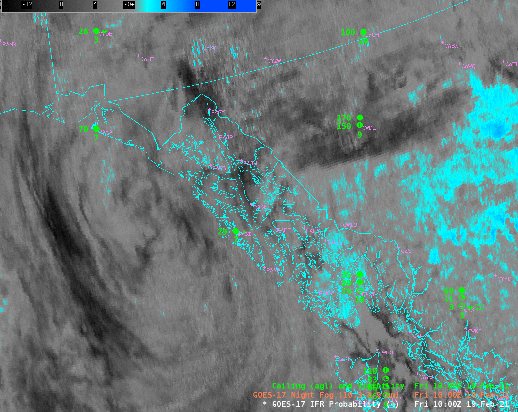
Clean Window infrared imagery from GOES-17, above, shows a cyclonic storm making landfall over the southeast Alaska peninsula. Multiple cloud levels can be inferred from this animation, and satellite detection of low clouds (and stratus), as reported in sparse METAR observations, is a challenge. Note also the occasional striping that suggests the Loop Heat Pipe on GOES-17 is not cooling the satellite (The Cooling Timeline — every 15 minutes for a Full Disk, is being used at the start of the animation).
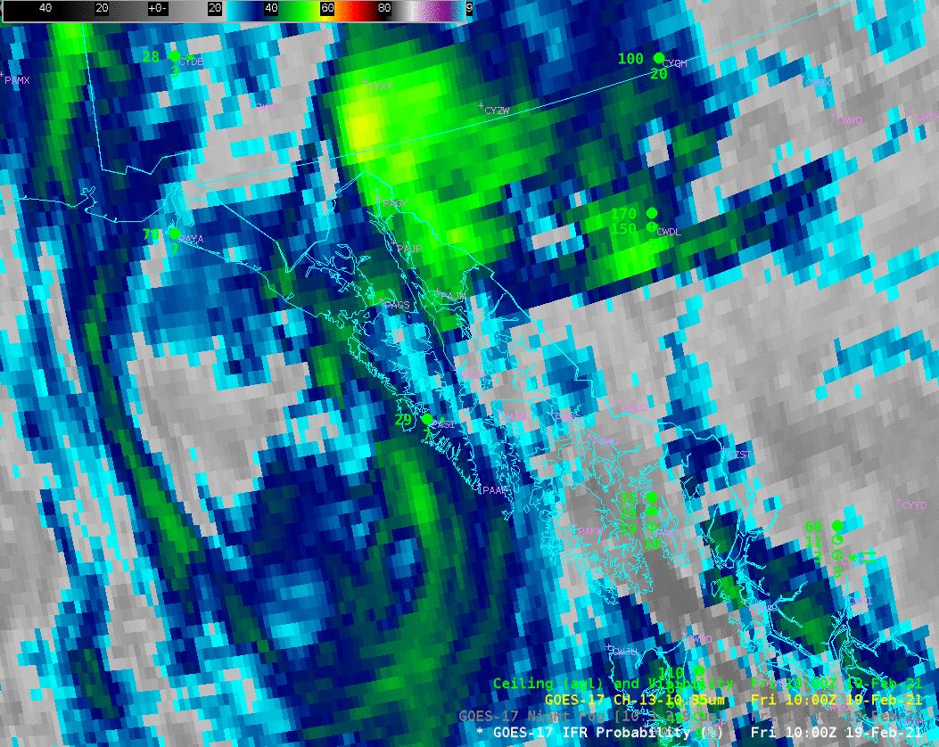
In particular, the GOES-based ‘Night Fog ‘ Brightness Temperature Difference field, below, commonly used alone, and as part of the night time microphysics RGB, does not show a consistent signal (cyan in the enhancement) associated with low clouds/stratus/fog — because higher clouds (grey in the applied enhancement) are interfering with the view.
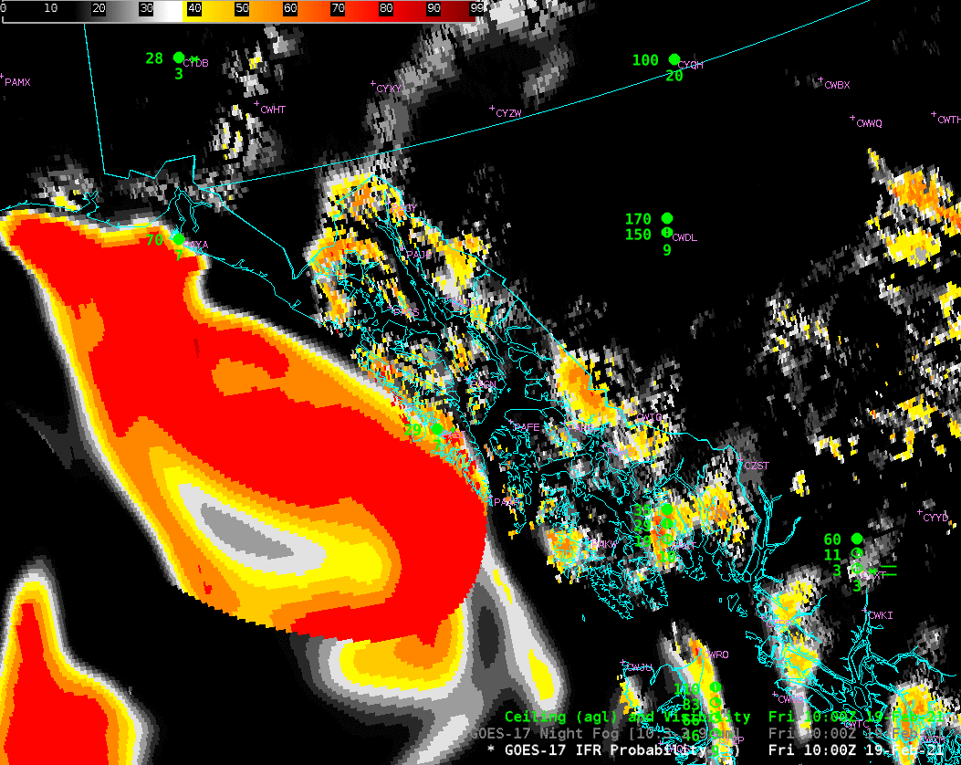
GOES-17 IFR Probability combines satellite information with Rapid Refresh model (resolution: 11 km) predictions of low-level saturation. More recent model data are incorporated every hour; you might notice that fields adjust slightly at the top of the hour as that happens.
IFR Probability fields show that the likelihood of IFR conditions are extending southward along the coastal range with time, and increasing in the Inside Passage as well. Note also how IFR Probability is generally larger near mountain tops: it is created with knowledge of topography