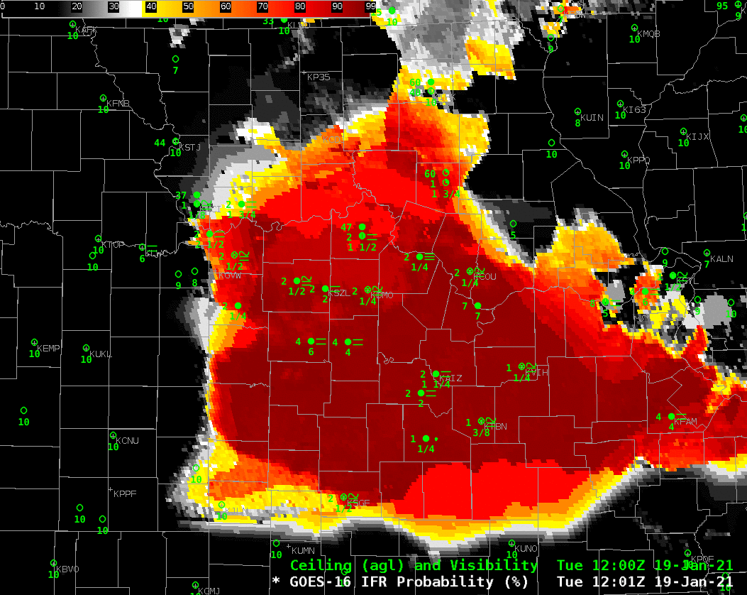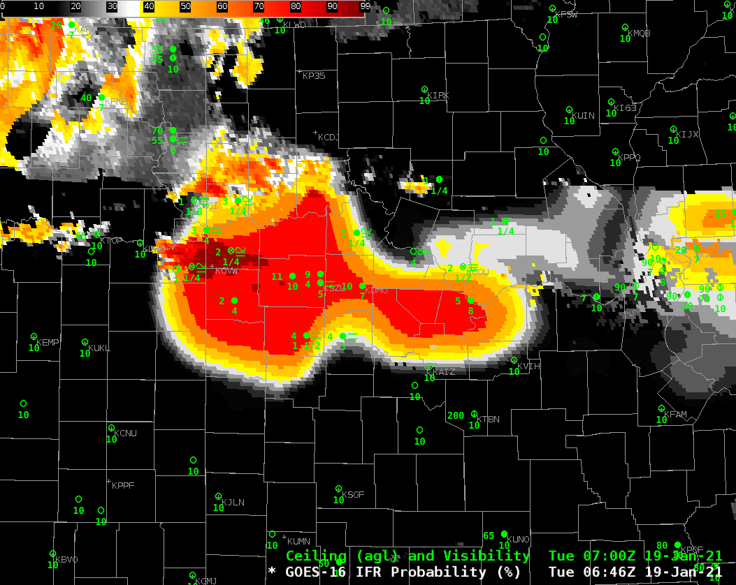
GOES-16 IFR Probability fields, above, show a gradual expansion southward of the regions of highest probability of reduced visibility. As the fields encroach over stations, visibilities and ceilings are reduced: there is a very good relationship between observed IFR conditions and enhanced IFR Probabilities. This field could be used on 19 January to predict the onset of low ceilings and reduced visibilities.
You will note that there are hourly changes to the IFR Probability fields. Rapid Refresh model data used in the computation of IFR Probability is updated each hour when a more recent model simulation is incorporated into the data. You can also identify regions where satellite data are not used because high clouds are preventing a satellite view of low stratus: there are regions where IFR probability is an unpixelated mostly uniform field.
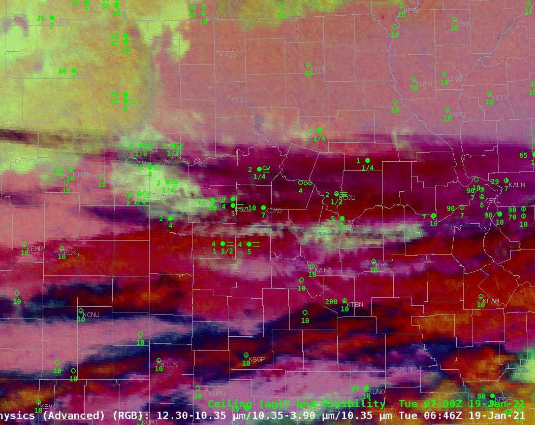
The Night Time microphysics RGB for the same period, shown below, also highlights the region of low clouds as a cyan/yellow feature slowly moving southward. In principle, this field is only showing you that stratus clouds are present, because information about the cloud base (supplied by the Rapid Refresh model in IFR Probability fields) is lacking.
The challenge of using the Night Time Microphysics field is also apparent near the end as the Sun rises and the color associated with the stratus clouds changes.
The toggle below compares the GOES-16 IFR Probability field and the GOES-16 Night Time Microsphysics RGB at 1201 UTC. A cirrus shield along the southern boundary of the IFR Probability field is hindering the ability of the Night Time Microphysics RGB there to detect low clouds.