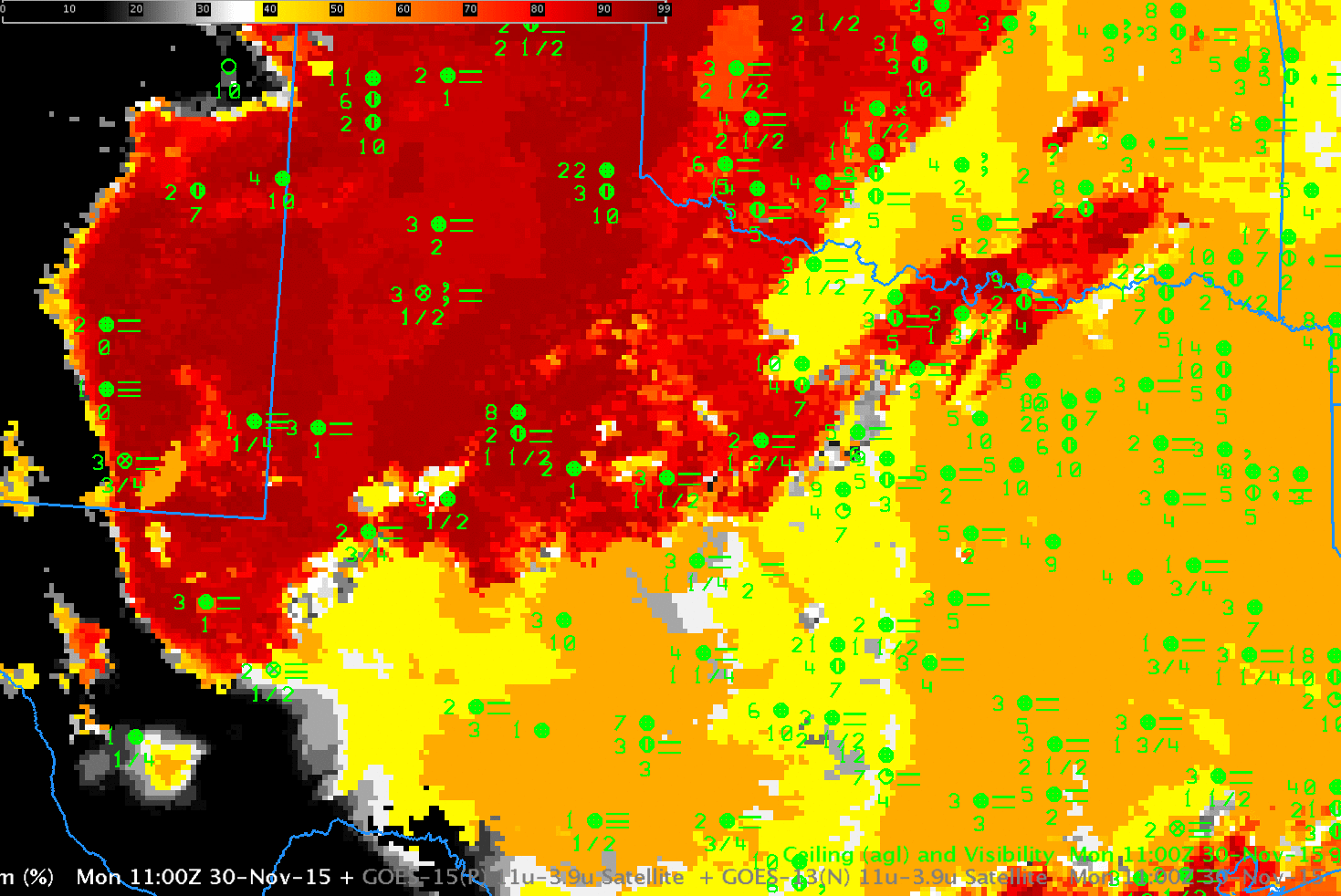
GOES-based GOES-R IFR Probabilities and GOES-13 Brightness Temperature Differences (10.7 µm – 3.9 µm), 1100 UTC on 30 November 2015 (Click to enlarge)
Extratropical cyclones are accompanied most time with multiple clouds levels. In the example above, a cirrus shield accompanies a subtropical jet over the southern boundary of the United States. That cirrus prevents the satellite from seeing any low clouds that may be present. To detect/diagnose low clouds and fog in such regions, other data sets must be used. For GOES-R IFR Probability fields (shown in the toggle above), that other data set is low-level saturation in the Rapid Refresh model. If the model suggests saturation is present, IFR Probability fields will show a strong signal even where cirrus shields prevent the satellite from viewing water-based clouds near the surface. That is the case above. IFR conditions are widespread in the scene above are are diagnosed quite well by the IFR Probability fields.