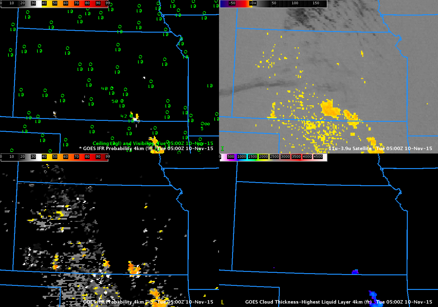
GOES-R IFR Probabilities (Upper left, computed from GOES-13 and lower left, computed from GOES-15), GOES-13 Brightness Temperature Difference fields (10.7 µm – 3.9 µm, Upper right) and GOES-R Cloud Thickness (Lower Right), hourly from 0500 through 1300 UTC 10 November 2015 (Click to enlarge)
Dense Fog Advisories were hoisted over western Kansas in response to the development of dense fog in the early morning on 10 November 2015. The hourly evolution of GOES-R IFR Probabilities (top left, bottom left), GOES-13 Brightness Temperature Difference fields (10.7 µm – 3.9 µm, upper right) and GOES-R Cloud Thickness fields (Bottom right) are shown above.
Both IFR Probability fields show highest probabilities over western Kansas where observations report IFR conditions. Portions of northern, central and eastern Kansas have strong returns in the GOES-13 Brightness Temperature Difference field, but IFR Probabilities are small and IFR conditions are not reported. In these regions, Rapid Refresh Model model output does not show low-level saturation and the IFR Probability algorithm correctly recognizes that IFR conditions are not likely despite the presence of stratus. It is the fusing of data in this way that gives the GOES-R IFR Probability field superior statistics (compared to the Brightness Temperature Difference field) in fog/low cloud detection.
Maximum cloud depth observed is more then 1200 feet. This suggests a long time before fog dissipation unless winds increase over Kansas.
GOES-R IFR Probabilities based on GOES-West show somewhat higher values than those based on GOES-East data; this difference arises because of the very oblique view of Kansas from GOES-15.