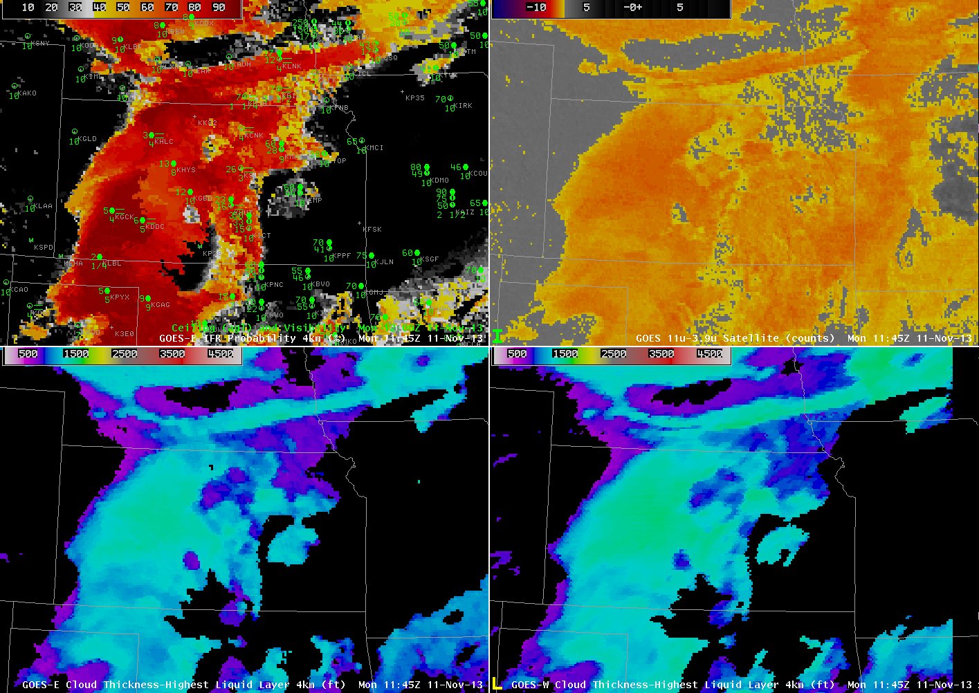
GOES-13-based GOES-R IFR Probabilities (Upper Left), GOES-13 Brightness Temperature Difference Product (10.7 µm – 3.9 µm) (Upper Right), GOES-R Cloud Thickness from GOES-East (Lower Left), GOES-R Cloud Thickness from GOES-West (Lower Right), all times as indicated (click image to enlarge)
GOES-R IFR Probabilities over the Central Plains from just before sunrise on 11 November 2013 are displayed above. The IFR Probabilities accurately depict the region of lower stratus and fog with reduced visibilities, separating that region from the mid-level stratus over eastern Kansas and western Missouri. In contrast the brightness temperature difference field (10.7 µm – 3.9 µm) highlights the entire region as one of interest.
The GOES-R Cloud Thickness from GOES-East (bottom left) and from GOES-West (bottom right) show cloud thickness over Dodge City at just under 1200 feet. Note that the values computed with GOES-West are somewhat larger because of the oblique view angle from GOES-West. The 1200 UTC sounding from Dodge City, below, shows a fog/stratus deck from the surface (928 mb, 2652 feet ASL) to 880 mb (4075 feet ASL), a thickness of 1423 feet. Given that the sounding is not saturated at the surface, that 1423 foot thickness is likely a slight overestimate. It is very close to the GOES-R Cloud Thickness estimate of 1200 feet, however.

1200 UTC Sounding at Dodge City, Kansas, 11 November 2013 (click image to enlarge)