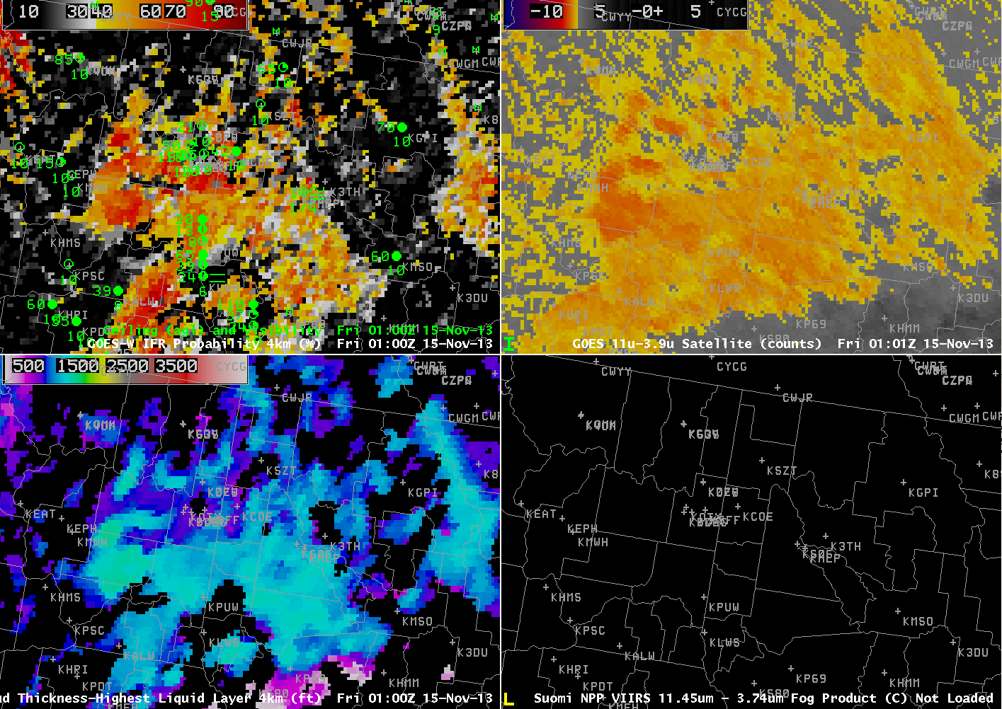
GOES-15-based GOES-R IFR Probabilities (Upper Left), GOES-15 Brightness Temperature Difference Product (10.7 µm – 3.9 µm) (Upper Right), GOES-R Cloud Thickness from GOES-15 (Lower Left), Suomi/NPP Brightness Temperature Difference and GOES-15 Visible data (Lower Right), all times as indicated (click image to enlarge)
The evolution of GOES-R IFR Probability fields showed an expected relationship between where Fog and Low stratus caused IFR Conditions and where IFR Probability was highest. The hourly animation, above, shows very high IFR Probabilities in and around Spokane in concert with IFR conditions that are observed. The Brightness Temperature Difference product, upper right, shows a strong signal there as well, but the positive signal extends to regions where IFR conditions are not observed: for example, over western Montana near Missoula. GOES-R IFR Probability fields thus are refining the signal in the brightness temperature difference field; the Rapid Refresh Model output allows the IFR Probability field algorithm to distinguish between fog/low stratus and mid-level stratus.
Later in the animation, IFR Probabilities decrease around Spokane as high-level clouds move in. Because these high clouds obscure the satellite view of low- and mid-level clouds, satellite information is not included in the computation of IFR Probabilities and Probabilities are lower. At the end of the animation, during the day, probabilities increase. Use of the visible data as a cloud-clearing product leads to higher probabilities (because there is more confidence that the cloud is actually present).
Note that Cloud Thickness is only computed in regions of low clouds that are comprised of water droplets. When high clouds are present, cloud thickness is not computed. In addition, cloud thickness is not computed during twilight conditions on either side of sunrise and sunset. Those restrictions show up plainly in the cloud thickness field in the animation.