 |
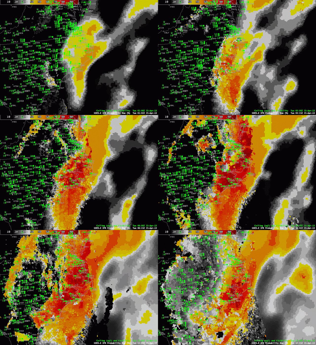
| GOES-R IFR Probabilities computed from GOES-East data, hourly from 0100 through 1200 UTC, 23 April 2013 |
A coastal storm along the east coast was responsible for low-level moisture over eastern North Carolina that resulted in IFR conditions. Multiple cloud layers in the beginning of the animation above mean that IFR probabilities were computed using model data. By 0315 UTC, however, upper level clouds had moved off the coast, leaving behind clouds at low layers that meant cloud data (brightness temperature difference) could influence the IFR probability fields; consequently, the probability increased. High clouds remained offshore, however, and the character of the IFR probability field shows the characteristic pixelated appearance over land — where satellite data are used in the computation of IFR probabilities — and the characteristic smoothed appearance over water where only model data are used to produce IFR probabilities. Note how the highest IFR probabilities over eastern North Carolina do overlap the stations reporting IFR and near-IFR conditions.
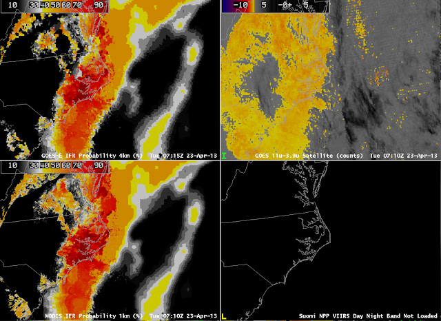
The image above compares GOES-R IFR probabilities computed with MODIS and with GOES-East. They do show very similar overall structures, with highest probabilities over land where the Brightness Temperature Difference field can contribute to the probability, and lower, smoother probability fields over water where only model data are used. Note that both GOES-R IFR fields correctly ignore the low cloud signal over eastern South Carolina and central North Carolina.
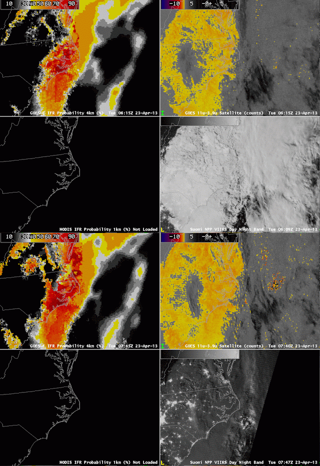
The GOES-based IFR probability field can also be compared to the Day/Night band sensed by VIIRS on board Suomi/NPP. The 0609 UTC Day/Night band shows the effects of a near-full moon on the product. The extensive cloud shield east of the Appalachians is visible, even though the image is at night, because of strong lunar illumination. As with the traditional brightness temperature difference field, however, the cloud information from the Day/Night band gives little information about the cloud bases; for that, the IFR probability field is needed, and low cloud bases are correctly restricted to extreme eastern North Carolina. The Day/Night band at 0747 UTC is from a time after the moon has set; only city lights and airglow are illuminating the clouds over Virginia and the Carolinas. Cloud edges are still easily discerned.


