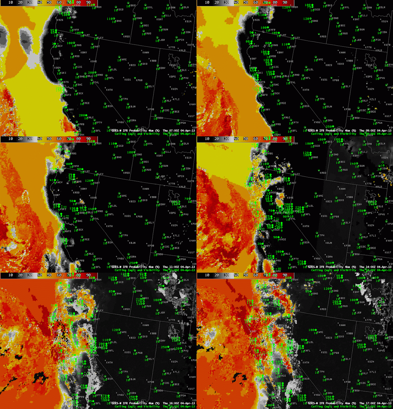
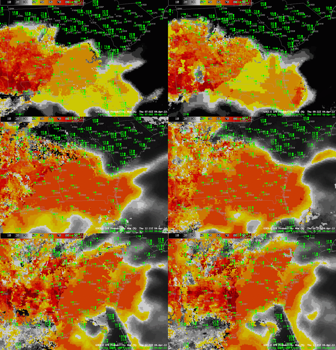
Two different systems — one approaching California, and one in the Gulf of Mexico — provide examples of how the GOES-R Fog/Low Stratus algorithm give information about visibilities and ceilings in regions where high clouds obscure the satellite view of low levels.
 |
| GOES-R IFR Probabilities computed from GOES-West, hourly, from 0700 through 1700 UTC 4 April 2013 |
The first case, off the West Coast, starts with a deck of high clouds over the coast associated with a landfalling cyclone. IFR Probabilities over the Pacific near the California coast are initially derived solely from Rapid Refresh model data. Consequently, IFR probabilities are not high. As the cirrus shield pushes inland, low clouds become visible to the satellite, and when both satellite and model predictors are used to compute IFR Probabilities, higher probabilities are a result. In addition, small-scale variability that is inherent in a satellite image (and perhaps not so inherent in model output) changes the character of the IFR Probability field from a flat field at the start to a more pixelated field later in the animation. As the low clouds push onshore, associated moisture and precipitation helps to generate near-IFR and IFR conditions in regions where the IFR Probabilities are depicted to be high.
The second case, below, over the deep South, shows a region of fog/low clouds moving over Georgia as mostly model-based IFR Probabilities also move over the state. Strong convection over the Gulf of Mexico produced abundant high-level cloudiness; thus, IFR Probabilities could only be computed using Rapid Refresh Data over Georgia — but the computed IFR Probabilities both outline the region of lowest ceilings/visibilities and match their slow spread to the north and east into South Carolina. The IFR Probability field over Mississippi has a more pixelated look to it, and shows higher values, because satellite data are also used to diagnose the IFR Probability: IFR Probabilities are highest only where both predictors (model and satellite) are used.
 |
| GOES-R IFR Probabilities computed from GOES-East, hourly, from 0702 UTC through 1745 UTC, 4 April 2013 |
