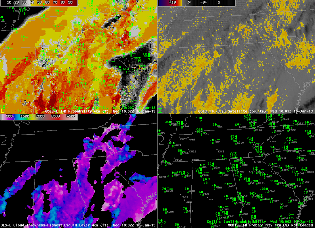
A slowly-moving weather system brought extensive cloudiness and IFR and near-IFR conditions over the southeast part of the United States again on January 16, and provided a good example of how the fused nature of the GOES-R Fog/Low Stratus product — combining both satellite and model information — yields a better signal (than is available from the traditional brightness temperature difference product) of where fog and low stratus are most likely. The imagery from 1000 UTC, which is characteristic of the entire event, shows a brightness temperature difference signal over the southest that is consistent with the observed multiple cloud layers. Such a cloud configuration makes it very difficult to relate the brightness temperature difference signal to surface observations. in contrast, the IFR Probability field show a widespread region of high probabilities, overlapping the regions of near-IFR and IFR observations over Tennessee, and points south. Cloud thickness, which is computed only where single water-cloud layers are detected from satellite, indicates cloud thicknesses around 1000 feet. Note that where the cloud thickness is diagnosed, in general, IFR probabilities are relatively larger. This is because IFR probabilities combine satellite predictors and model predictors. If the satellite predictors cannot be generated because of multiple cloud layers and/or a single high cirrus deck, then only the model predictors are driving the IFR probability value, and the probability will therefore be lower. This is the case over western Tennessee and central Georgia.
IFR conditions with multiple clouds layers over the southeast US
Leave a reply

