 |
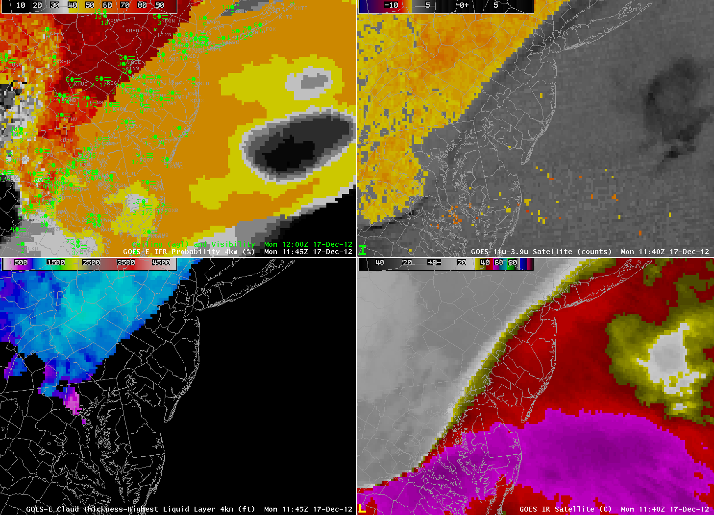
| GOES-R IFR Probabilities computed using GOES-East (Upper Left), GOES-East Brightness Temperature Difference (10.7 µm- 3.9 µm, The ‘traditional’ fog detection product) (Upper Right), GOES-R Cloud Thickness computed using GOES-East (Lower Left), GOES-East Window Channel (10.7 µm) Brightness Temperature (Lower Right) |
When high clouds overspread an area, the traditional brightness temperature difference product cannot be used to highlight areas of fog and low stratus because radiation emissions are originating from high clouds, not from the water-based low clouds. In this example from Monday morning, 17 December 2012, IFR conditions, causing airport flight delays, are commons from Washington DC to New York, and the GOES-R IFR probability product highlights the area where IFR (and near-IFR) conditions prevail. Modest values (around 50%) occur where the satellite predictors do not provide a fog/low stratus signal; however, the Rapid Refresh model data does show high probability of fog and low stratus. Where the Satellite does contribute to the product (that is, in Pennsylvania north and east of the high cloud deck), IFR probabilities are very high.
Note also that the GOES-R Cloud Thickness product (bottom left), is computed only for the highest water-based cloud (in non-twilight conditions). It is therefore not shown under the cirrus canopy, over southern New Jersey, Delaware, and Chesapeake Bay.