 |
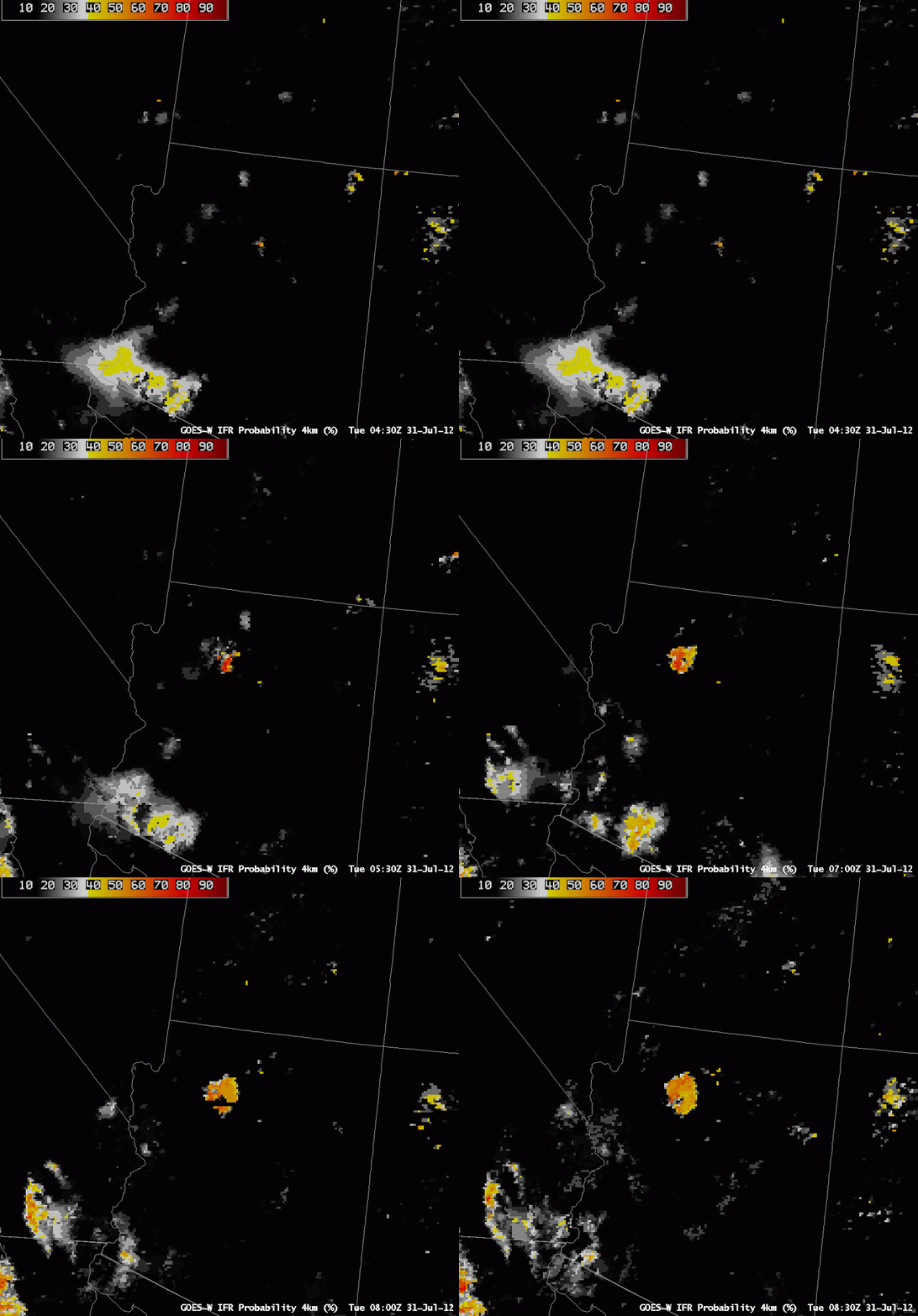
| Animation of GOES-W IFR Probabilities over Arizona, half-hourly from 0430 UTC to 0800 UTC 31 July 2012 |
The animation of GOES-R IFR Probabilities over north-central Arizona shows the development of relatively high probabilities as the night progresses, an evolution that is consistent with the formation of radiation fog. However, there are no surface observations routinely taken in the region to verify the presence of IFR conditions, or even clouds. How much credence should be given to such a field?
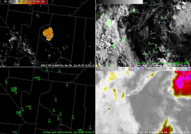
A serendipitous Suomi-NPP overpass shows a region of clouds neatly outlined by the GOES-W IFR probabilities. Although the Day/Night band cannot give ceiling heights or visibilities (that is, it cannot alone determine if IFR conditions are occurring), it does show the presence of low clouds.
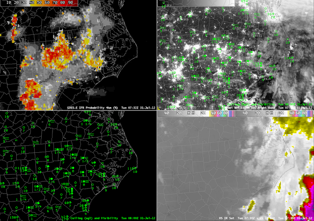
An earlier Suomi/NPP overpass over the eastern United States overflew a second developing region of enhanced IFR probabilities, over the piedmont from North Carolina southwestward into South Carolina (below). The city lights of the Carolinas make it more difficult to detect cloud edges, although evidence of one does exist between Camden SC (KCDN) and Fairfield CO Airport (KFDW). This is a also a region where IFR probabilities quickly drop from high values (near KCDN, where there is fog with 100-foot ceilings) to low (near KFDW, which reports clear skies).


