 |
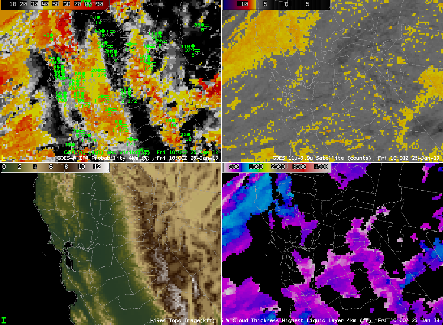
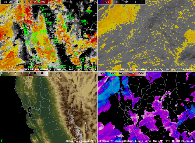
| GOES-R IFR Probabilities compted from GOES-West (Upper Left), GOES-West Brightness Temperature Difference (10.7 µm- 3.9 µm) (Upper Right), Central Valley Topography (Lower Left), GOES-R Cloud Thickness of Highest single liquid layer (Lower Right), 1000 UTC on 25 January 2013 |
GOES-R IFR Probabilities suggest the presence of IFR conditions both to the west and to the east of California’s San Joaquin Valley, providing a much more coherent signal of IFR conditions than can be discerned from the traditional Brightness Temperature Difference Product. That traditional product is hamstrung by the multiple cloud layers present over the West Coast as an extratropical cyclone approaches from the Pacific Ocean. The signal present at 1000 UTC (and earlier) continues through most of the morning. The synthesis of Satellite Predictors and Model Predictors (Rapid Refresh Model) in the Naive Bayesian Model produces a product that gives better information in this case on exactly where IFR conditions are most likely.
 |
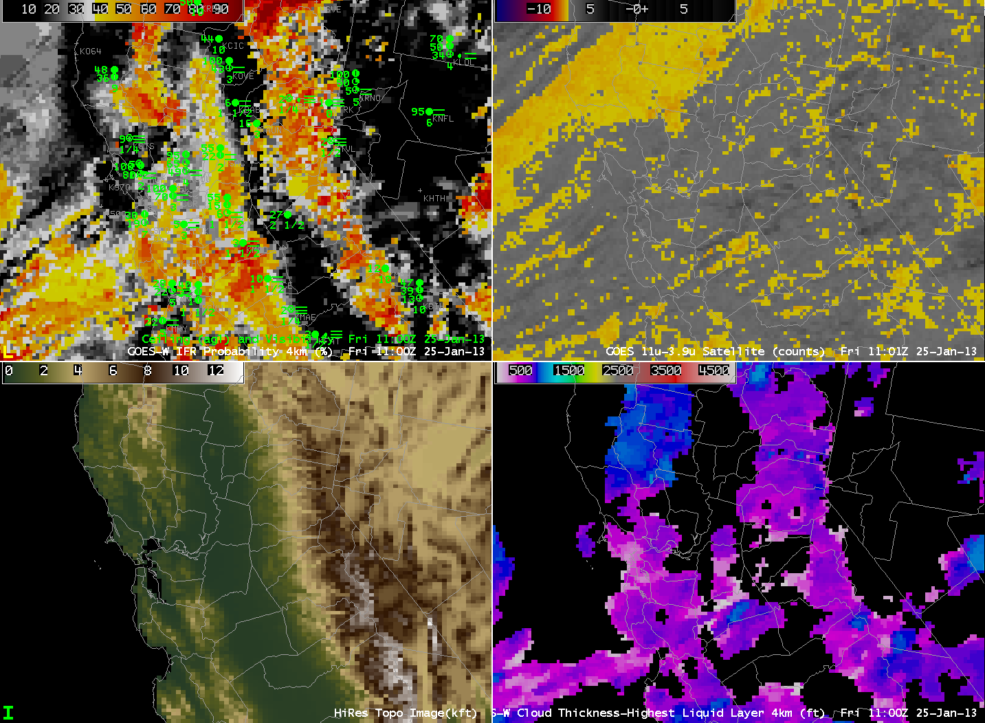
| As above, but at 1100 UTC |
 |
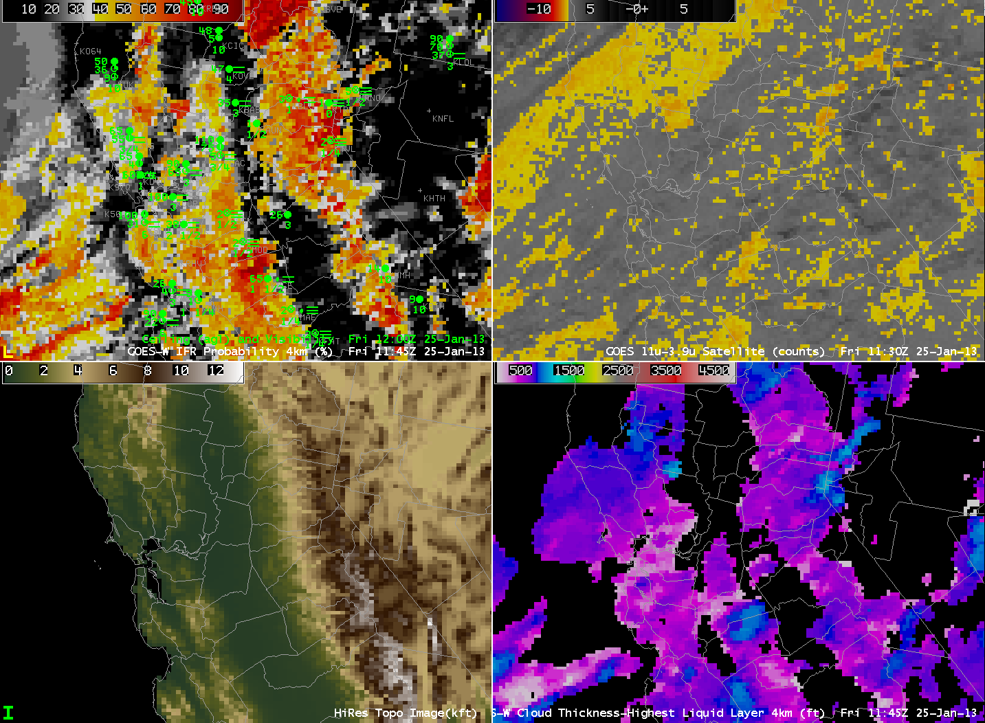
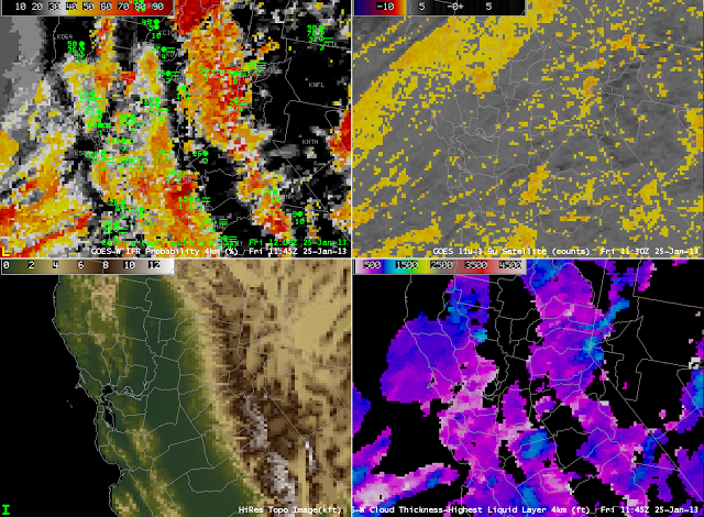
| As above, but at 1145 UTC |
 |
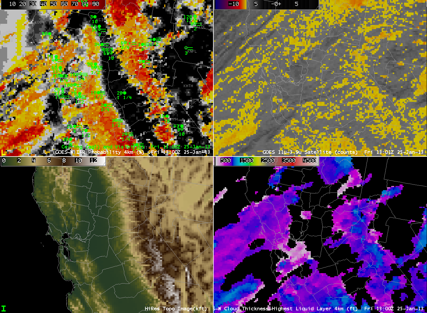
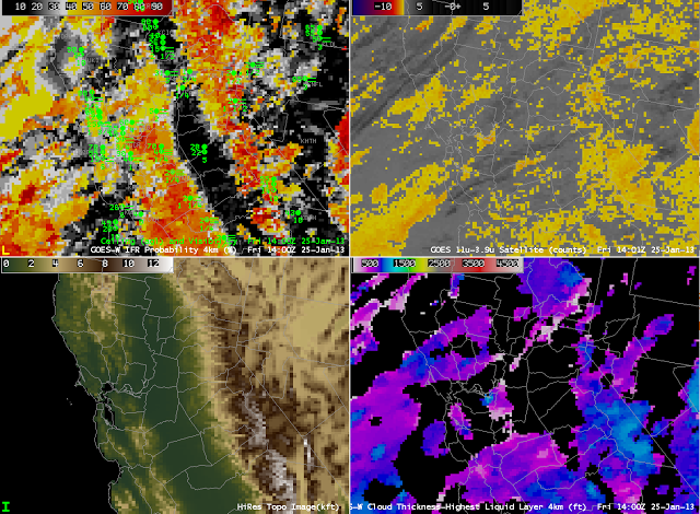
| As above, but at 1300 UTC |
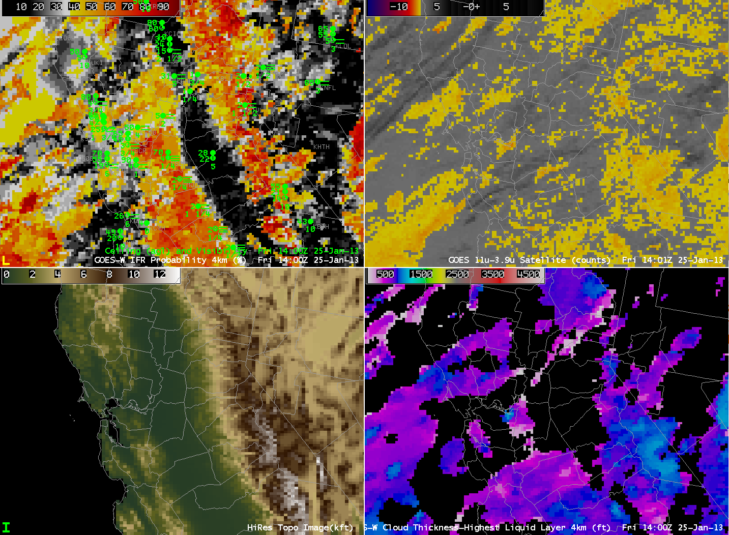
 |
| As above, but at 1400 UTC |