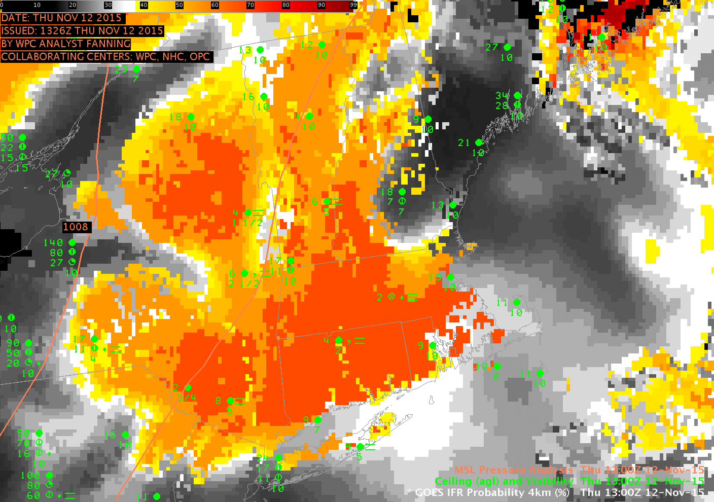
GOES-R IFR Probability Fields (from GOES-13 and the Rapid Refresh Model), 1300 and 1400 UTC on 12 November 2015 (click to enlarge)
Strong Extratropical Cyclones, such as the one affecting the central and eastern United States on 11-12 November 2015 (1200 UTC Map on 12 November is here), generate multiple levels of clouds that make it difficult to detect fog/low stratus from satellite, because intervening cloud layers get in the way. GOES-R IFR Probability fields, however, because they incorporate near-surface information from the Rapid Refresh Model, can yield useful information about the likelihood of IFR Conditions. The toggle above shows data at 1300 and 1400 UTC over the northeast United States. Highest IFR Probabilities are removed from the coastlines of New England — as observations confirm. Note how the Adirondack and Catskill regions have higher probabilities, where terrain is reaching up into the stratus deck. Features in the IFR Probability field are strongly related to surface-based observations of fog and low stratus.
The toggle below shows IFR Probability fields and GOES-13 Brightness Temperature Differences as 1300 UTC. Features in the brightness temperature difference field have no relationship to surface-based observations of fog and low stratus.

GOES-R IFR Probability Fields (from GOES-13 and the Rapid Refresh Model) and GOES-13 Brightness Temperature Difference fields (10.7µm – 3.9µm), 1300 UTC on 12 November 2015 (click to enlarge)