 |
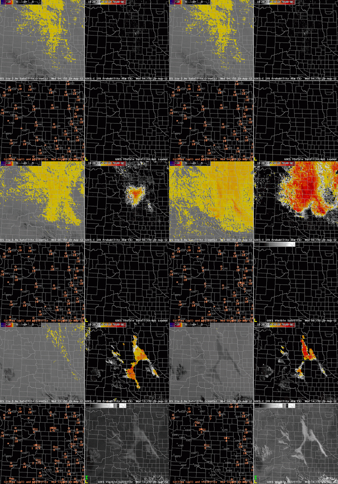
| GOES-East brightness temperature difference (Upper left), GOES-R FLS Product (Upper Right), Ceiling and visibility observations (Lower left), Visible Imagery (Lower right) |
Relatively light winds and high dewpoints promoted the development of isolated fog over the Dakotas on the morning of the 29th. How did satellite-based and satellite-influenced fog detection algorithms perform?
The Brightness Temperature difference field shows returns suggestive of fog or low stratus in regions over western North Dakota — west of the Missouri River — where IFR conditions are not reported. The GOES-R FLS product suggests a smaller region of fog and low stratus; there are high probabilities in regions where IFR conditions occur. However, there are several examples of IFR conditions that are reported at stations just at the edge of the region of high probabilities: KMHE at 1115 and 1215 UTC, for example. The isolated nature of the fog in the visible imagery also is suggetive of a more limited fog event than might have been expected given the Fog/Low stratus probabilities. Note the abrupt change as daytime predictors replace nighttime predictors. In this case, it seems as though the daytime predictors better handle the small horizontal scale of the fog event.
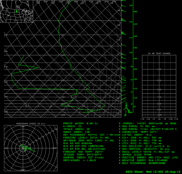
The morning sounding from KBIS is characteristic of a fog event in a river valley.
 |
| Thermodynamic diagram for KBIS at 1200 UTC on 29 August 2012. Note the saturated layer at the surface. |
