Category Archives: Rocky Mountains

Freezing Fog over Idaho’s Snake River Valley

GOES_IFR_PROB_20150114_03_18

GOES-R IFR Probabilities over southern Idaho, hourly from 0300 through 1800 UTC on 14 January 2015 (Click to enlarge)

High Pressure over the Rocky Mountains, and its associated inversion, has trapped moisture at low levels, including along the Snake River in southern Idaho. As a consequence, fog is prevalent at low levels, and cold temperatures are allowing for the development of freezing fog. (Click here for a National Weather Service advisory from the Pocatello WFO).

The GOES-R IFR Algorithm shows high probabilities over the Snake River Valley where the Fog/Freezing Fog was occuring — Twin Falls and Rexburg both reported freezing fog during the animation above. The Brightness Temperature Difference field, below, also captures the areal extent of the low stratus deck.

US_11-3.9_Sat_20150114_04_18

GOES Brightness Temperature Difference fields (10.7µm – 3.9µm) over southern Idaho, hourly from 0400 through 1800 UTC on 14 January 2015 (Click to enlarge)

Extended Period of Fog/Low Stratus over the Arizona

GOES13_AzFOG_6_13December2014visloop

GOES-13 Visible Imagery at 1600 and 2300 UTC from 6 December through 13 December 2014 (Click to enlarge)

Northern Arizona experienced a wet start to December (From 2-4 December, Flagstaff received 1.79″, Winslow received 0.80″ and Grand Canyon Airport received 0.41″). When High Pressure and an inversion then settled over the region (an animation of surface weather charts is here), the stage was set for a prolonged period of fog and low stratus, as noted here, for example. The visible imagery, above, testifies to the persistence of the low clouds and fog. It is apparent on 6 December during the day, and persists through the 12th. Visible imagery also shows the presence of high clouds; the presence of those high clouds makes ongoing detection of lower clouds difficult. In addition, both the visible imagery and brightness temperature difference product (10.7 µm – 3.9 µm on GOES-13, historically and still routinely used to detect water-based clouds) give information about the top of the cloud. There is great difficulty in using this information to infer a surface visibility or ceiling (that is, information about the bottom of the cloud).

Fused products have an advantage of incorporating surface-based data (assimilated into the model — the Rapid Refresh in this case) to provide information on whether saturation is occurring in the lowest kilometer of the atmosphere. If that is the case, IFR Probabilities will be larger. The animation below shows Brightness Temperature Difference products and IFR Probabilities at 3 different times (~0700, ~1700 and ~2300) during the days on 8-11 December. IFR Probability fields continually show a strong signal in the region of fog/low stratus over eastern Arizona; the brightness temperature difference field does not, as it is affected by cirrus clouds and by solar reflectivity during the day. Clear skies on 10-11 December at night did allow the brightness temperature difference product to highlight the low clouds over Arizona.

GOES13_BTD_IFR_8_11December

GOES-13 Brightness Temperature Difference (Left, 10.7 µm – 3.9 µm) and IFR Probability (Right) from 8 December through 11 December at ~0700, ~1700 and ~2300 UTC. The Brightness Temperature Difference is enhanced so that fog/low stratus are yellow/orange/red at night, black during the day. (Click to enlarge)

Ice Fog causes Flight Diversions at Denver International

Ice Fog at Denver International Airport on Sunday 30 November resulted in the diversion of almost 50 flights. (News Link) From the link:

Sunday morning fog caused about 46 flights scheduled to land at Denver International Airport to be diverted, airport officials said.

GOES_R_IFRProb_30Nov2014_anim

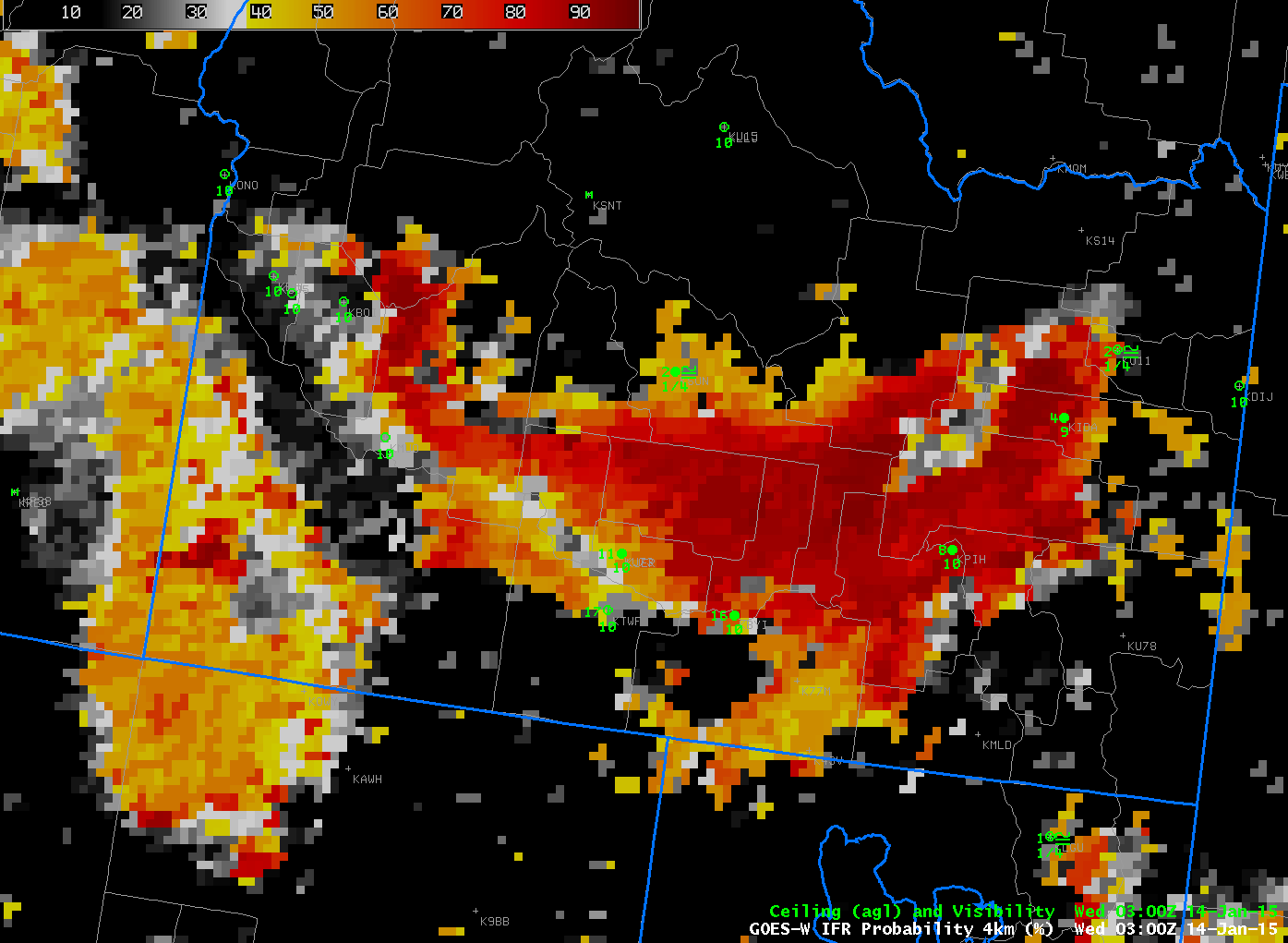
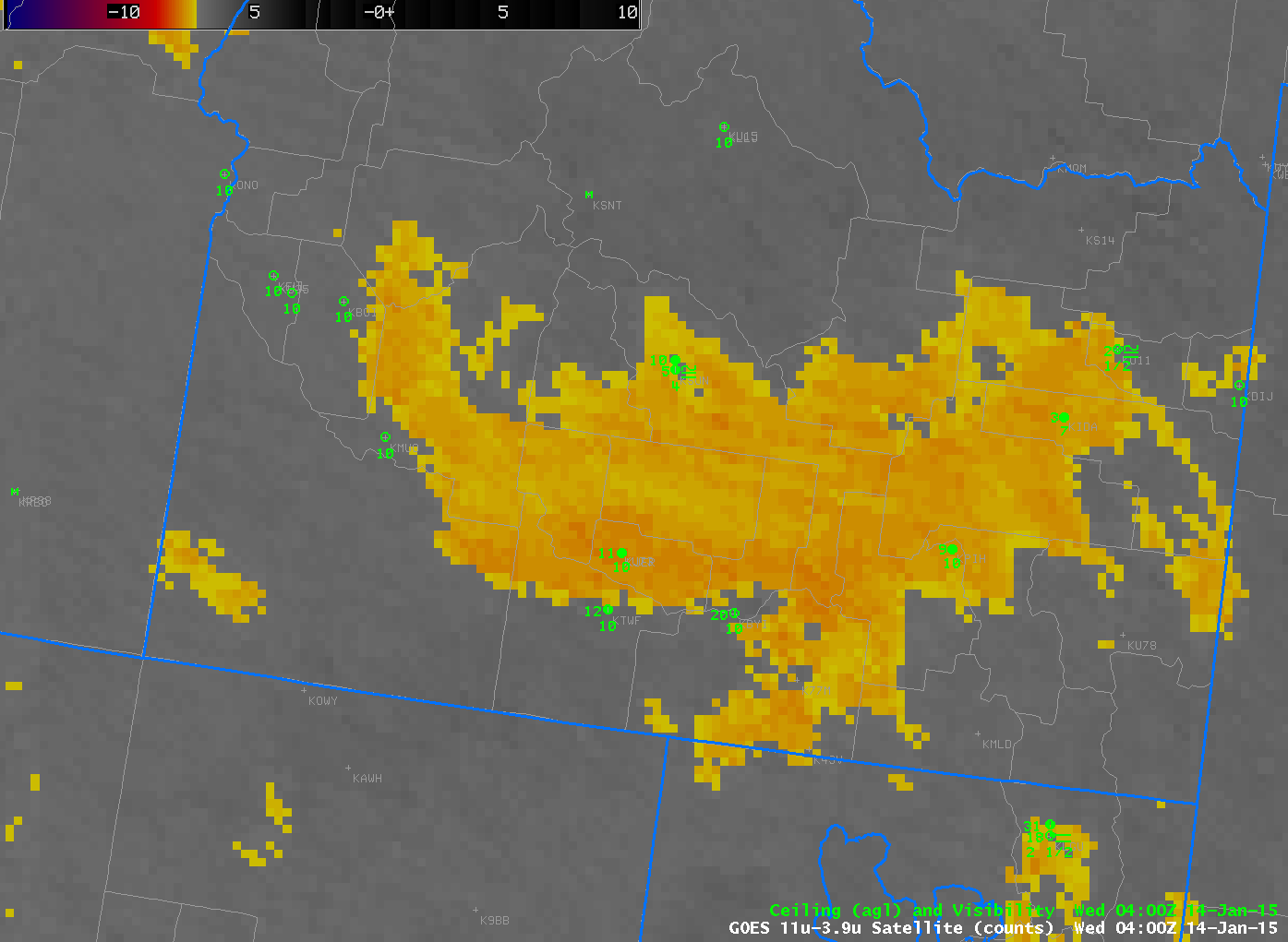
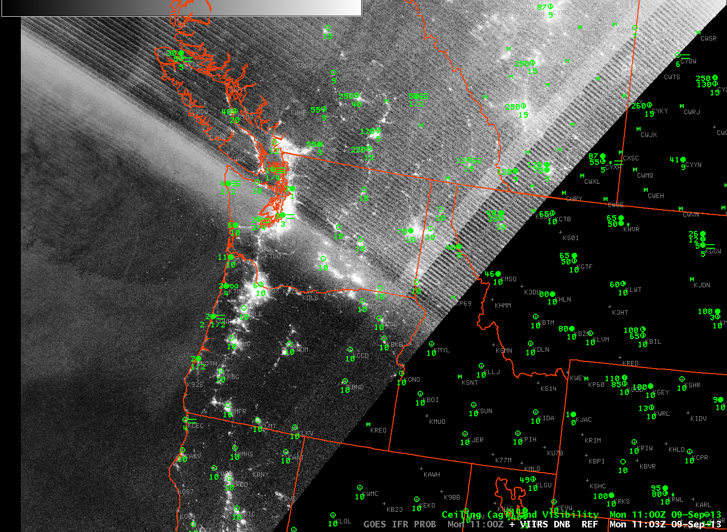
GOES-R IFR Probability Fields, every 15 minutes, from 0500 UTC through 2200 UTC on 30 November 2014, along with surface reports of ceilings and visibility (Click to enlarge)

The GOES-R IFR Probability field gave useful anticipatory information for this event. The animation above shows a line of high IFR Probability moving southward and westward. Stations within the highest IFR Probability reported freezing fog (e.g. Sidney Nebraska (KSNY) at 0800 UTC, Akron, CO (KAKO) at 1200, 1300 and 1400 UTC and Kit Carson Airport in Burlington CO (KITR) at 1400 UTC). When the region of higher IFR Probability abuts up against Denver International (KDEN), then, at 1600 UTC, the Freezing Fog that occurred should not surprise. This region of enhanced IFR Probability persisted near Denver International through 2200 UTC.

The METARS, listed below, show the onset of the freezing fog (FZFG). Note that times are boldface in black, and fog-related observations are boldfaced in red:

KDEN 301353Z 13005KT 10SM FEW110 BKN220 07/M13 A2981 RMK AO2
SLP068 T00721128 $=
KDEN 301453Z 17007KT 10SM FEW110 SCT220 06/M11 A2984 RMK AO2
SLP082 FG BANK DSNT NW-SE T00561111 51034 $=
KDEN 301539Z 07016KT 1/2SM R35L/P6000FT FZFG FEW001 FEW110
SCT220 M06/M08 A2988 RMK AO2 WSHFT 1505 FG FEW001
T10611078 $=
KDEN 301542Z 07017KT 1/4SM R35L/P6000FT FZFG FEW001 FEW110
SCT220 M06/M07 A2989 RMK AO2 WSHFT 1505 FG FEW001 VIS W
1/2 T10611072 $=
KDEN 301553Z 07019KT 1/4SM R35L/2200VP6000FT FZFG VV002
M06/M07 A2991 RMK AO2 WSHFT 1505 PRESRR SLP131 FROPA
I1000 T10611072 $=
KDEN 301630Z 07020KT 1/8SM R35L/1400V2200FT FZFG VV001
M06/M07 A2993=
KDEN 301637Z 08019KT 1/4SM R35L/1400V2400FT FZFG VV001
M06/M07 A2994 RMK AO2 PK WND 07026/1633 TWR VIS 1/4
I1004 T10611072 $=
KDEN 301651Z 08021G28KT 1/4SM R35L/1000V1600FT FZFG VV002
M07/M07 A2995 RMK AO2 PK WND 07028/1643 I1004 $=
KDEN 301653Z 08023KT 1/4SM R35L/1000V1400FT FZFG VV002
M07/M07 A2996 RMK AO2 PK WND 07028/1643 SLP145 I1004
T10671072 $=

(Click here to see a more English Language Listing; Click here to see a meteorogram)

GOES_BTD_30Nov2014_anim

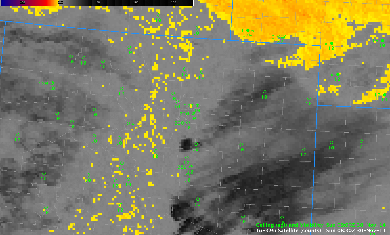
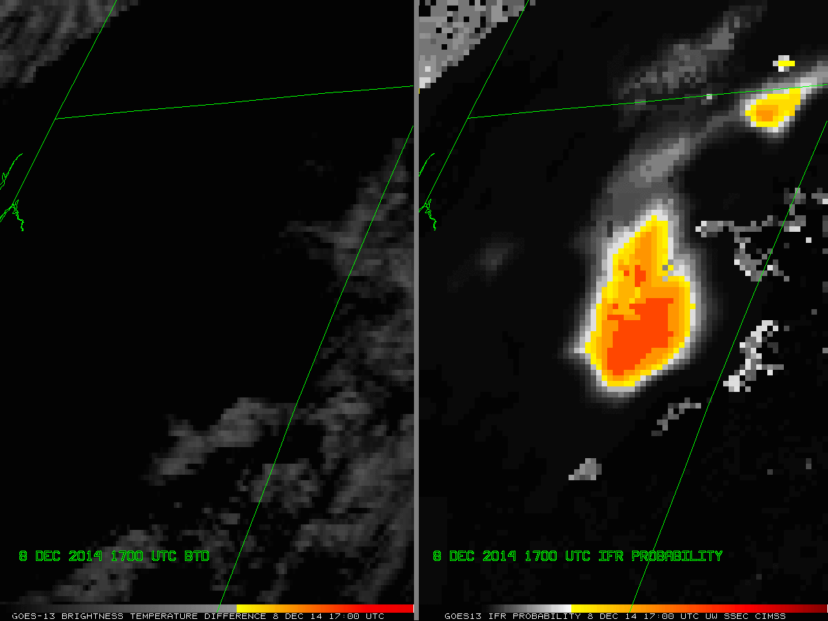
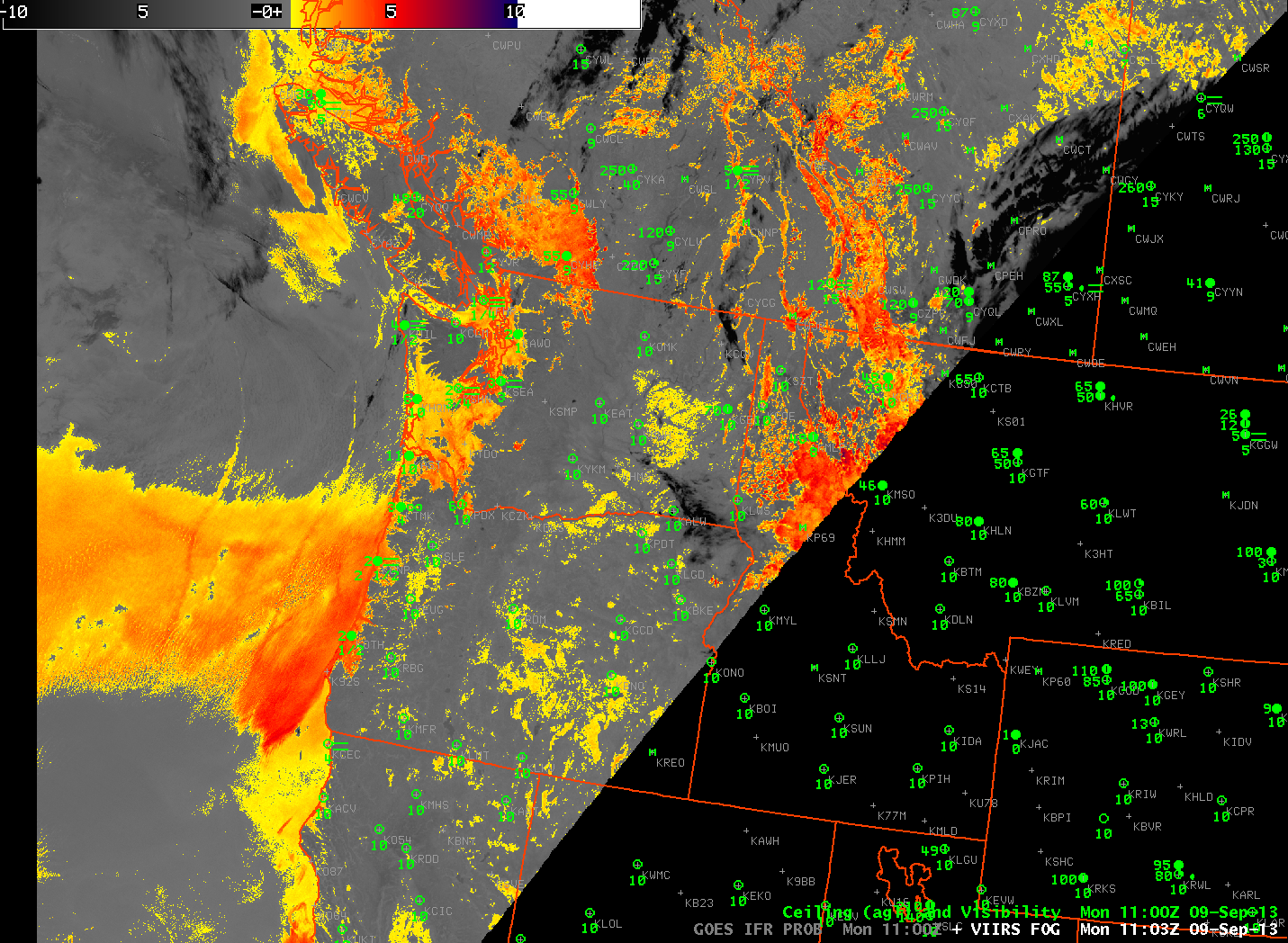
GOES-13 Brightness Temperature Difference fields (10.7µm – 3.9µm) from 0800 through 1600 UTC on 30 November 2014 (Click to enlarge)

For comparison, the Brightness Temperature Difference Field is shown above. Terrain-induced cirrus clouds largely obscured the view of low clouds from satellite in this case. Thus, the incorporation of surface information via the Rapid Refresh model was key to producing an IFR Probability field with useful content.

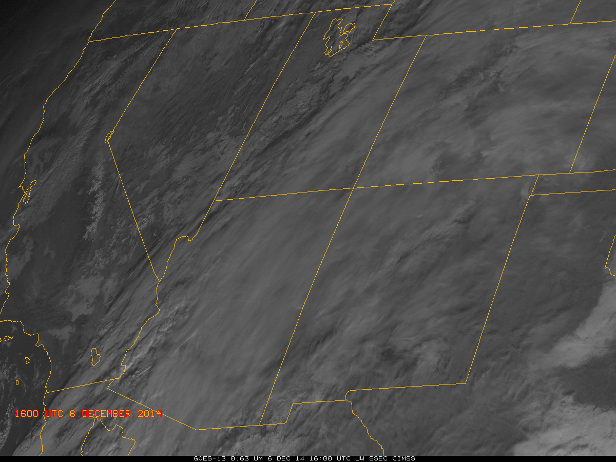
Visible Imagery from GOES-13 (below) and GOES-15 (bottom) show the cirrus and the underlying low clouds. The steady southward advancement of the low clouds is consistent with the motion of the IFR Probability fields.

GOES13_DENVER_ICE_30Nov2014anim

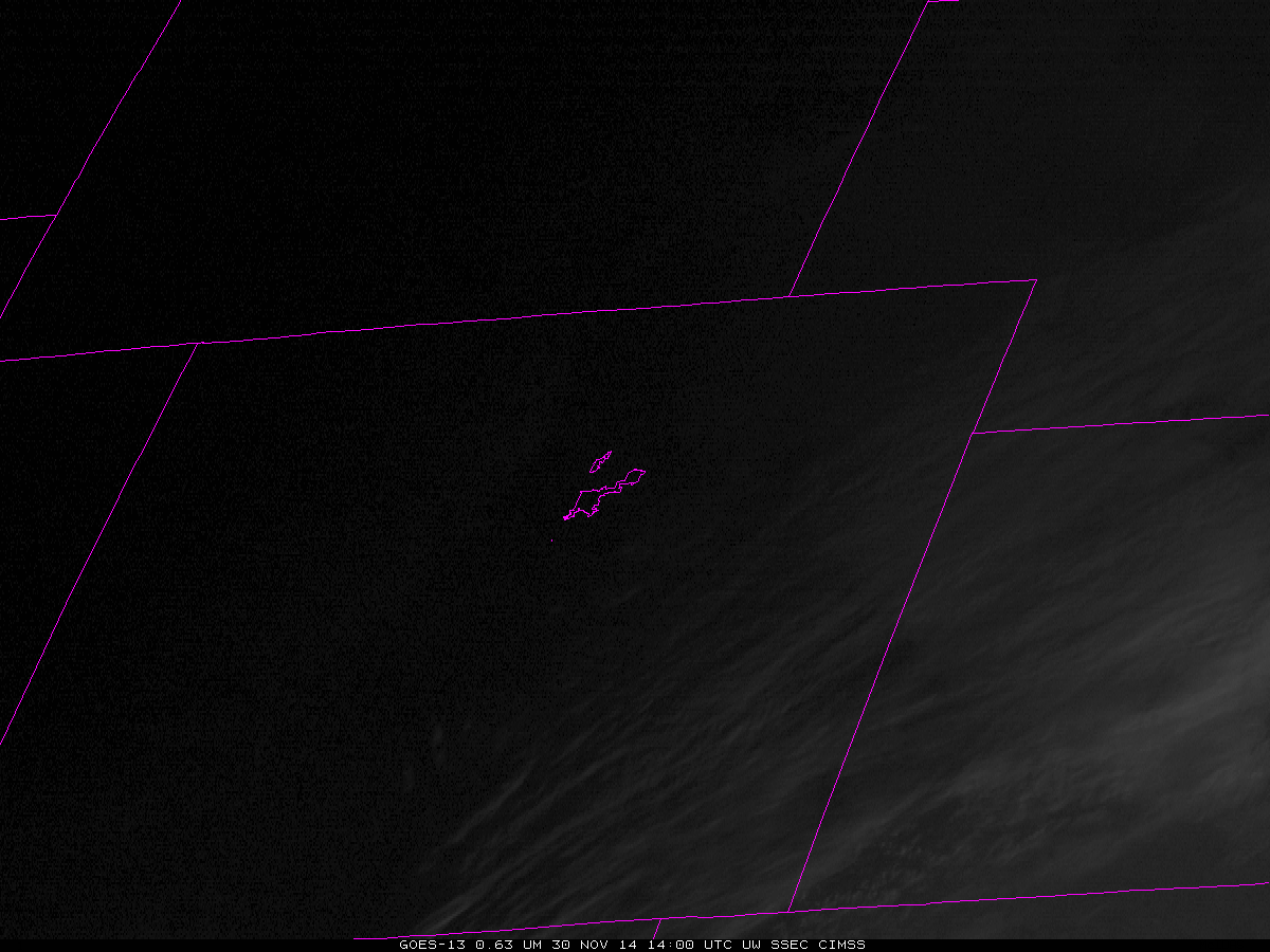
GOES-13 Visible Imagery (0.63µm) animation, 1400-1800 UTC on 30 November 2014 (Click to enlarge)

GOES15_DENVER_ICE_30Nov2014anim

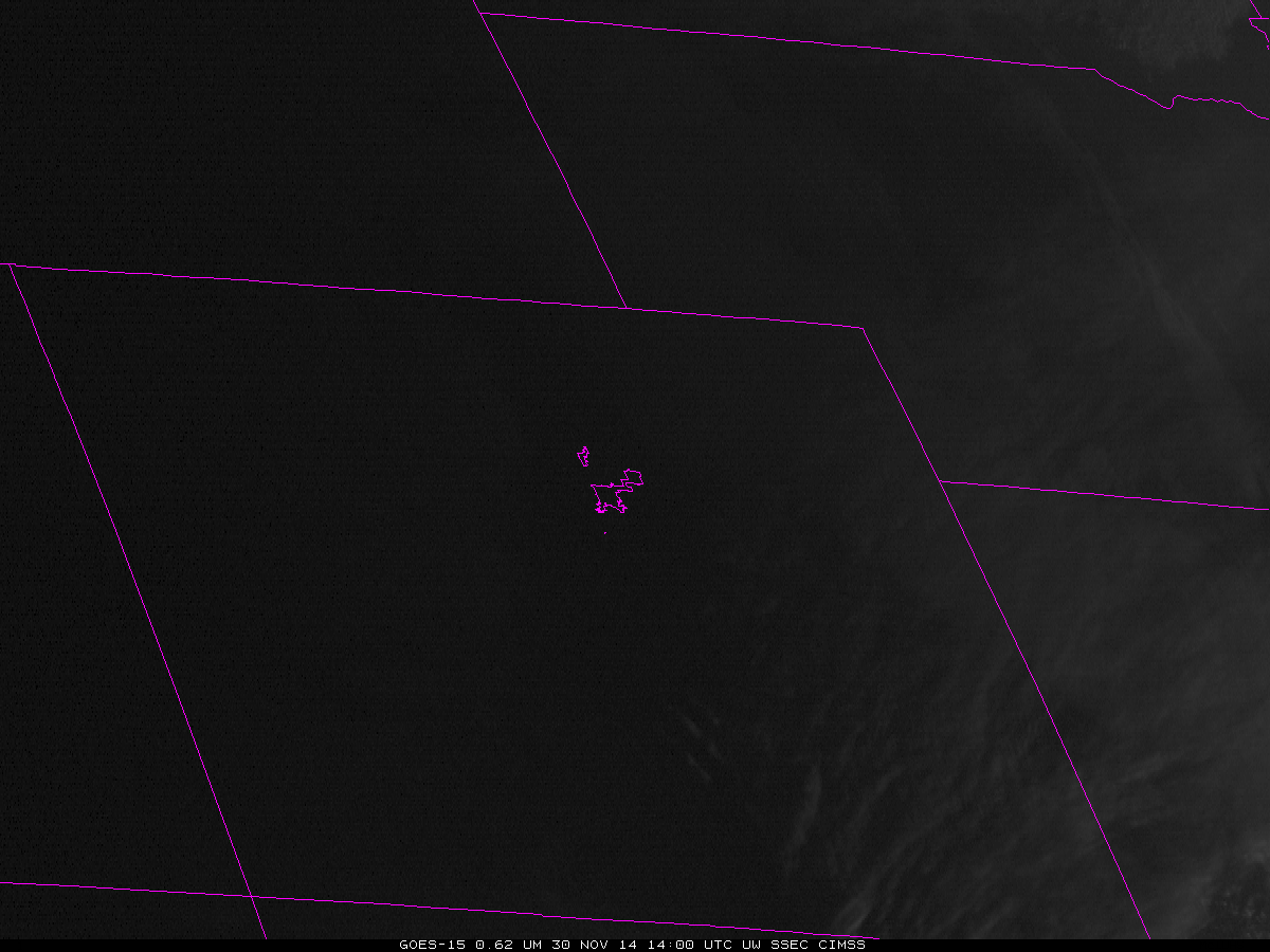
GOES-15 Visible Imagery (0.62µm) animation, 1400-1800 UTC on 30 November 2014 (Click to enlarge)

IFR Probabilities over the Texas Panhandle

GOES_MODIS_IFR_SNPP_BTD-DNB_0930UTC_02Sep2014

GOES-R IFR Probabilities (Upper Right), GOES-13 Brightness Temperature Difference (10.7 µm – 3.9 µm) (Upper Left), MODIS IFR Probabilities (Lower Left), Suomi NPP Brightness Temperature Difference (11.35 µm – 3.74 µm) and Day Night Band (Lower Right), all near 0930 UTC 2 September 2014 (Click to enlarge)

GOES-R IFR Probabilities (from GOES and from MODIS) over the Great Plains and southern Rockies indicated one region where IFR conditions were most likely: over the Texas panhandle, where IFR conditions were reported. There is a strong signal in the GOES-based Brightness Temperature Difference field there (and in the Suomi NPP Brightness Temperature Difference field) as well. There is also a Brightness Temperature difference signal in regions where IFR conditions are not occurring; in those locations, stratus is present, or (over the Rockies) emissivity differences in the dry soil are present, both of which conditions will lead to a signal in the brightness temperature difference that is unrelated to surface visibility and ceilings. This is therefore another example showing how incorporation of model data that accurately describes saturation (or near-saturation) in the lowest model layers can help the GOES-R IFR Probability more accurately depict where IFR conditions are present.

Brightness Temperature Differences over the Rockies

GOESVIIRS_20130919_0930

The heritage brightness temperature difference method of detecting fog/low stratus works because clouds that are comprised of liquid water droplets have different emissivity properties at 3.9 µm and at 10.7 µm. Clouds are not black-body emitters at 3.9 µm; they are more closely blackbody emitters at 10.7 µm. Consequently, the 3.9 µm radiance detected by the satellite suggests a cooler emitting blackbody temperature than the 10.7 µm radiance detected by the satellite. The difference between those two temperatures therefore highlights water-based clouds.

Some soils over the western US also have emissivity properties that are a function of wavelength such that the brightness temperature difference product will show a maximum in some regions but not in others. A careless interpretation of the brightness temperature difference signal, then, might lead to an erroneous assumption that fog/low clouds are present in a region of clear skies. The loop above shows the brightness temperature difference field at 0930 UTC on 19 September, and there are many regions with a signal that is consistent with fog/low clouds. The GOES-R IFR Probability algorithm correctly screens out many of these regions because the Rapid Refresh data does not predict low-level saturation. The day-night band image from Suomi/NPP can be used to verify where low clouds are present, and the image shows that most of the western US was clear. The IFR Probability field has false positives in 4 locations: extreme northeastern Arizona, Northwestern Mexico just to the east of the Colorado River, and two patches in the Pacific, one west of northern California, and one west of southern California.

Brightness Temperature Difference signals sometimes show positives over the central and eastern US in cases of extreme drought, as shown here.

Fog/Low Clouds over the Northwestern US

GOESBTD_IFR_20130909_1100

Brightness Temperature Difference from GOES-W and GOES-R IFR Probability computed from GOES-West and Rapid Refresh data, both images at 1100 UTC 9 September (click image to enlarge)

Fog and low clouds off the coast of Washington and in Montana are instructive in describing some strengths of the GOES-R IFR Probability algorithm. A general statement is that the IFR Probability improves — sometimes greatly — the approximation of where fog and low clouds are present. In the example above, the brightness temperature difference shows a positive signal — suggestive of low clouds — along the Washington and Oregon coasts (where IFR conditions are reported within the marine layer of stratus/fog). The brightness temperature difference also has a strong signal over Montana; there is a scattershot signal as well over Nevada, Idaho and western Oregon/Washington. These are regions where the GOES-R IFR Probability field is correctly minimizing the probability of fog/low clouds. Over Montana, the Brightness Temperature Difference signal is driven by an elevated stratus deck. The positive signal in arid Nevada, Idaho, Oregon and Washington arises from soil emissivity variability. The IFR Probability field maintains a strong signal where IFR conditions are reported, and reduces the strong signal in regions where fog/low stratus likely do not exist.

BTD_GOES_VIIRS_20130909_1100

Brightness Temperature Difference from GOES-W and and from Suomi/NPP, both images at ~1100 UTC 9 September (click image to enlarge)

Suomi/NPP was passing over the Pacific NW at 1100 UTC, the times of the imagery above, and it provided a higher-resolution look. Suomi/NPP data allows for better definition of the — apparently — thickest stratus/fog layer right along the Washington and Oregon coast. The superior resolution also allows for a better approximate of the dendritic nature of river valley clouds, as demonstrated over southern British Columbia. However, the brightness temperature difference here is also unable to distinguish between fog on the ground and stratus that at mid levels.

PacNW_FOG_20130909_1100

Brightness Temperature Difference from GOES-W, Day/Night Band, Brightness Temperature Difference from Suomi/NPP, Day/Night Band, GOES-based GOES-R IFR Probabilities, all at ~1100 UTC 9 September (click image to enlarge)

The animation above loops through the GOES-Based Brightness temperature difference, the Suomi-NPP Brightness temperature difference, the Suomi-NPP Day/Night band, and the GOES-R IFR Probability field computed with GOES-W and Rapid Refresh data.

GOES-R IFR Probabilities Refine the Area of IFR Conditions over New Mexico

GOES-R IFR Probabilities from GOES-West (Upper Left), GOES-R IFR Probabilities from GOES-East (Lower Left), GOES-East Brightness Temperature Difference (10.7 µm – 3.9 µm) (Upper Right), GOES-R Cloud Thickness of Highest Liquid Layer computed from GOES-West (Lower Right), all from 1100 UTC on 15 February 2015

Because GOES-R IFR Probabilities include information about the near-surface atmosphere in the Rapid Refresh Model (and therefore, through assimilation into that model of surface data, the actual atmosphere), IFR probabilities do a better job of distinguishing elevated stratus from fog/low stratus.  In the image above from 1100 UTC on 15 February, the GOES brightness temperature difference product, the traditional method of alerting forecasters to the possibility of fog, shows a signal over the high plains of eastern New Mexico in regions where observations show high ceilings. The GOES-R Fog/Low Stratus product computed from either GOES-West data (top left) or GOES-East data (bottom left) correctly restricts the possibilities of IFR conditions to regions between the Sangre de Cristo mountains in the north to the Sacramento mountains in the south.

Know your Terrain!

GOES-R IFR Probabilities (Upper left), GOES Brightness Temperature Difference (10.7 – 3.9 ) (Upper Right), color-enhanced Topography (Lower Left), Window Channel Infrared (10.7 ) (Lower Right).  Imagery from 0715, 1015 and 1415 UTC 18 December 2012.

Interpretation of the GOES-R IFR probability must include a consideration of terrain height, because a cloud bank that exists over a valley as elevated stratus can quickly become fog or low stratus as the ground rises into the fog on the sides of the valleys.  This happens with some frequency over the Sierra Nevada next to California’s San Joaquin valley, but it is also apparent in the images above over the higher terrain of central Idaho near the Snake River Valley.  A strong IFR Probability signal develops over central Idaho and also over eastern Idaho/northwest Wyoming where high terrain exists.

Difficulties detecting FLS over arid regions using satellite alone.

GOES-R IFR probabilities (top left) and the traditional 3.9-11 micron brightness temperature difference (top right) from GOES-West on October 2, 2012 at 13:30 UTC. The blue circles are surface observations with the surface visibility (in miles) below. 
The maximum relative humidity in the lowest 1000ft layer above ground level from the Rapid Refresh forecast model valid at 13:15 UTC on October 2, 2012.
The traditional 3.9-11 micron brightness temperature difference (BTD) used to detect liquid stratus clouds exploits the emissivity differences at the 3.9 and 11 micron wavelengths. Liquid water clouds typically emit less at 3.9 microns than at 11 microns and this difference can be used to differentiate them from other types of clouds. This method works well when the liquid stratus clouds are the highest cloud layer and are distinguishable from the background surface characteristics. However, fog/low stratus (FLS) detection over arid regions can be difficult using satellite data alone because the very dry land surface typically has a low surface emissivity at the 3.9 micron wavelength as well, resulting in a satellite signal very similar to that of liquid stratus clouds. This is shown in the top right image above where the arid regions of the SW U.S. have a similar BTD signal as the status clouds offshore California even though all the surface observations in the area indicate no clouds are present. 
The GOES-R IFR product (top left image above) can greatly reduce the false satellite signal caused by the land surface by incorporating model relative humidity (RH) data. For the GOES-R IFR product the satellite data is combined with the maximum RH found in the lowest 1000 ft layer above ground level from the Rapid Refresh RH profiles using a naive bayesian probabilistic model. FLS generally occurs when the low-level RH is relatively high (> 80%). The low level RH in arid regions is usually very low (< 30%), so even when the satellite signal is strong, indicating FLS may be present,  the weak model signal works to lower the probability that FLS is present. 
However, sometimes the low-level RH can be elevated over dry land surfaces when clouds are not present. When this occurs, the relatively high model signal along with the relatively high satellite signal (from the land surface) indicate there is a greater chance that FLS may be present so the GOES-R IFR probabilities are slightly elevated. This is shown in the top left image above where an area of elevated GOES-R IFR probabilities in central California indicate that there is a roughly 40% chance that IFR conditions are present even though the surface stations report clear skies. The low-level modeled RH from the Rapid Refresh model (bottom image above) indicates a sliver of elevated RH (> 80%) in central California. This area of elevated low-level RH combined with the relatively higher satellite signal (from the land surface) resulted in the GOES-R IFR probabilities being slightly elevated. GOES-R IFR probabilities around 40% are considered to be relatively low and, combined with the surrounding surface observations, forecasters should feel pretty confident that this is indeed a false signal and that FLS is not present.

GOES-R IFR probabilities (left) and the traditional 11-3.9 micron brightness temperature difference (right) from MODIS on October 2, 2012 at 9:05 UTC. The blue circles are surface observations with the surface visibility (in miles) below.

The higher spatial resolution (1 km) MODIS instrument shows in more detail the elevated traditional BTD satellite signal caused by the arid land surface (right image) over the SW U.S. The GOES-R IFR probabilities applied to MODIS (left image) again show how the GOES-R IFR product significantly reduces the false FLS signal that is seen in the traditional BTD product.

How to validate GOES-R IFR in regions with no surface observations

Animation of GOES-W IFR Probabilities over Arizona, half-hourly from 0430 UTC to 0800 UTC 31 July 2012

The animation of GOES-R IFR Probabilities over north-central Arizona shows the development of relatively high probabilities as the night progresses, an evolution that is consistent with the formation of radiation fog.  However, there are no surface observations routinely taken in the region to verify the presence of IFR conditions, or even clouds.  How much credence should be given to such a field?

GOES-R IFR Probabilities from GOES-West (upper left), Suomi-NPP Day/Night band imagery (upper right), Surface observations (lower left), GOES-West color-enhanced window channel (lower right), times as indicated.

A serendipitous Suomi-NPP overpass shows a region of clouds neatly outlined by the GOES-W IFR probabilities. Although the Day/Night band cannot give ceiling heights or visibilities (that is, it cannot alone determine if IFR conditions are occurring), it does show the presence of low clouds.

An earlier Suomi/NPP overpass over the eastern United States overflew a second developing region of enhanced IFR probabilities, over the piedmont from North Carolina southwestward into South Carolina (below).  The city lights of the Carolinas make it more difficult to detect cloud edges, although evidence of one does exist between Camden SC (KCDN) and Fairfield CO Airport (KFDW).  This is a also a region where IFR probabilities quickly drop from high values (near KCDN, where there is fog with 100-foot ceilings) to low (near KFDW, which reports clear skies).

GOES-R IFR Probabilities from GOES-East (upper left), Suomi-NPP Day/Night band imagery (upper right), Surface observations (lower left), GOES-West color-enhanced window channel (lower right), times as indicated.