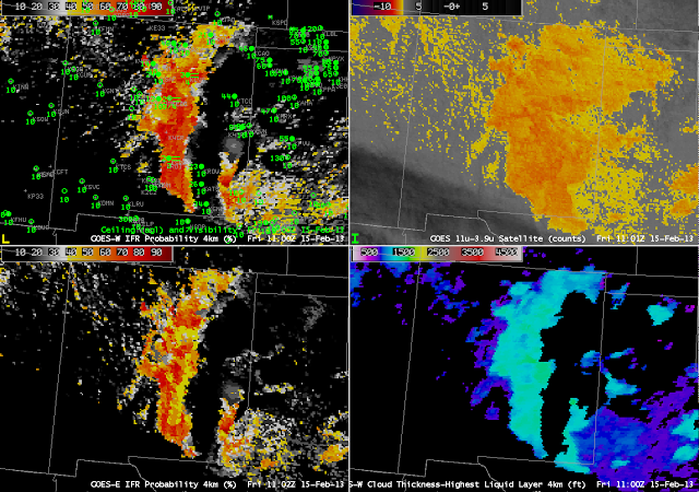
Because GOES-R IFR Probabilities include information about the near-surface atmosphere in the Rapid Refresh Model (and therefore, through assimilation into that model of surface data, the actual atmosphere), IFR probabilities do a better job of distinguishing elevated stratus from fog/low stratus. In the image above from 1100 UTC on 15 February, the GOES brightness temperature difference product, the traditional method of alerting forecasters to the possibility of fog, shows a signal over the high plains of eastern New Mexico in regions where observations show high ceilings. The GOES-R Fog/Low Stratus product computed from either GOES-West data (top left) or GOES-East data (bottom left) correctly restricts the possibilities of IFR conditions to regions between the Sangre de Cristo mountains in the north to the Sacramento mountains in the south.
GOES-R IFR Probabilities Refine the Area of IFR Conditions over New Mexico
Leave a reply

