
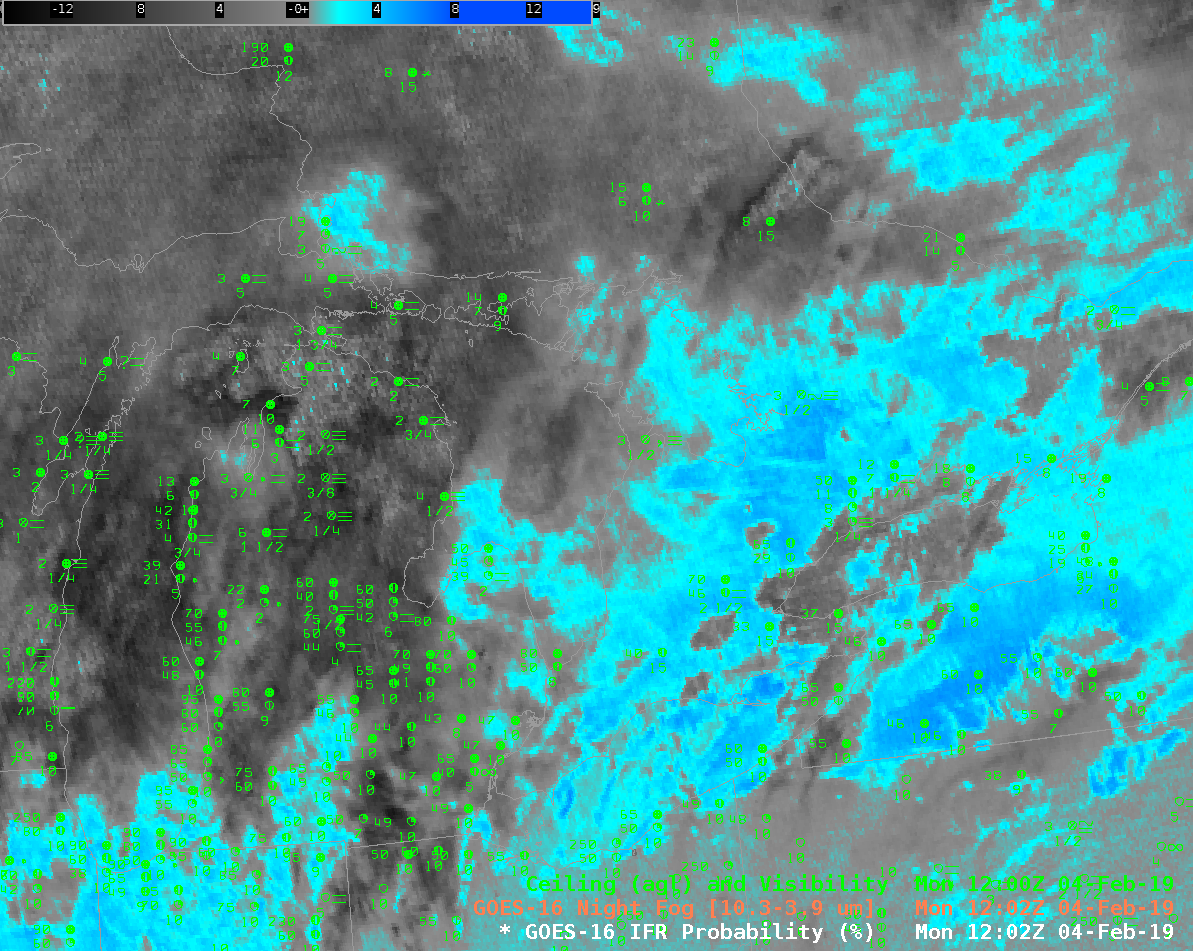
‘Night Fog’ Brightness Temperature Difference field (10.3 μm – 3.9 μm) and GOES-R IFR Probability at 1202 UTC on 4 February 2019 (Click to enlarge)
Advection Fog during thaws, when very cold surfaces are overrun by air with dewpoints above freezing, can be very dense, and very difficult to detect via satellite; typically advection fog accompanies extratropical cyclones and their accompanying multiple cloud layers. The toggle above compares the ‘Night Fog’ Brightness Temperature Difference field (10.3 μm – 3.9 μm), historically used to detect low stratus because of radiation emissivity differences of clouds made up of water droplets at those two wavelengths, and GOES-R IFR Probability which fuses information from the satellite — not particularly useful in this case as far as low-level visibility is concerned — with information about low-level saturation from the Rapid Refresh Model. GOES-R IFR Probability gives a much more accurate depiction of exactly where the reduced visibilities and lowered ceilings are present, a vital piece of information for aviation (for example).
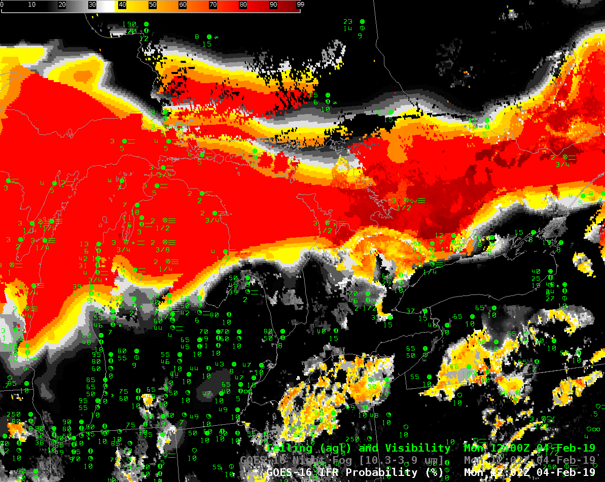
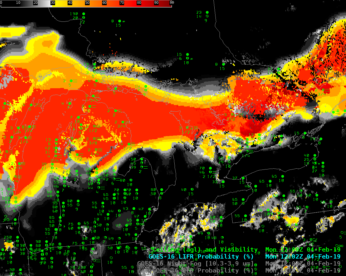
In addition, Low IFR Probability suggests where the lowest ceilings and greatest visibility reductions occur. The toggle below compares IFR Probability and Low IFR Probability at 1202 UTC (Here’s the toggle at 1642 UTC). As expected, the region of Highest Low IFR Probability is contained within the region of highest IFR probability; values of Low IFR Probability are somewhat smaller than those for IFR Probability (the same colorscale is used for both products).

GOES-R IFR Probability and Low IFR Probability at 1202 UTC on 4 February 2019 (Click to enlarge)