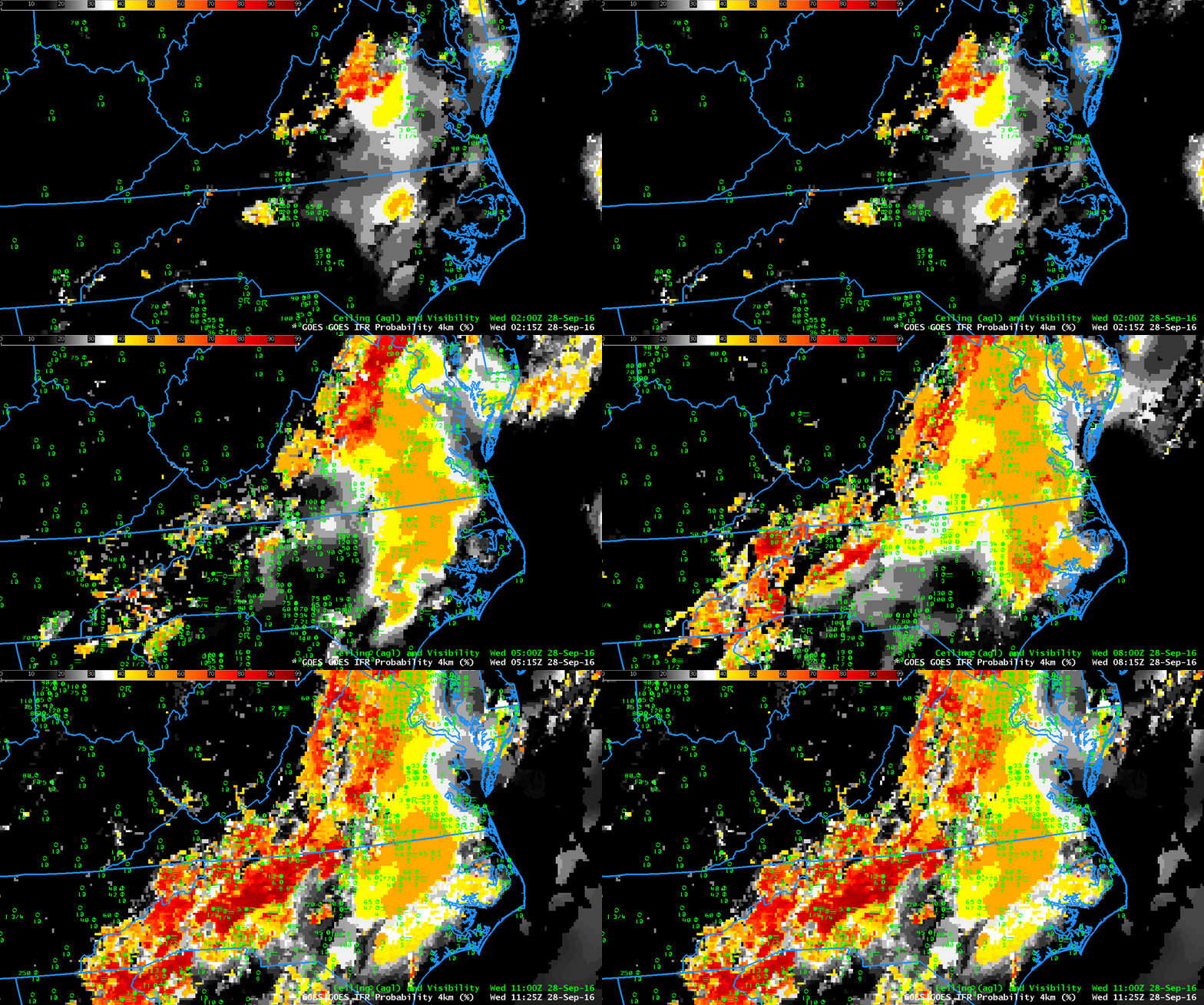
GOES-R IFR Probability fields, hourly from 0215 UTC through 1115 UTC on 28 September 2016 (Click to enlarge)
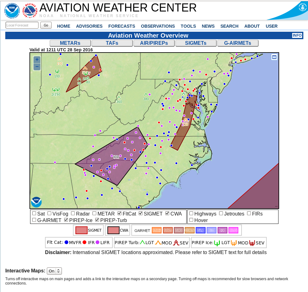
IFR and Low IFR Conditions developed over parts of Virginia and the Carolinas Piedmont Region during the morning of 28 September 2016. The screengrab below, from the Aviation Weather Center, shows the areal extent of the reduced visibilities and/or low ceilings. (The text of the IFR Sigmet is here.) Fog over southeastern Virginia is developing under multiple cloud decks associated with the convection near a front. IFR Probabiities in this region are determined by Rapid Refresh data that shows low-level saturation; the flat-looking field over that region is characteristic of model-only IFR Probability fields. Farther to the southwest, over western North Carolina, IFR Probabilities are determined by both satellite and model data; notice how pixelated the data are in that region.
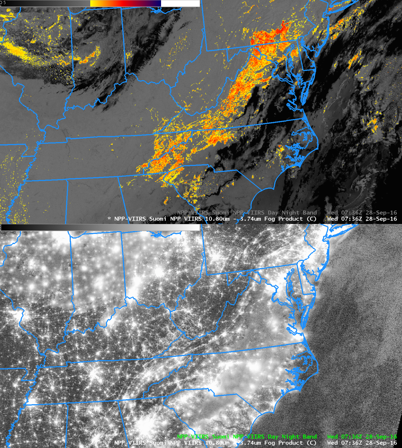
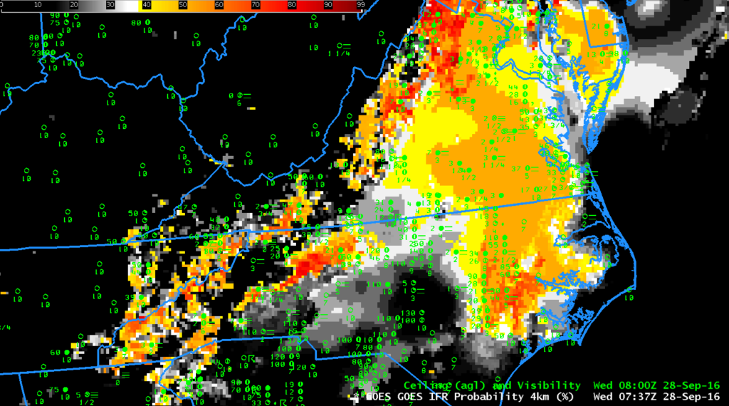
Suomi NPP overflew the eastern United States shortly after 0730 UTC, and the toggle below shows the Day Night Visible Band and the Brightness Temperature Difference field (11.45 – 3.74 ). Water-based clouds (yellow and orange in the enhancement used) are detected just to the west of cirrus and mixed-phase clouds (black in the enhancement used). The 0737 UTC IFR Probability field, at bottom, had model-data only as predictors in regions where Suomi NPP shows multiple cloud layers. Note also that the 1-km resolution of Suomi NPP is resolving the developing valley fogs in the Appalachian mountains of Ohio, West Virginia and Kentucky. There are only a few pixels in the IFR Probability field that are suggesting valley fog development — but note in the end of the animation at the top of this post that more valley pixels show IFR Probability signals. When GOES-R is flying, its superior (to GOES-13) 2-km resolution should mitigate this too-slow identification of valley fogs.


