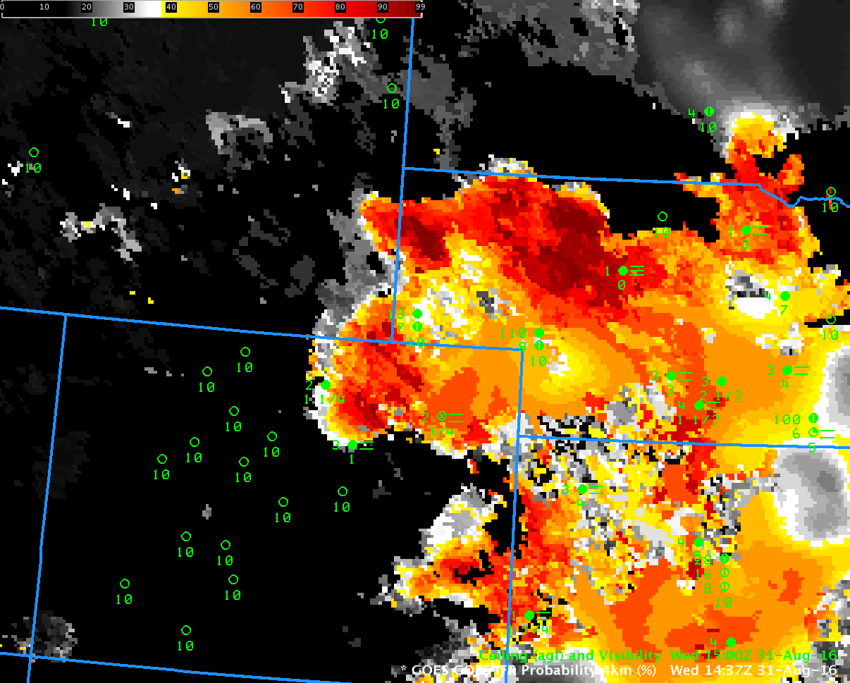
GOES-R IFR Probability Fields, 1437 UTC on 31 August 2016, with surface observations of ceilings and visibilities (Click to enlarge)
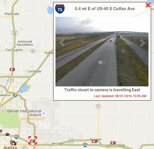
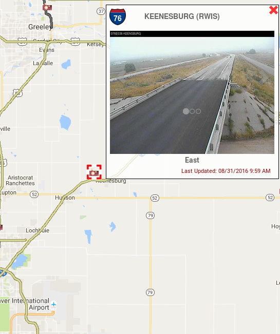
GOES-R IFR Probability Fields over Colorado and Nebraska on the morning of 31 August 2016 show high IFR Probabilities in close proximity to Denver International Airport (DIA), which airport was reporting IFR conditions starting at 1237 UTC. Webcams to the southwest and northeast of the airport shortly after 1500 UTC confirm that the IFR conditions’ edge was very near the airport.
The hourly animation of GOES-R IFR Probability fields, below, shows the evolution of the field. Its motion could be used in a prognostic manner.
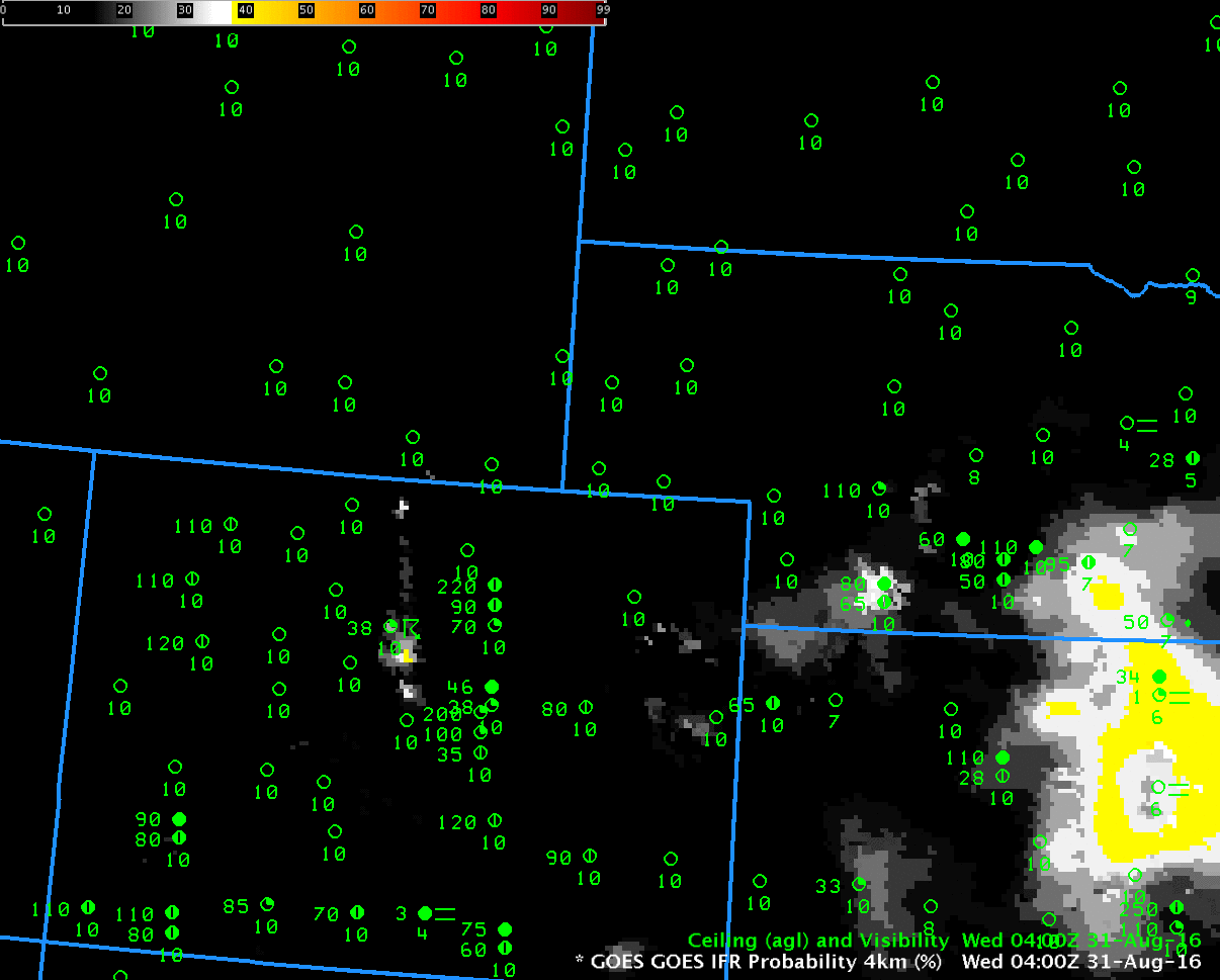
GOES-R IFR Probability fields, ~hourly from 0400 through 1400 UTC on 31 August 2016 (Click to enlarge). Surface observations of ceilings and visibility are also plotted.
A similar event occurred on 22 September, see below from Mike Eckert and Amanda Terborg.