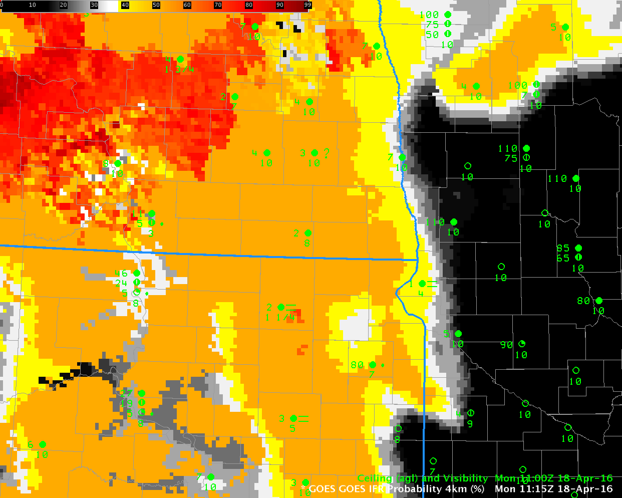
GOES-R IFR Probabilities at 1115 UTC and 1100 UTC surface observations of ceiling and visibility (Click to enlarge)
The image above shows GOES-R IFR Probabilities over North/South Dakota and Minnesota shortly before sunrise on Monday April 18 2016. There is a distinct difference in the field between western Minnesota and eastern North and South Dakota that occurs because Rapid Refresh model fields (low-level saturation) are used as a predictor of IFR Probability. Reduced visibilities and ceilings are reported where IFR Probabilities exceed 50% (the orange shading). In contrast, the window channel and water vapor imagery for the same time, below, gives little indication that fog and low ceilings are present over eastern North and South Dakota: satellite views of the lowest levels are blocked by mid- and upper-level clouds. Fusing model data and satellite data into one predictor yields a superior product for detection of low ceilings and reduced visibilities.
GOES Infrared imagery (10.7 µm and 6.5 µm) and GOES-R IFR Probability fields, 1115 UTC on 18 April (Click to enlarge)