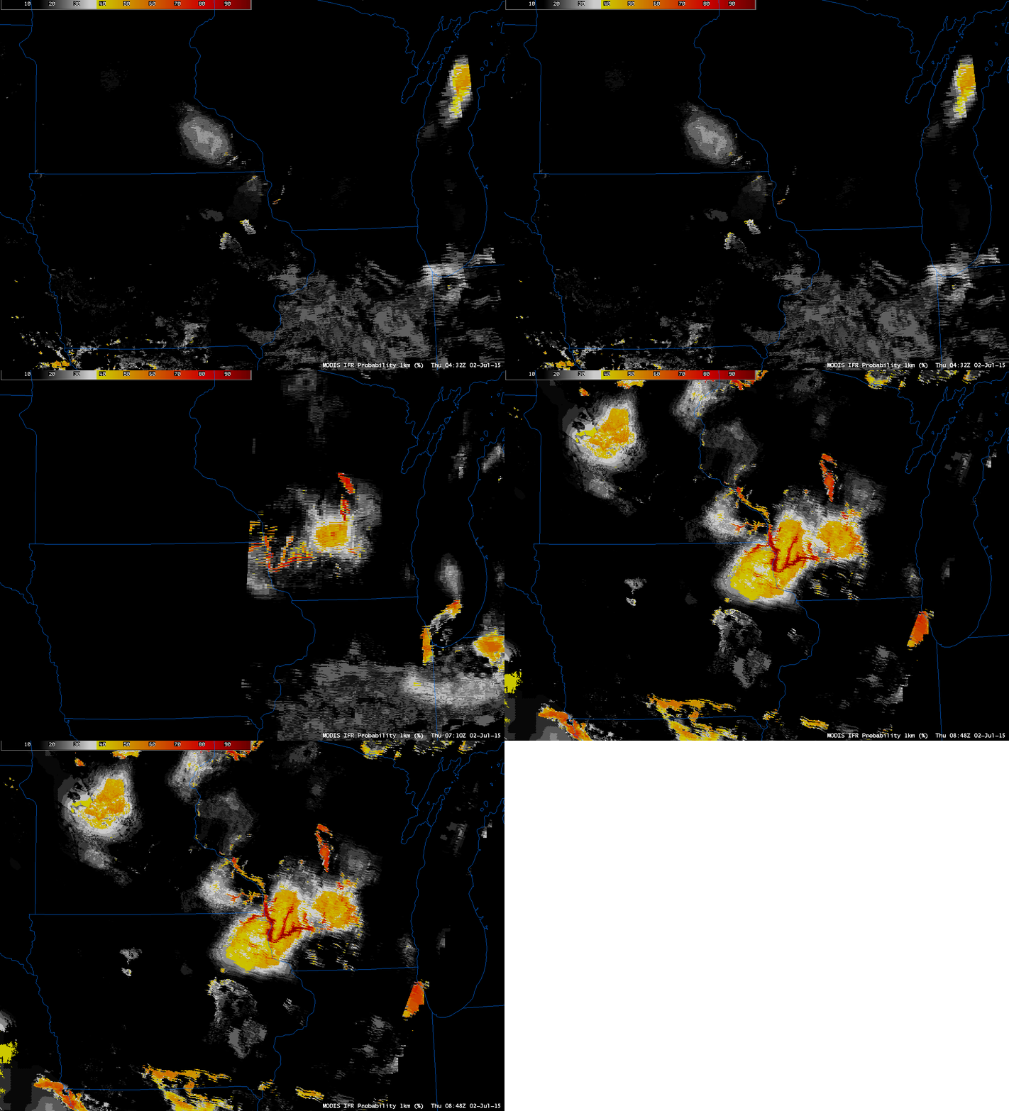
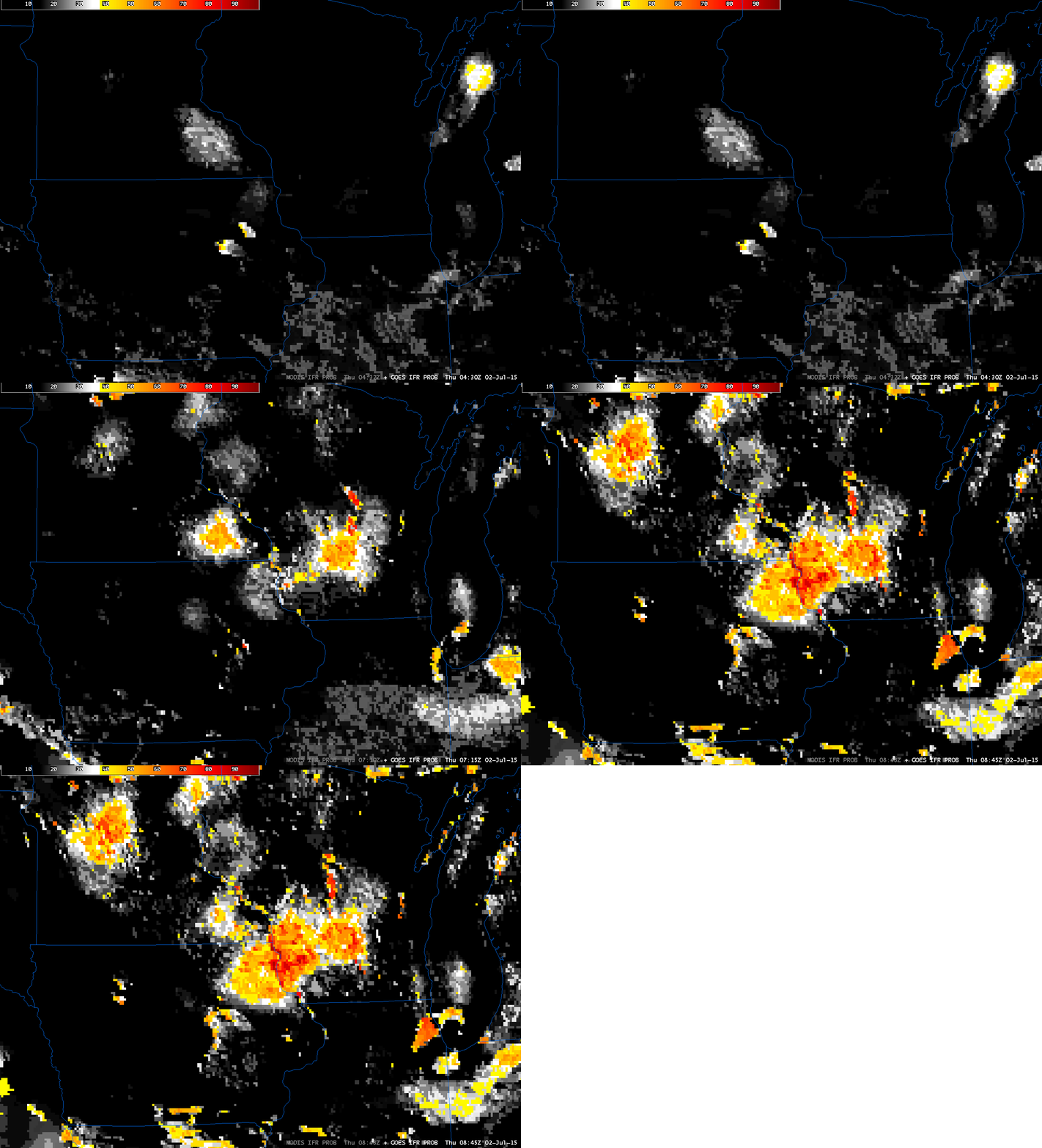
The CIMSS Satellite Blog shows a case on July 2nd 2015 of Day Night Band detection of river valley fog over the upper midwest. River Valley fog is a challenge for GOES detection because of the large pixel footprint. So how did it do in this case, and how does that compare to MODIS-based detection? The animation below shows the three MODIS scenes during fog development that occurred. MODIS-based IFR Probability at 0432 UTC (from Terra) hints at the development of fog over the Wisconsin and Kickapoo Rivers over southwestern WI. GOES-based IFR Probability from 0430 UTC (shown below the MODIS data) shows no signal there. GOES-based IFR Probabilities do appear at 0715 UTC, however. The MODIS-based signal has given any forecaster an early alert to the development of fog over the River valleys. (Toggles between GOES and MODIS-based IFR Probabilities are available for 0430 UTC, 0715 UTC and 0845 UTC). Note that both 0710 and 0848 UTC MODIS-based fields (from Aqua) have a geometry such that the Mississippi River valley is near the edge, and artifacts related to the so-called bow-tie effect are present as repeated features in the field. Nevertheless, the MODIS-based field correctly limits the fog to the River Valleys and shows very high IFR Probabilities; GOES-based pixels fail to resolve narrow river valleys.
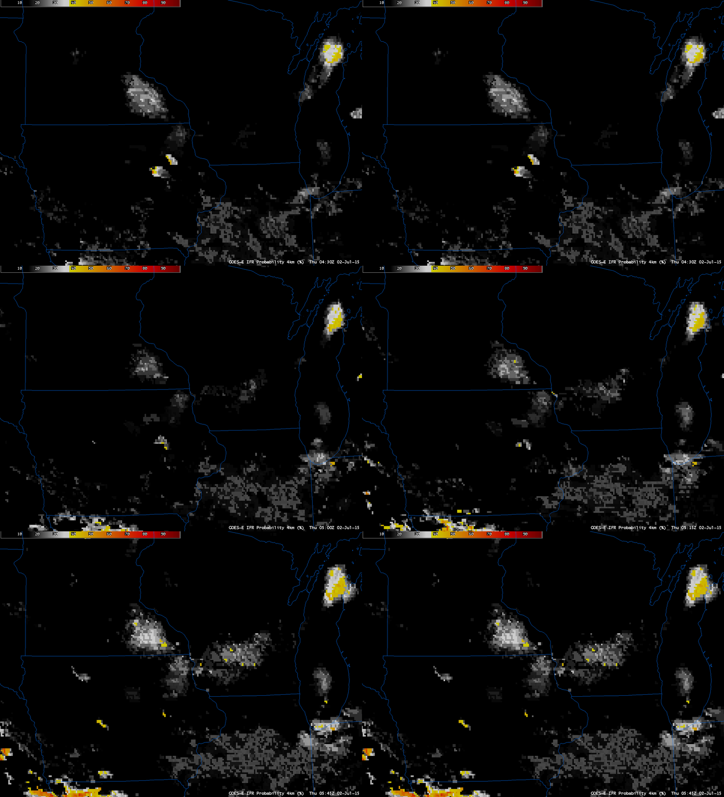
An animation of GOES-based IFR Probabilities, below, suggests that GOES data identified the likelihood of IFR conditions starting around 0515 UTC, almost 45 minutes after the higher-resolution MODIS pass at 0432 UTC.


