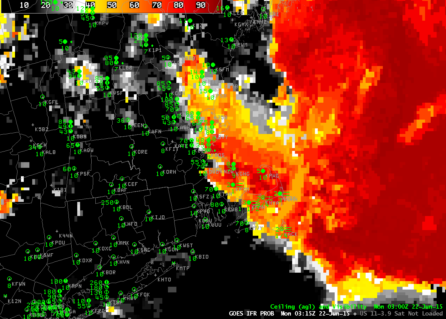
GOES-R IFR Probability, 0315 through 1215 UTC on 22 June 2015 (Click to enlarge)
Sea fog penetrated inland over eastern New England overnight. How did GOES-R IFR Probabilities depict the event, and how did those fields compare to the traditional fog-detection method, brightness temperature differences between the 10.7 µm and 3.9 µm channels? The animation above shows the IFR Probabilities, and they neatly outline the regions of low ceilings and reduced visibilities.
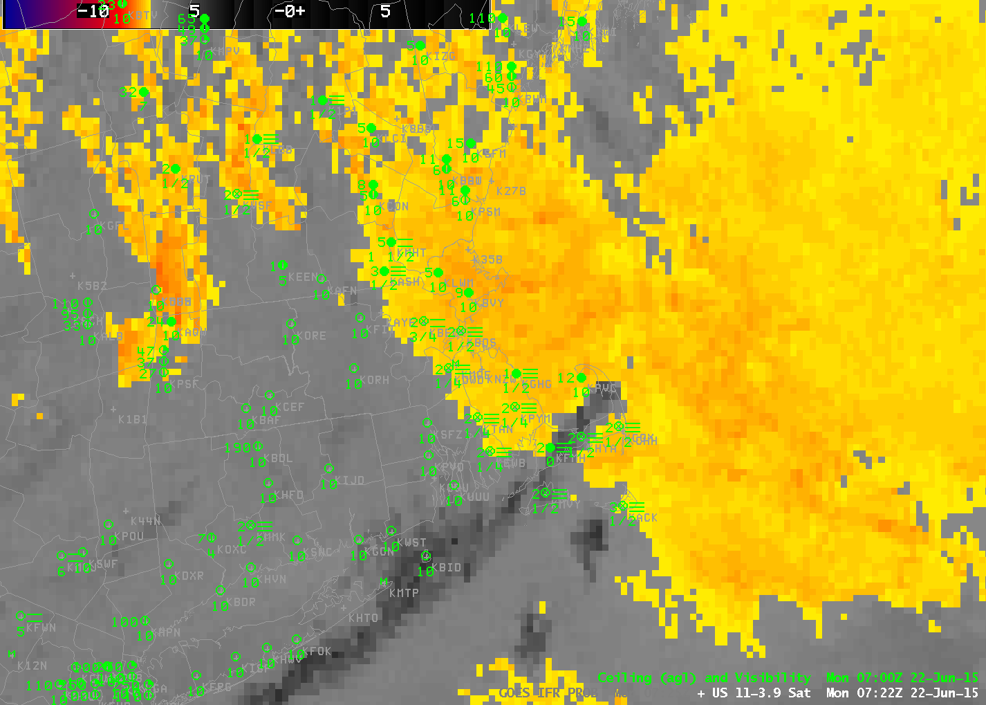
In contrast, Brightness Temperature Difference fields, shown below, are troubled by two different factors in these loops. Around 0700-0800 UTC, thin cirrus over southern Cape Cod impedes the satellite view of low clouds (Click here for a toggle between the two fields at 0722 UTC); brightness temperature difference fields yield little information when that happens. (GOES-R IFR Probability values drop when the Satellite component cannot be used; make certain when interpreting the values that you are aware of the presence/absence of high clouds!) In addition, the brightness temperature difference field loses features around sunrise, when solar radiation with a wavelength around 3.9 µm increases. GOES-R IFR Probability fields maintain a coherent signal through sunrise, however.
Careful inspection of the animation above does reveal some stations where IFR Conditions occur and IFR Probabilities are low. For example, Lebanon NH in the Connecticut River Valley reports IFR Conditions intermittently. Small-scale valley fog is a challenge for both GOES detection and for Rapid Refresh detection.
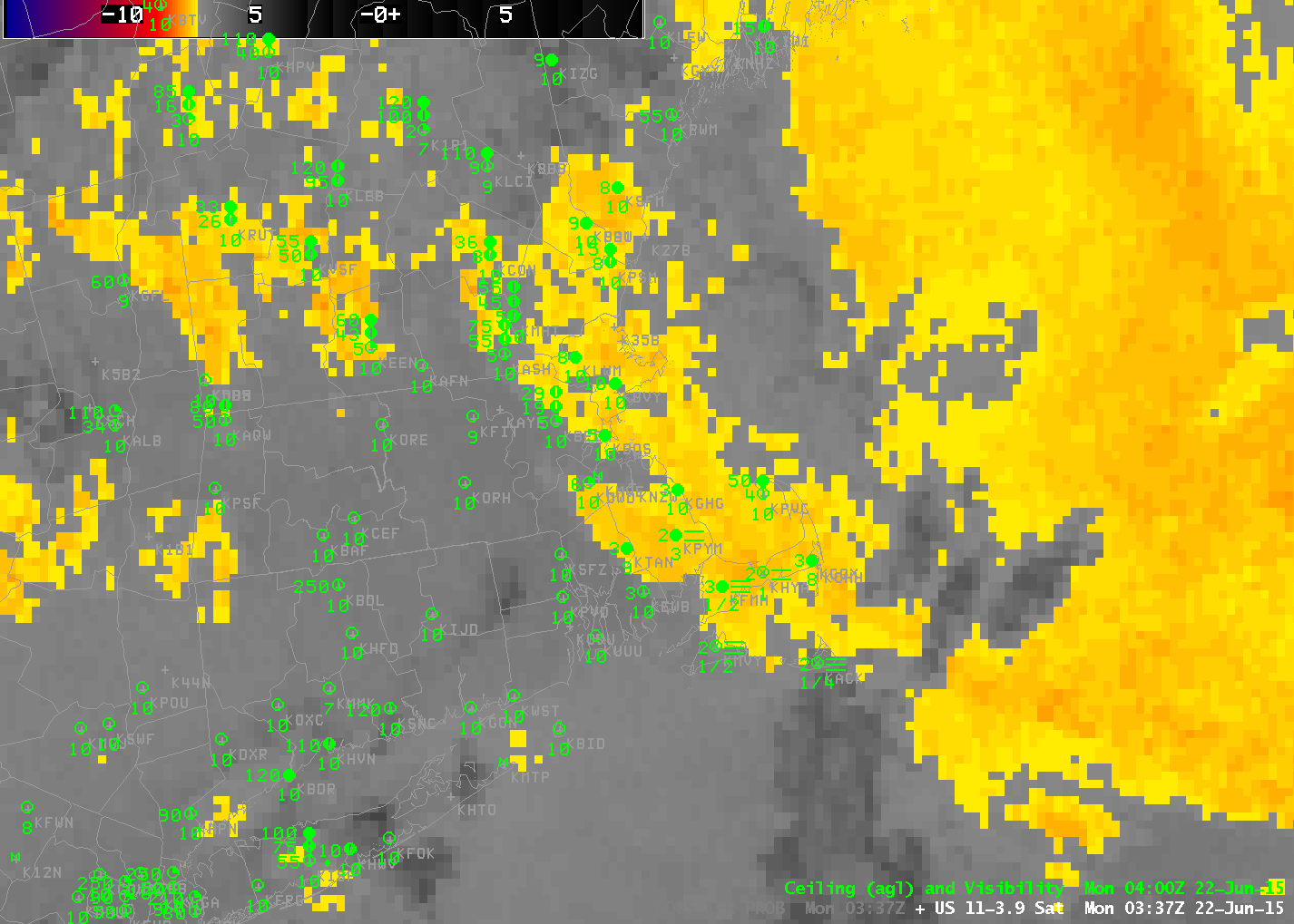
GOES-13 Brightness Temperature Difference Fields (10.7 µm – 3.9 µm), ~0315-1215 UTC on 22 June 2015 (Click to enlarge)