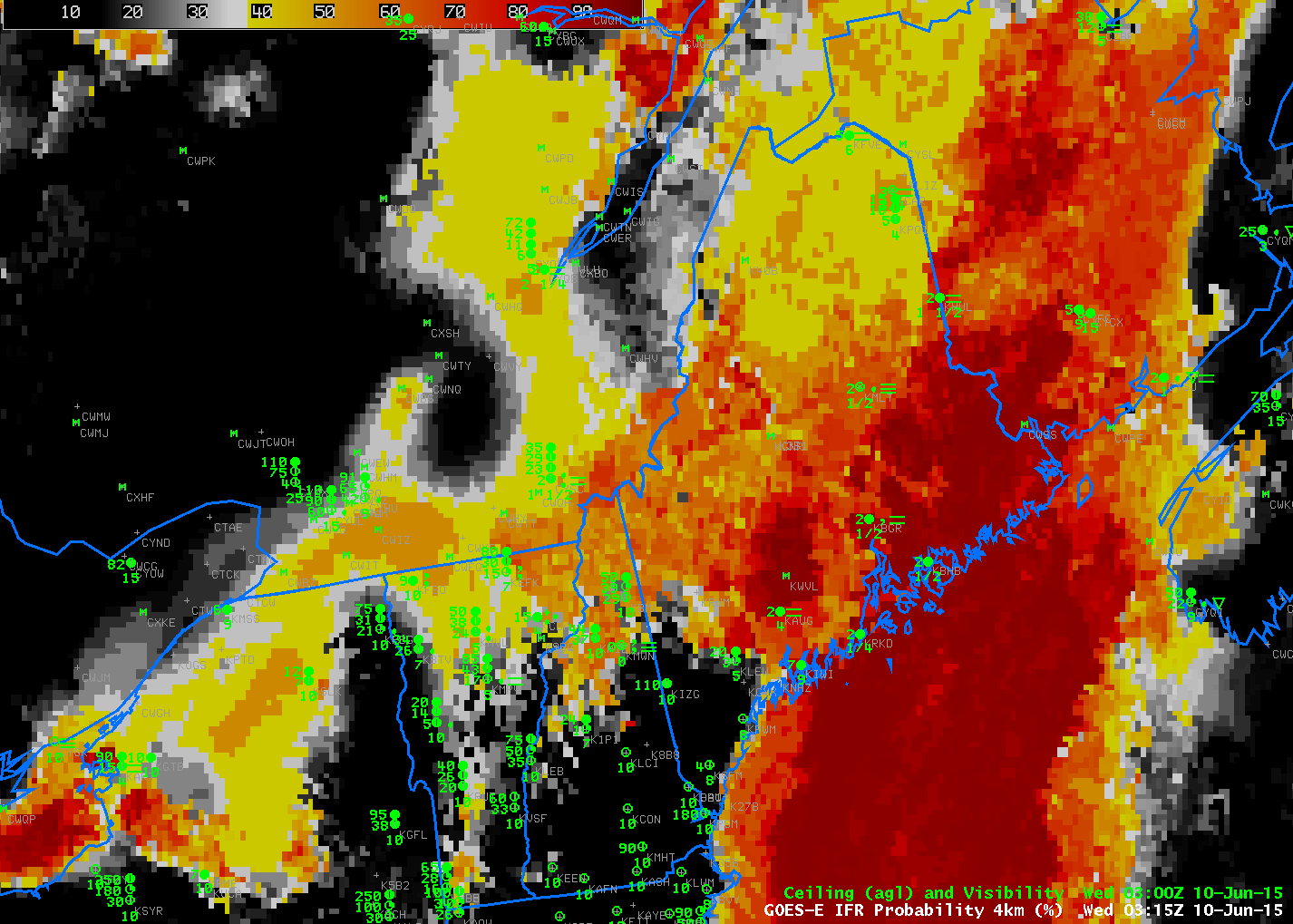
GOES-R IFR Probability Fields, hourly from 0315 to 1215 UTC on 10 June 2015 (Click to enlarge)
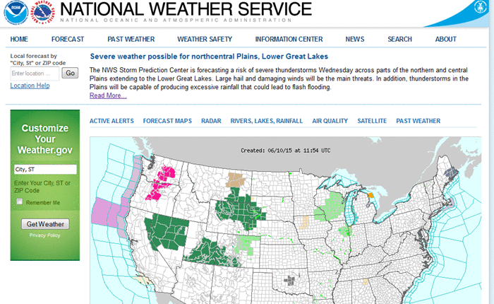
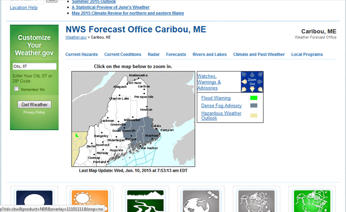
A cold front that moved across Maine early in the morning on 10 June 2015 was accompanied by dense fog. Dense Fog Advisories were hoisted over eastern Maine (screenshot from weather.gov; screenshot from the Caribou ME National Weather Service). The hourly imagery of IFR Probabilities, above, showed high probabilities over eastern Maine (where surface observations are scant). Note how the back edge of the high IFR Probabilities, after the frontal passage, correlates will with the timing of rising ceilings and reduced visibilities. This occurs at Augusta (KAUG), Bangor (KBGR) and Millinocket (KMLT), for example.
The traditional method of detecting fog and low cloud, the brightness temperature difference field that compares values at 10.7 µm and 3.9 µm , had difficulty indicating regions of fog for two reasons on the morning of 10 June. An animation of the product is below. There were high clouds present that interfered with the satellite’s view of low clouds. (IFR Probability can still give a useful signal in this case because of information that comes from the Rapid Refresh Model). In addition, the ever-earlier sunrise in early June supplies enough 3.9 µm radiation at the end of the animation to flip the sign of the brightness temperature difference field and the distinct signal of low water-based clouds is lost.
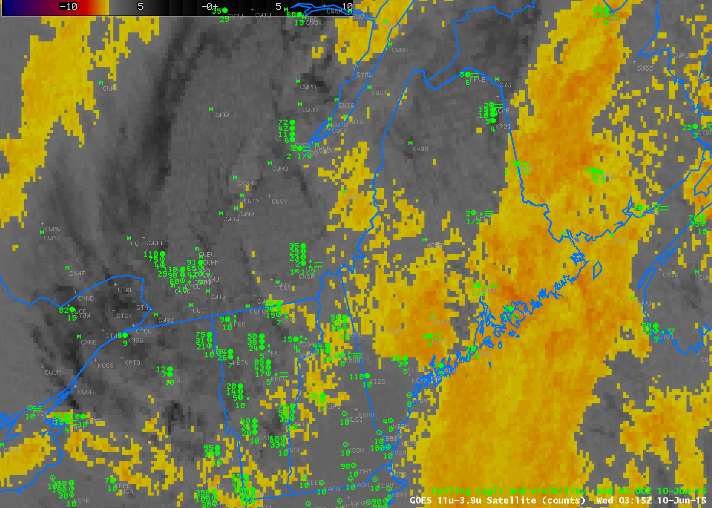
Brightness Temperature Difference Fields (10.7 µm – 3.9 µm), hourly from 0315 through 1215 UTC on 10 June 2015 (Click to enlarge)