Dense Fog Advisories were issued for the northwestern part of the Florida Panhandle overnight (Link). How did various fog-alert satellite products perform for this case?
The brightness temperature difference product, below, that works because clouds comprising water droplets have different emissivity properties at 3.9 µm and 10.7 µm, did not provide much guidance for this event. This is because multiple cloud layers prevented the satellite from seeing down to the developing stratus/fog deck near the surface. The cloud deck persisted over Alabama, but eroded over northwest Florida by 0700 UTC. (Click here for an animation of GOES-Sounder Cloud Heights). In addition, fog persists through sunrise, and the rising sun is emitting 3.9 µm radiation; that makes interpretation of the brightness temperature difference field problematic.
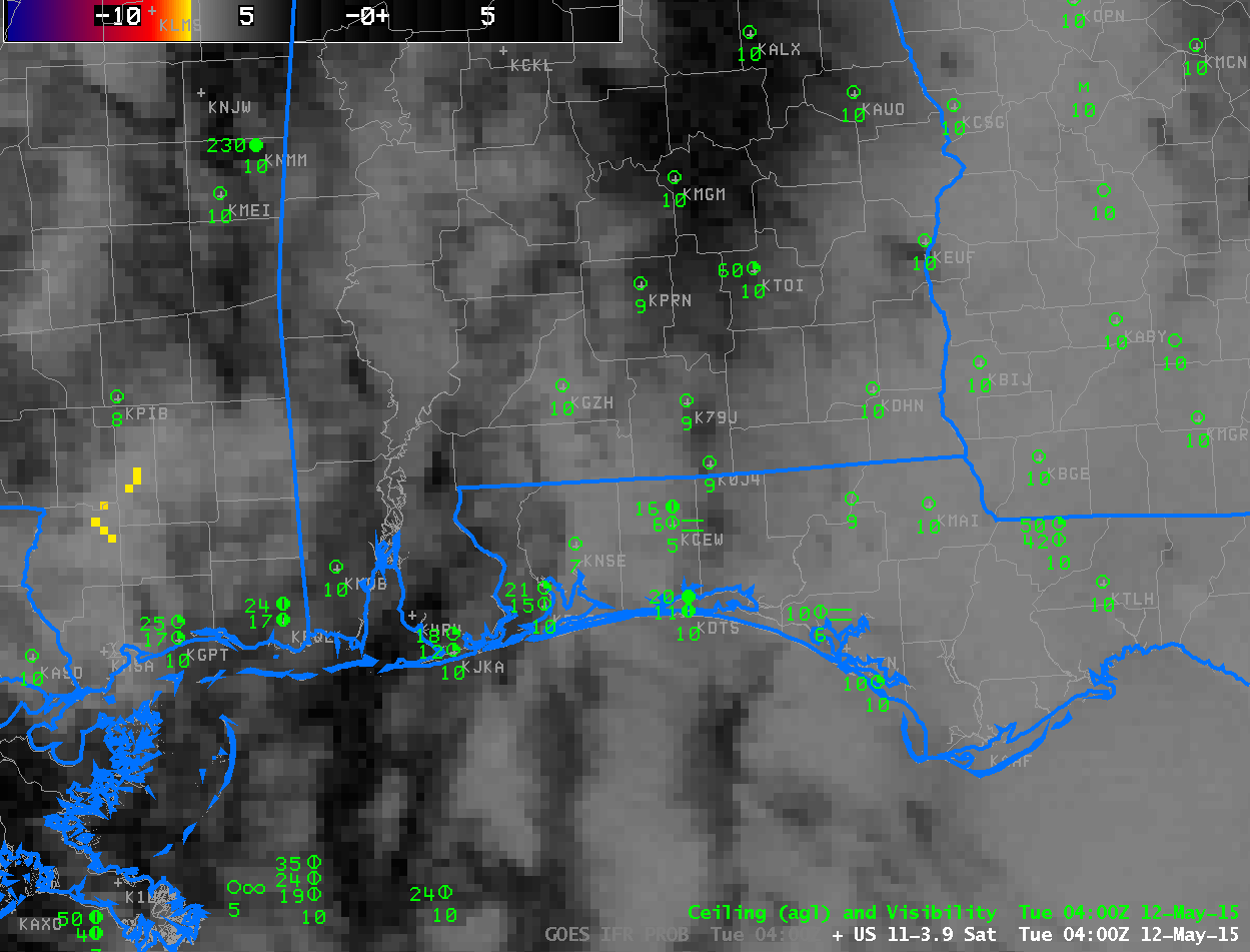
Brightness Temperature Difference Fields (10.7 µm – 3.9 µm) from GOES East, ~hourly from 0400 through 1215 UTC on 12 May 2015 and surface observations of ceilings and visibilities (Click to enlarge)
The GOES-R IFR Probability field, below, provided better information about the developing cloud field. Probabilities increase as the fog develops, and the spatial coverage of the enhanced IFR Probabilities better matches the regions where Dense Fog Advisories were issued. In addition, the strong signal persists through sunrise.
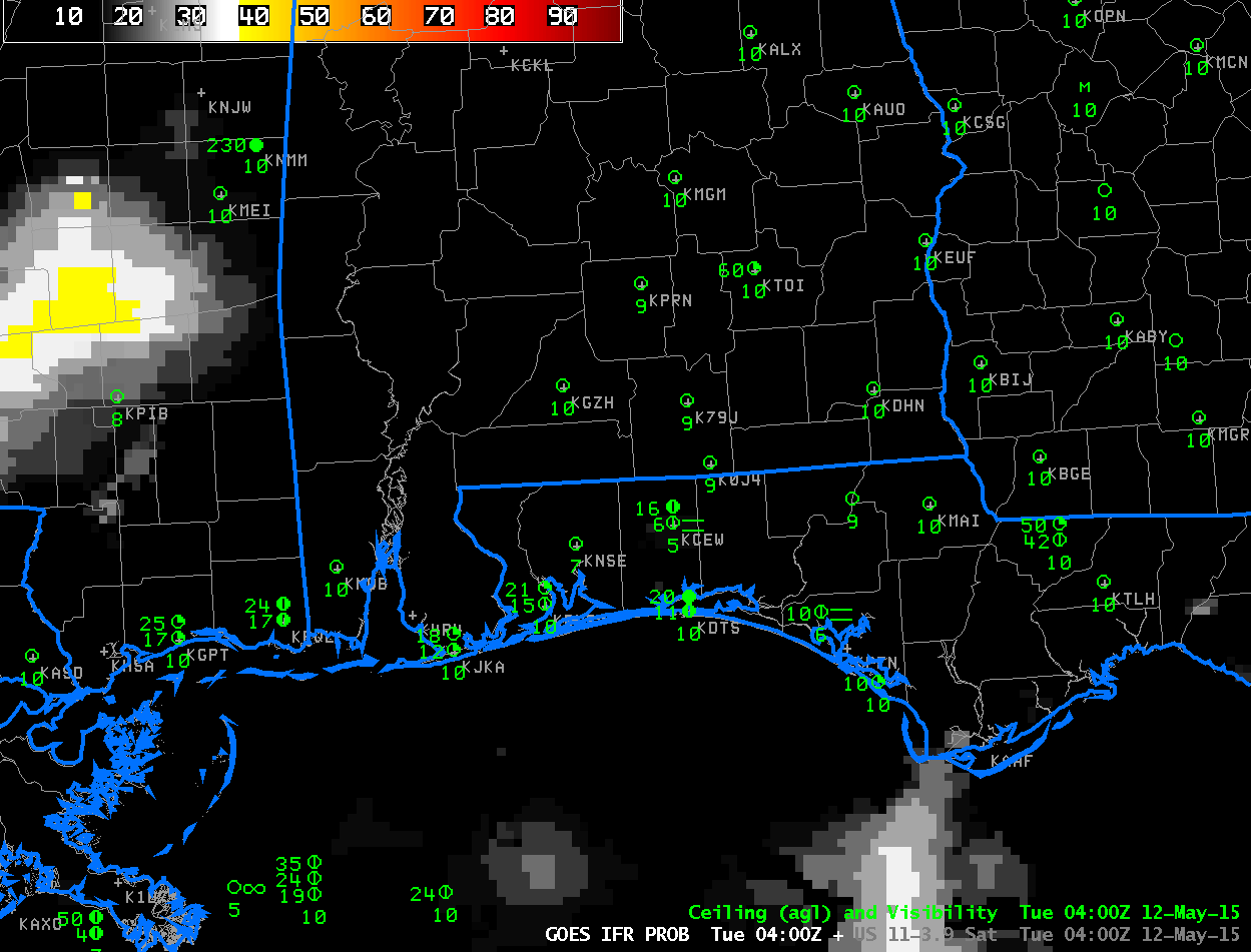
GOES-R IFR Probability Fields computed from Rapid Refresh and GOES-13 Data, ~hourly from 0400 through 1215 UTC, and surface observations of ceilings and visibilities (Click to enlarge)